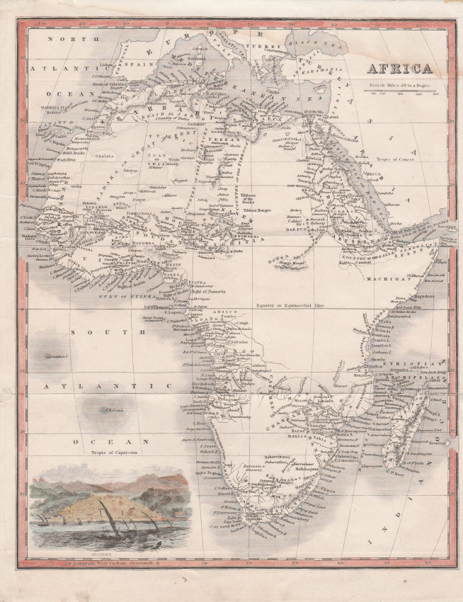
Attractive anonymous English map of Africa with a coloured vignette of Algiers at the bottom left.
This c. 1830 map of Africa shows settlements in Southern Africa that were established shortly before and after the arrival of the 1820 settlers in Albany: Grahamstwon, Bathurst and the short lived Fredericksburg.
Lake Maravi is today's Lake Malawi with an undefined northern shore as the lake had yet to be explored and reported to the English.
The envisaged Suez Canal is shown as a dotted line, suggesting that the map was printed in the 1830s when surveys were conducted to determine the feasibility of the canal.
The White Nile is shown to arise in the Douga Mountains (possibly par of the Mountains of the Moon) but Lake Victoria is absent (first reported to thee English by Speke in 1859).
This attractive small map of obscure origin is in fine condition.
- Overall Condition: Fine
- Size: 20cm x 25cm
- Sold By: Roger Stewart Antiquarian
- Contact Person: Dr. Roger Stewart
- Country: South Africa
- Email: [email protected]
- Telephone: +27836541081
- Preferred Payment Methods: LOCAL: EFT; INTERNATIONAL: Bank Transfer; Visa and Mastercard via PayFast
- Trade Associations: IMCOS


