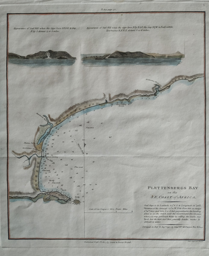
Attractively coloured example of the plan and hydrographic soundings of Plettenberg Bay.
The survey was conducted in 1797 by Lieut. McPherson Rice on behalf of the governor of the Cape Colony. This chart was engraved by Samuel Neele in London and published in 1804 in volume two of John Barrows Travels into the interior of Southern Africa.
The Government Storehouse is the old VOC wood store that is now in ruins. Below the title of the chart, there is an interesting comment on delivering fresh water in barrels through the surf at the landing place ... apparently not often very successful.
This chart is in fine condition, has wide margins and has been tastefully hand coloured.
Not in Tooley's Collectors' Guide to Maps of Africa nor Norwich's Maps of Africa.
- Overall Condition: Fine
- Size: 20.0x23.5cm
- Sold By: Roger Stewart Antiquarian
- Contact Person: Dr. Roger Stewart
- Country: South Africa
- Email: [email protected]
- Telephone: +27836541081
- Preferred Payment Methods: LOCAL: EFT; INTERNATIONAL: Bank Transfer; Visa and Mastercard via PayFast
- Trade Associations: IMCOS


