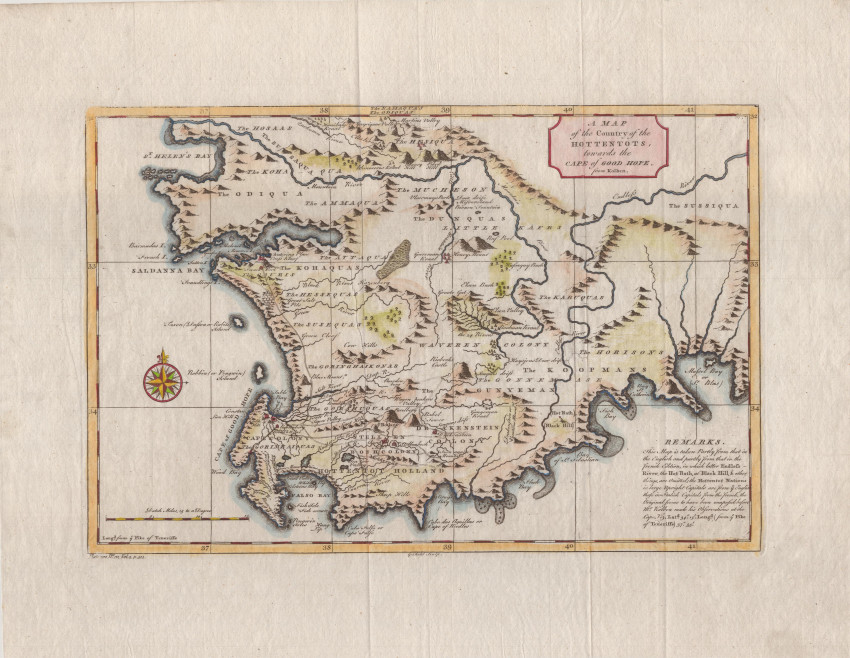
This is an uncommonly available 1746, English map of the Cape of Good Hope, which was based on the popular French map by Nicolas Bellin (c.1747), but also from a scare, similar English map that was published in Peter Kolb & Mr. Medley. The Present State of the Cape of Good Hope. (London: W. Innys, 1731; London: W. Innys & R Manby, 1738). Although Bellin is attributed on the map, his map (and the map in Medley's book) is after the map by Peter Kolbe(1727) who closely copied the map by Francois Valentyn (1726).
This attractive, derivative map was published in the second volume of John Green's A new general collection of voyages and travels. (London: T Astley, three volumes, 1745 – 1747). It highlights a very inaccurate Endless River, i.e., the Riviersonderend.
This later coloured map is in fine condition and is printed on a page with wide margins
- Overall Condition: Fine
- Size: 36.0 x 22.6cm
- Sold By: Roger Stewart Antiquarian
- Contact Person: Dr. Roger Stewart
- Country: South Africa
- Email: [email protected]
- Telephone: +27836541081
- Preferred Payment Methods: LOCAL: EFT; INTERNATIONAL: Bank Transfer; Visa and Mastercard via PayFast
- Trade Associations: IMCOS


