

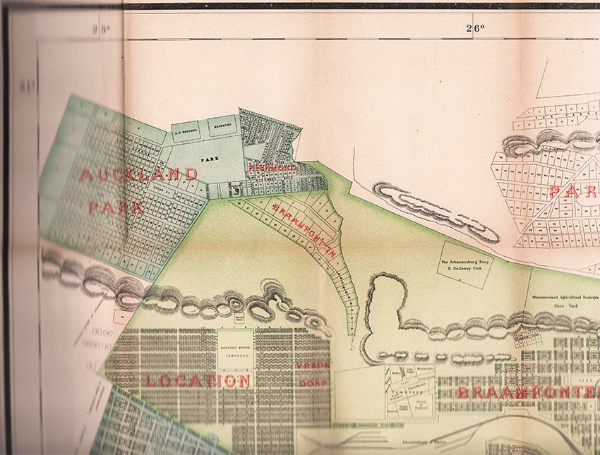

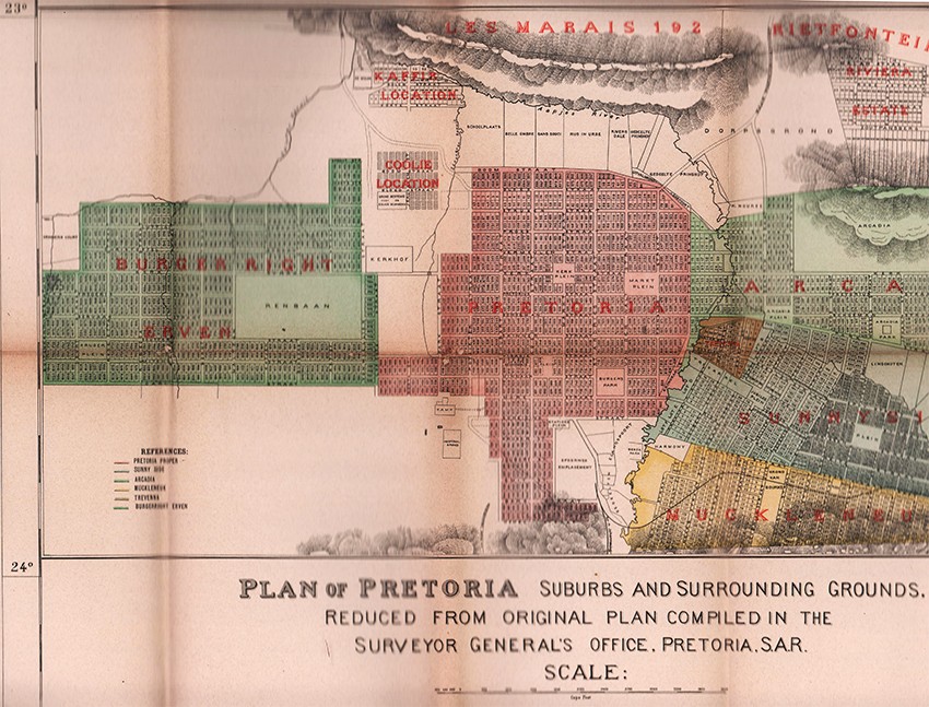


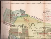
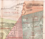
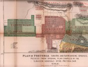
Plan of Johannesburg and surrounding Suburbs and Townships (reduced form Pritchard's Commercial Map of Johannesburg and Plan of Pretoria suburbs and surrounding grounds reduced from the original plan compiled in the Surveyors General's Office Pretoria S.A.R.
Folding map lithograhed in colours on glazed linen by Swiss Firm of Wurster, Randegger & Cie (J. Schlumpf), clumsily folded at the first fold – but does not affect the map, in green cloth covers titled gilt on the upper cover, a very good copy.
This map was originally published in 6 sheets.
On the Boer side during the Anglo-Boer War, the best map in every respect was 'Jeppe's Map of the Transvaal or South African Republic and surrounding Territories' in six sheets drawn to a scale of 1/476 000, with special insets for Pretoria and Johannesburg. This map was compiled by Mr Jeppe, chief draughtsman in the Surveyor-General's Office, Pretoria, using information from official farm surveys and other data. He was assisted by his son, who was subsequently killed at the battle of Spion Kop (24-25 January l900). http://samilitaryhistory.org/vol113jp.html
- Overall Condition: A Very Good Copy
- Size: folio (770 x 680mm)
- Sold By: Clarke's Africana & Rare Books
- Contact Person: Paul Mills
- Country: South Africa
- Email: [email protected]
- Telephone: 021 794 0600
- Preferred Payment Methods: Visa & Mastercard via PayGate secure links and Bank transfers.
- Trade Associations: ABA - ILAB, SABDA


