


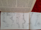
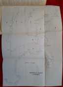


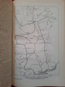
With 3 large folding maps:
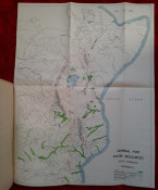
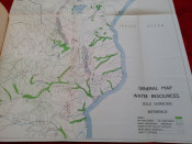
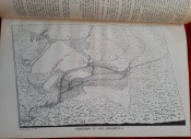
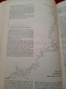
1) Color folding General Map Water Resources (60 x 47 cm; scale 1:6.000.000);
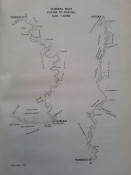
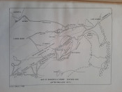
2) Folding Map of Bangweulu Swamps (Channels) (56 x 42 cm; scale 1:120.000);
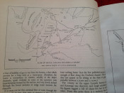
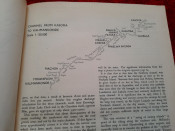
3) Folding Compass Traverse of the Upper Shire River, Nyasaland, made by Prof. F. Debenham from A. Launch, June 1946 (47 x 20 cm; scale 1:50.000)
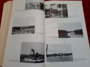
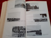
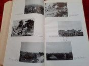
"Report on the Water Resources of the Bechuanaland Protectorate, Norther Rhodesia, the Nyasaland Protectorate, Tanganyika Territory, Kenya and the Uganda Protectorate."; Hardcover; Text in English; Collation complete - Title page, 86 pages, with 3 folding maps; Ex-library stamp embossed in gilt to the front board, ex-library label to the front paste down and numerous stamps to blank pages. Minor wear to extremities and tan to textblock edges. Contents clear, no foxing throughout, pages little yellowed, all maps in excellent codition, a lovely copy.
IMPORTANT informations regarding shipping: Shipping to South Africa possible only via UPS/DHL Express service ($80). Shipping to EU via national postal services ($18-25). Shipping to UK only via UPS/DHL Express service ($35). Shipping to US via FedEx ($30).
- Binding Condition: Very good
- Overall Condition: Very good
- Size: 32,5 x 21 cm
- Sold By: The Antiquarian Book
- Contact Person: Mariana Deric
- Country: Romania
- Email: [email protected]
- Telephone: +40727375356
- Preferred Payment Methods: Paypal (no additional charges); Bank (WIRE) transfer via IBAN/BIC/SWIFT
- Trade Associations: AA Approved


