


.jpg)


.jpg)
First Edition: 444 pages, 345 maps and numerous other illustrations, maps on endpapers, specially bound in quarter brown leather with matching marbled paper sides, a very good copy.
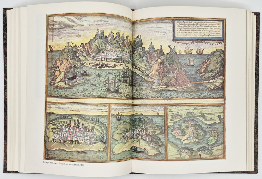
Editor's Note: This book, the result of many years collecting and research, is designed to provide an illustrated guide to maps of Africa for collectors as well as for those with a more general interest in the art. The maps are all individually illustrated, each with its own carto-bibliography. They have been subdivided into sections dealing with the Continent of Africa, Southern Africa, the Cape of Good Hope, Sea Charts, North, East and West Africa, and Islands, Town Plans and Ports.
- Overall Condition: Very good
- Size: 4to (300 x 230 mm)
- Sold By: Clarke's Africana & Rare Books
- Contact Person: Paul Mills
- Country: South Africa
- Email: [email protected]
- Telephone: 021 794 0600
- Preferred Payment Methods: Visa & Mastercard via PayGate secure links and Bank transfers.
- Trade Associations: ABA - ILAB, SABDA


