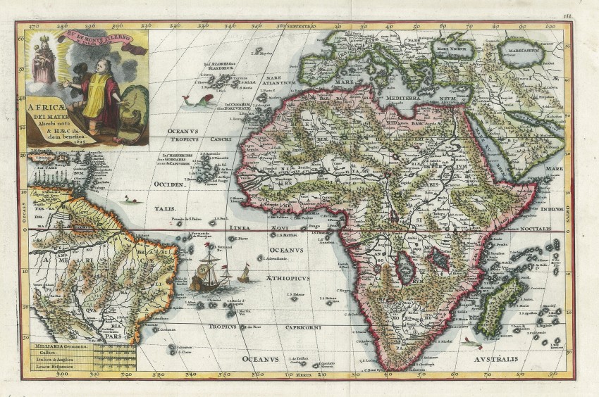
This attractive map was drawn by Heinrich Scherer (1628-1704), a mathematician and devout Jesuit. He prepared the map for his Atlas Novus exhibens Orbem Terraqueum ...; the atlas was unique in that it had a theme centred on Catholicism. It was published in three parts between 1702 and 1710, with this map appearing in the third part.
The religious theme on this map is exemplified by the vignette, which includes a Jesuit with a cross on his clothing and an African behind him, both of whom are kneeling below Mary with the baby Jesus in her arms. The ship in the southern Atlantic is flying the Jesuit standard. In order to accommodate the elaborate vignette, Scherer extended the map westwards to include the Caribbean Islands and most of Brazil.
Themap depicts Scherer's own, somewhat unusual view of the geography of Africa, although he does follow the Ptolemaic tradition with the Nile's source in the large southern lakes.
The entire page with the map is in fine condition. This beautiful map will be an unusual and quite uncommon addition to most collections of historical maps of Africa.
Reference: Bets #169. Not in Norwich or Tooley.
- Overall Condition: fine
- Size: 35 x 23cm
- Sold By: Thorolds Legal & Antiquarian Booksellers
- Contact Person: Kim Roberts
- Country: South Africa
- Email: [email protected]
- Telephone: 0118759991
- Preferred Payment Methods: Cash; EFT; Credit Card
- Trade Associations: Antiquarian Bookseller's Association


