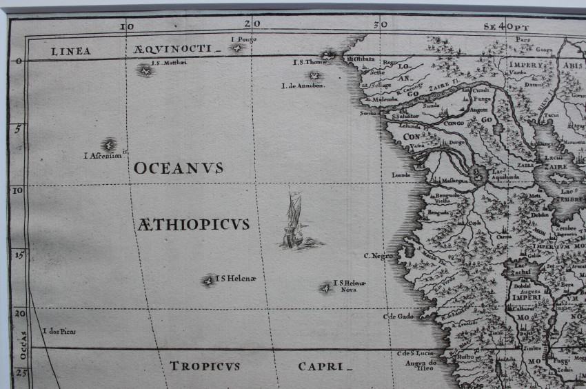


Map of southern Africa, Madagaskar and adjacent islands, filled with the geography of the period: large lakes, rives and mountains.
The star-like symbol of the Jesuits (IHS) sits atop the distance scale.
The title cartouche depicts two lions, an open chest, and two ormolu plates resting on a table. The map is further adorned with flying fish and sailing ships.
Taken from the Atlas of Heinrich Scherer - Atlas Novus Exhibens Orben Terraqueum Per Natura Opera, Historiae Navae.....
This map is not included in Tooley's Collectors' Guide to Maps of the African Continent and Southern Africa.
- Size: 24 x 35 cm
- Sold By: Mantis Books
- Contact Person: Charl Yates
- Country: South Africa
- Email: [email protected]
- Telephone: 0833219905
- Preferred Payment Methods: EFT & Paypal
- Trade Associations: AA Approved