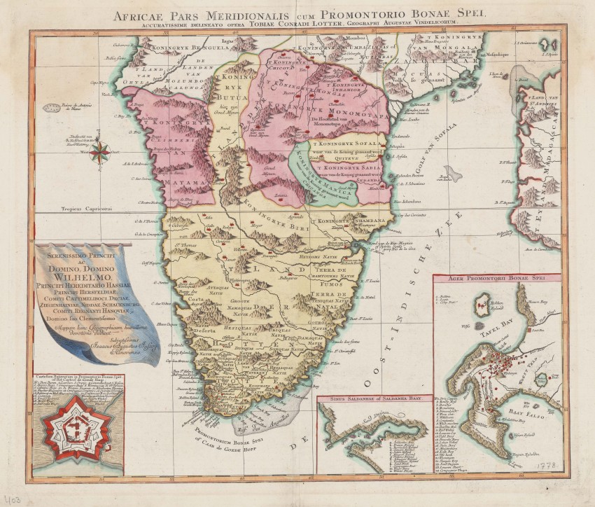
A beautifully coloured map of Southern Africa that was produced by Tobias Lotter [1717-1777], probably published in his Atlas geographique. A dedication is displayed on a cartouche above the inset of the Castle. The map was dedicated to William I, Elector of Hesse (1743 –1821) by Issak Augustus Jassoy, a merchant from Hanover. The map is printed on two pages that have been joined.
The map is beautiful but, as is the case with many maps of the time, it was not a geographical advance even though it was produced by a well known German cartographer. It contains interesting information from the Dutch settlement but has an inaccurate coastline and seems to retain some remnants from the old Ptolemaic geography. It indicates ruins of Portuguese and Dutch Forts beside the Spiritu Santo and Marquis Rivers
There are three detailed insets: the Cape Fort (i.e. Castle)near Table Bay, Saldanha Bay and the Cape of Good Hope, all with annotations and/or legends. Through the use of legends, Lotter has been able to convey considerable detail in the small inset of the Peninsula and area to the east of Table Mountain.
The "Com Post" near Seekoe Valley, the east, became Vergelegen the famous farm, still in existence, that became the hunting lodge and then farm of Willem Adriaan van der Stel before he was forced to return to the Netherlands.
A brown stain in the northern Atlantic Ocean does not detract from the the map which is in very good condition.
A stunningly beautiful map in very good condition, from a well known German family of cartographers.
Reference: Norwich map #177; not in Tooley.
- Overall Condition: Very good
- Size: 46.0 x 55.0 cm.
- Sold By: Thorolds Legal & Antiquarian Booksellers
- Contact Person: Kim Roberts
- Country: South Africa
- Email: [email protected]
- Telephone: 0118759991
- Preferred Payment Methods: Cash; EFT; Credit Card
- Trade Associations: Antiquarian Bookseller's Association


