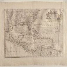
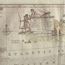
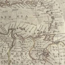

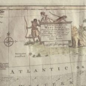
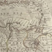
An Accurate Map of the West Indies. Drawn from the Best Authorities, Assisted by the Most Approved Modern Maps and Charts, and Regulated by Astronomical Observations.
[London, 1752]
Scale ca. 1:12,500,000. Hand colored. Relief shown pictorially. "No. 57." From the author's A complete atlas or distinct view of the known world. 1752.
Ref: Sellers & Van Ee #1682.
Country (current geographic location)
Central America and the Caribbean
Geographical specification
West Indies, Caribbean Area
Map Builder / Editor
Emmanuel bowen
Map / Book Title
An Accurate Map of the West Indies. Drawn from the Best Authorities,
Period
1751-1760
Condition
Good
Technique
Copper engraving
Additional Information
Relief pictorially shown.
Larger image size
340 × 420 mm
Shipping in a tube
- Sold By: El Arte de la Memoria SCP
- Contact Person: Maite Muns
- Country: Spain
- Email: [email protected]
- Telephone: +34628208909
- Preferred Payment Methods: paypal, bank transfer
- Trade Associations: LILA-ILAB, IMCOS, IMTA,


