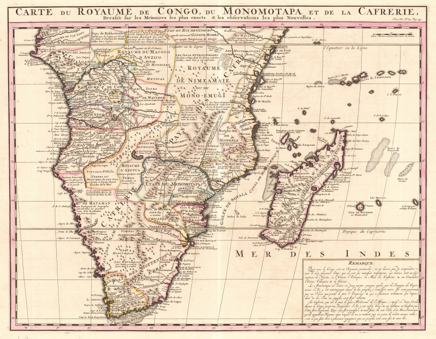
'A map of southern Africa issued in vol. 6 of the Atlas Historique et Méthodique which was published in seven volumes, compiled by Gueudeville and Garillon, with a supplement by H.P. Limiers and maps by Henri Abraham Chatelain,engraver and geographer of Amsterdam. It was first published in 1705 – 1720 with a second edition in 1732. It contains 300 fine engraved plates, many of them large folding. The maps are largely based on L’Isle. There are many views of Africa and especially of the Cape. In the lower right-hand corner of this map there is a long note describing the Congo, Monomotapa and Kaffraria.'
There are numerous interesting annotations on the map, e.g. the Jagas Anthropophages (cannibals) which inhabit the equitorial region.The text at the bottom right describes the three main geographical and trbal regions of the map and speculates on gold from, for example the map's M.Fur ... which proved not to be true. The duch settlement at the Cape if referred to s Fort Hollandois.
There is an elaborate watermark most of which, unfortunately, is obscured by the map. The map is in fine condition.
This is one of the most attractive and scientifically most detailed map fof southern Africa from the 18th century
References
Norwich: Maps of Africa, 1983, Map 165' Tooley's Collectors' guide to Maps of Africa ... p. 36
- Overall Condition: Fine
- Size: 52.5cm x 41.0cm
- Sold By: Thorolds Legal & Antiquarian Booksellers
- Contact Person: Kim Roberts
- Country: South Africa
- Email: [email protected]
- Telephone: 0118759991
- Preferred Payment Methods: Cash; EFT; Credit Card
- Trade Associations: Antiquarian Bookseller's Association


