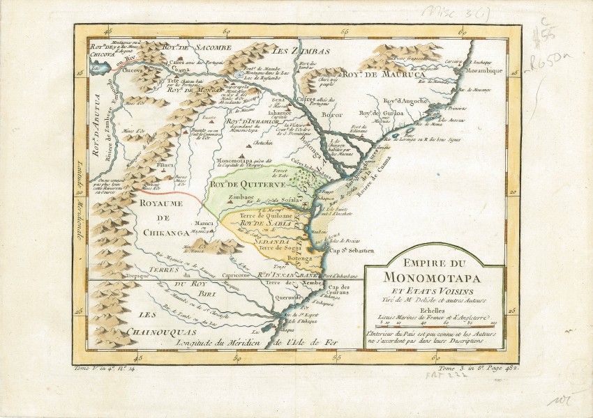
This mid 18th century map features the Kingdom of Monomotapa, mostly in today's Mozambique. It is based on maps by Delisle and other cartographer.
The map includes the Zambeze River and is bisected by the Tropic of Capricorn. There are numerous annotations on gold mines and the supposed sources of rivers.
The map was produced by Jacques Nicolas Bellin and included in Prévost d' Exile's "Histoire des Voyages", published between 1738-1775.Jacques Nicolas Bellin (1703-1772) was one of the most important and proficient French cartographers of the mid-eighteenth century. He was appointed the first Ingenieur Hydrographe de la Marine, and also Official Hydrographer to the French King.
- Size: 27.0cm x 20.1cm
- Sold By: Thorolds Legal & Antiquarian Booksellers
- Contact Person: Kim Roberts
- Country: South Africa
- Email: [email protected]
- Telephone: 0118759991
- Preferred Payment Methods: Cash; EFT; Credit Card
- Trade Associations: Antiquarian Bookseller's Association


