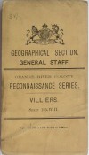
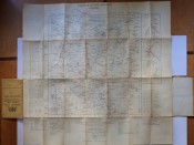
These folding maps are bound in to matching printed buff wrappers measuring 180x95mm. Unfolded the maps measure 630x630mm. The lot comprises:
1. Geographical Section. General Staff. Orange River Colony. Reconnaissance Series. Villiers. Sheet 125-W-11. 1910.
2. Geographical Section. General Staff. Orange Free State. Topographical Series. Dewetsdorp. Sheet South-H-35/1 - 1V. 1913.
3. Geographical Section. General Staff. Orange Free State. Topographical Series. Fouriesburg. Sheet South-H-35/E-111. 1913.
4. Geographical Section. General Staff. Orange Free State. Topographical Series. Reddersburg. Sheet South-H-35/I-111. 1914.
5. Geographical Section. General Staff. Orange Free State. Topographical Series. Wepener. Sheet South-H-35/J-111. 1915.
All maps printed at the War Office and marked "For Official Use Only". In very good condition.
- Overall Condition: Very Good
- Sold By: Ronald Levine - Modern First Editions
- Contact Person: Ronald Levine
- Country: South Africa
- Email: [email protected]
- Telephone: 011643 8437
- Preferred Payment Methods: EFT for South African customers and International Bank Tranfer for customers abroad. I am unable to accept payment by credit card.
- Trade Associations: SABDA

Similar lots in the current auction View all
Click on an item to view more details and to bid.


