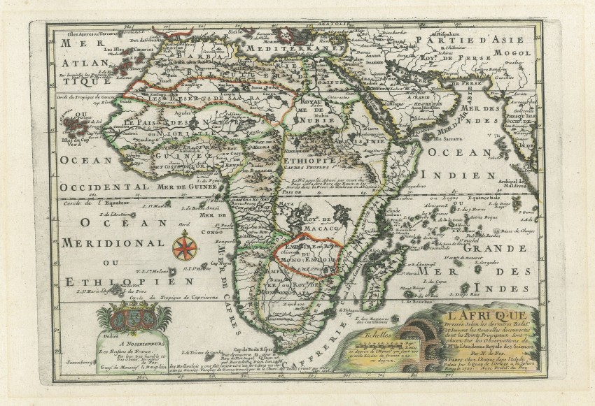
Striking copper plate engraved map of Africa from Nicholas de Fer's L'Atlas Curieux ou le Monde. The map is based on De Fer's own wall map of 1696. The title of the map is within a cartouche adjacent to which is a set of kilns, perhaps lime kilns. At the bottom left, there is a dedication to the Dauphin. This example is the first state of the map, as it is dated 1700 - subsequent stated were dated 1705 and 1717.
The southwest coastline between the Cape and the Congo has a curious convex bulge, the source of which is obscure. The map includes three notorious phantom islands: Saxenbourg in the extremee South-west Atlantic; St Helene Nouvelle to the east of St. Helene and, within the Indian OCean, Dos Romeiros to the south-east of Madagascar.
In Central Africa there is a paragraph concerning the origin of the Nile in Abyssinia; the source of the Nile is close to correct, but two mythical lakes, Zaire and Zaflan, re disconnected from the Nile.
"Monomotapa" is shown in the south and at the Cape of Good Hope there is a description about the voyage past the Capeby Diaz in 1486.
Nicholas de Fer (1646-1720) was the youngest son of Parisian print and map seller, Antoine de Fer [d.1673]. He became an official geographer to both French and Spanish kings. Nicholas de Fer was one of the most prolific and influential French geographers and cartographers of the late 17th and early 18th Century.
Three tiny areas of loss at the left edge of the page, well away from the plate line, have been professionally repaired. The area within the plate line is in fine condition, with one tiny worm hole above the E in PARTIE (D' ASIE).
A beautiful map, in very good condition, by an important French cartographer.
Reference: Betz #170.1; Norwich #64 and Tooley p45
- Overall Condition: Very good
- Size: 31.5 x 23.5cm
- Sold By: Thorolds Legal & Antiquarian Booksellers
- Contact Person: Kim Roberts
- Country: South Africa
- Email: [email protected]
- Telephone: 0118759991
- Preferred Payment Methods: Cash; EFT; Credit Card
- Trade Associations: Antiquarian Bookseller's Association


