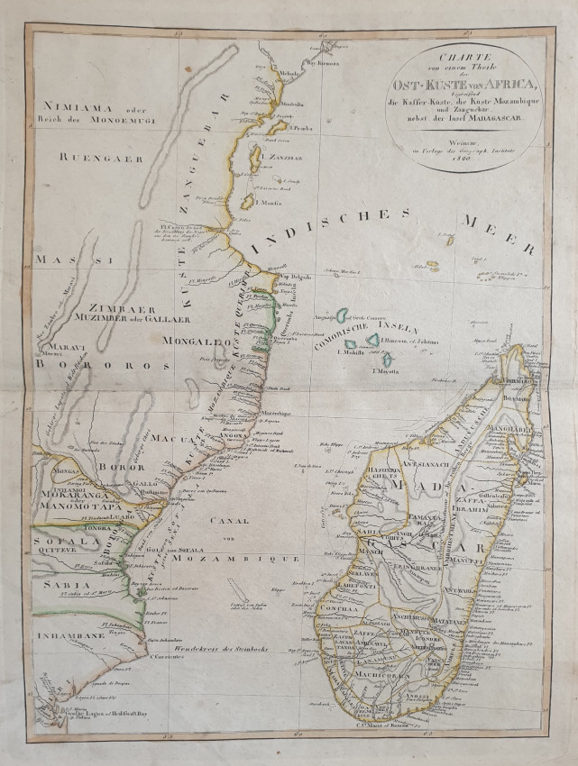
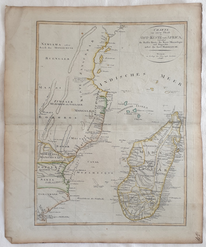
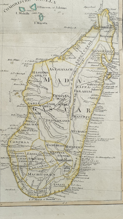
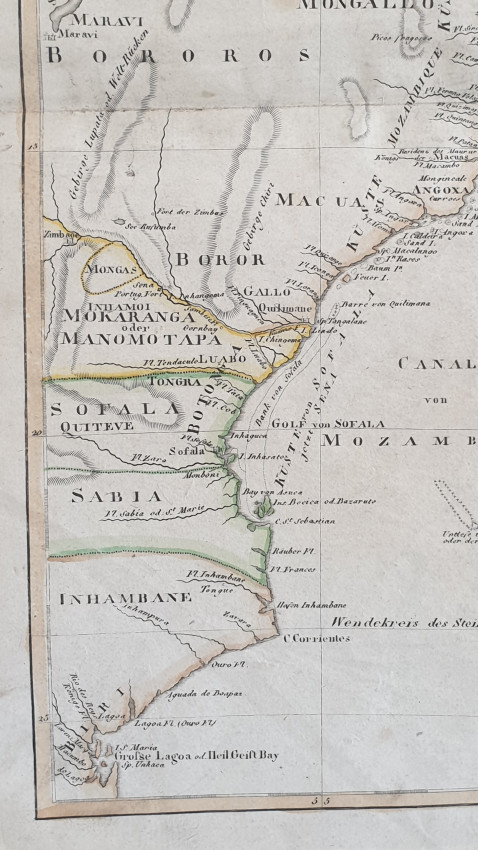
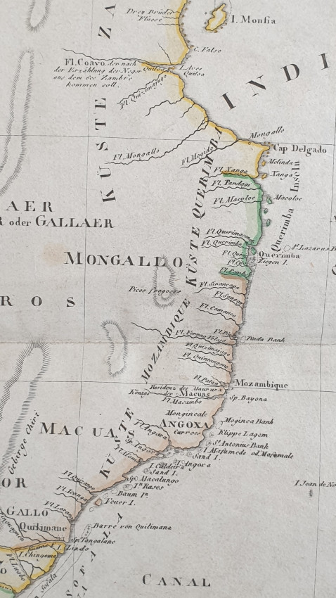
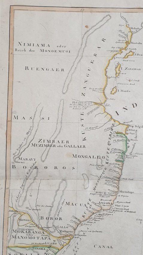
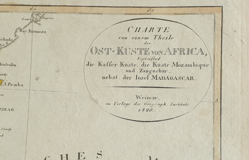
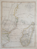
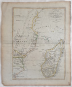
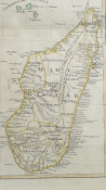

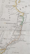
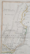
Original map of 1820 featuring eastern coast of Africa and Madagascar Island in the very precious light blue paper generally produced in Naples Kingdom from late 18th century to early 19th century.
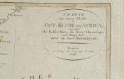
Nice coeval colouring with aquarello painting. Title framed. Editorial folding.
The map has been drawn between 1817 and 1821 year of publication by Weimar editor
Atlas: Verkleinerter Hand – Atlas uber alle Theile der Erde fur Burgerschulen und Zeitungsleser bestimmt
Date: 1820
Technique: copper engraving
Leaf Dimension: 46,5x38 cm (18.3x15 inches)
Engraving Dimension: 40,5x30 cm (15.9x11.8 inches)
Conditions: Good conditions. Foxing. Antique handwritten number in the lower right corner.
Shipping cost to South Africa: slow tracked shipping with NL Post: $ 10, Fast shipping with express courier: $ 32
Shipping cost to USA: slow tracked shipping with NL Post: $ 7.5, Fast shipping with express courier: $ 21
Shipping cost to Europe: slow tracked shipping with NL Post: $ 8.7, Fast shipping with express courier: $ 12
Other destinations: Please ask!
We always combine shipping
- Overall Condition: Good
- Size: 46,5x38 cm
- Sold By: Sephora Libri
- Contact Person: Elena Serru
- Country: Italy
- Email: [email protected]
- Telephone: 3492903979
- Preferred Payment Methods: paypal credit card
- Trade Associations: Sephora di Elena Serru


