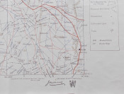
1st. Edition. A 18 panel linen backed map measuring 61cm x 50 cm which folds down to 17cm x 12cm with red cloth outer covers.. Titles in gilt on the front cover. Very good publisher's original mauve cloth covers with titles in gilt on the front cover. Rear cover evenly faded. Wear to the bottom of the spine with some loss. Some light wear to the corners.The map in very good (+) condition with no foxing, marks or other blemishes. Some light browning/toning to the reverse side of the map.
This map of Bloemfontein was compiled for the British Army Field Intelligence Department by John J. Wood & Ortlepp, surveyors and map compilers of Cape Town & Johannesburg in February 1900.The map shows shows the Bloemfontein region with farm boundaries and fences, farm names, divisional boundaries, roads, rivers, telegraph lines and railways in the Bloemfontein area. The map also indicates hills, pans (often dry), homesteads, cultivated land and trees. The key and other information occupy the three panels on the right hand side of the map with the warning “This map is not to be considered as absolutely accurate”. Scale 1/250000.This is a scarce map. I have not seen a copy of this map offered for sale in the last decade or more. I doubt if many were printed. The only copies of this map I can find are: one in the University of Cape Town Library and another (Map No. 107796) in the Rare Map Collection at MacMaster University Library, Ontario, Canada.
- Jacket Condition: N/A
- Binding Condition: Very Good
- Overall Condition: Very Good
- Size: 61cm x 50 cm / 17cm x 12cm
- Sold By: White Eagle Books
- Contact Person: Andrew Saidi
- Country: United Kingdom
- Email: [email protected]
- Telephone: 020 8997 9894
- Preferred Payment Methods: Paypal
- Trade Associations: PBFA IOBA


