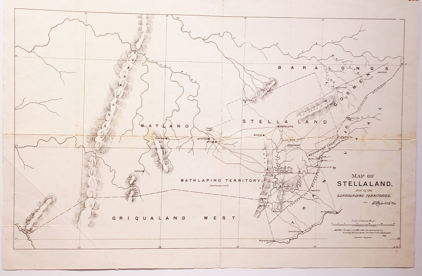
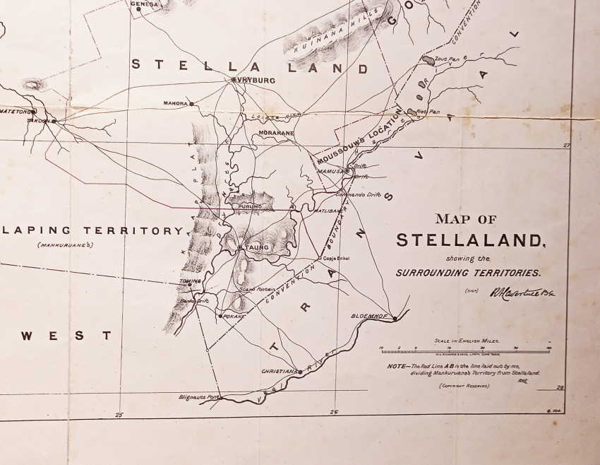

Showing the surrounding territories. Sigd. in ink: R. A. Lavertine 134. Note: "The Red Line AB is the line laid out by me, dividing Mankuruane's Territory from Stella Land". Initialled. RAL. Scale in English Miles [10 miles equals 1 inch]. Copyright reserved. G.104 in lower right corner. Folds backed by masking tape on the reverse. Sheet dimension: 820 mm x 540 mm
Lavertine appointed Government Surveyor to the Transvaal Republic in 1881. In that capacity he conducted between February, 1882, and May, 1884, a flying survey of Stella Land (Bechuanaland), 10,000 square miles in extent, and laid out the town of Vryburg; and, during the two following years he was continuously employed on extensive surveys for the Transvaal Government.
Ref: Lavertine, Richard Aloysius. https://www.artefacts.co.za/main/Buildings/archframes.php?archid=6114
- Overall Condition: A good copy
- Sold By: Clarke's Africana & Rare Books
- Contact Person: Paul Mills
- Country: South Africa
- Email: [email protected]
- Telephone: 021 794 0600
- Preferred Payment Methods: Visa & Mastercard via PayGate secure links and Bank transfers.
- Trade Associations: ABA - ILAB, SABDA


