Antiquarian Auctions

Auction #114 has ended

Frederick Dangerfield

Map of the South African Republic (1884)

A large attractive folding tinted litho MAP (72 x 89 cm) printed by F. Dangerfield (lithographer). Boundaries of SAR defined following end of First Boer War. Johhanesburg yet to appear on map.

Published: Her Majesty's Stationery Office, London, 1884

Edition: First Edition

Lot closed

Sold for: Register or Sign In to find out

Bids: 3

Visits: 37

Have a similar item to sell? Contact Us with the details.

How it works

Register

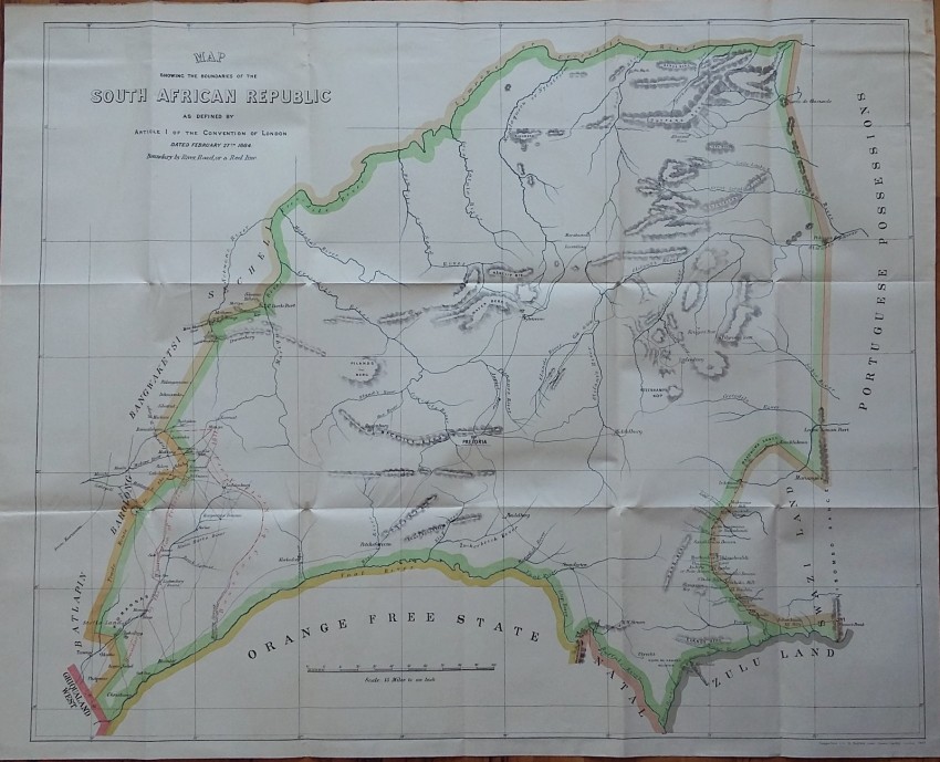
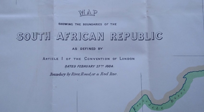
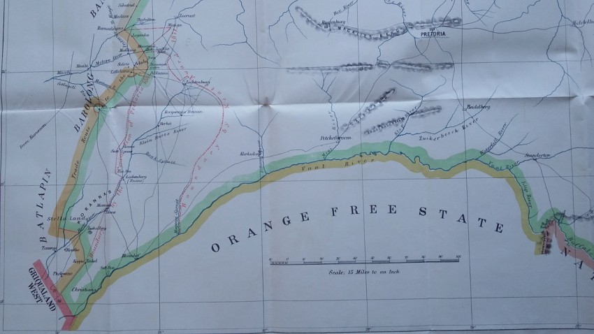
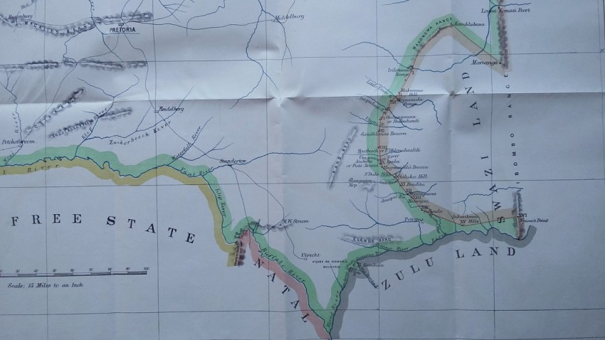
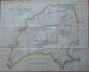
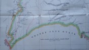
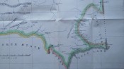
Map showing the Boundaries of the South African Republic as defined by Article I of the Convention of London dated February 27th, 1884. Boundary by River, Road, or a Red Line.

  • Overall Condition: Near fine
  • Size: 72 x 89 cm
  • Sold By: The Antiquarian Book
  • Contact Person: Mariana Deric
  • Country: Romania
  • Email: [email protected]
  • Telephone: +40727375356
  • Preferred Payment Methods: Paypal (no additional charges); Bank (WIRE) transfer via IBAN/BIC/SWIFT
  • Trade Associations: AA Approved


© 2024 Paul Mills trading as AntiquarianAuctions.com. All rights reserved. Use of this website is regulated by our website Terms of Use and Privacy Policy.