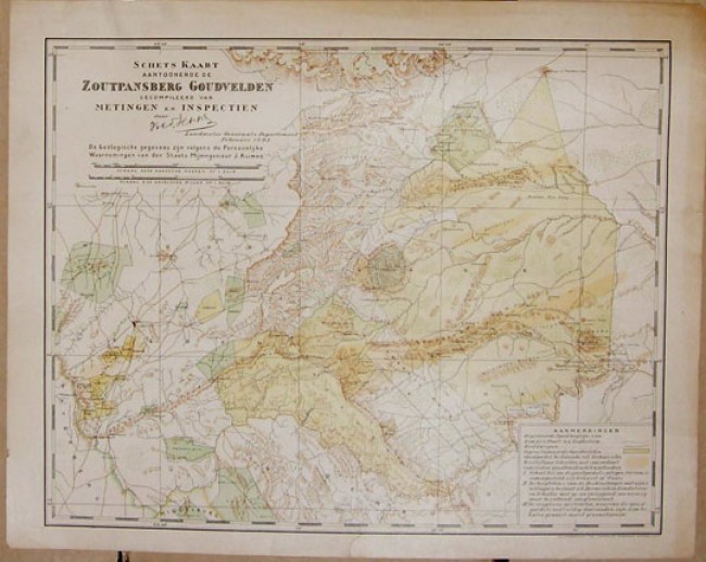
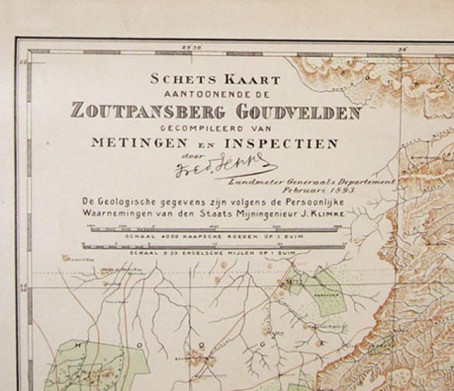

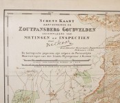
"Schets Kaart Aantoonende de Zoutpansberg Goudvelden Gekompileerd van Metingen en Inspectien Door Fred. Jeppe Landmeter Generaals Departement Februari 1893."
"Schaal 4000 Kaapsche Roeden op 1 Duim. Shaal 9;39 Engelsche Miljen op 1 Duim (Inch)."
This map has recently been the subject of research. Its relevance today has to do with land claims and mineral rights in the Zoutpansberg, and how colonial authorities acted in the interests of the mining houses rather than the indigenous people of the Zoutpansberg
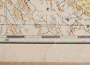
CONDITION DETAILS: Images have been provided of some of the marks on the rear of the map. The tear at the bottom edge is also pictured, front and rear views. A close up of the right hand side margin shows the darkening around the entire margin caused by a mount for the many years that this map was in a frame, and two short closed tears. The back of the map is also darkened. This map has no fold marks.
- Overall Condition: Good
- Size: 341mm x 428mm
- Sold By: Gandolph's Books
- Contact Person: Arnaud Labuschagne
- Country: South Africa
- Email: [email protected]
- Telephone: +27 11-624-1752
- Preferred Payment Methods: Cash, Cheque deposits in Rands, bank transfers.
- Trade Associations: AA Approved


