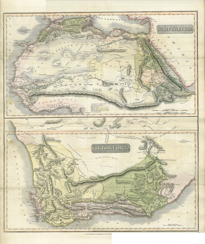
John Thomson’s unusual and well profuced map is two maps in one: North Africa and South Africa – the two areas of Africa that were reasonably well known to the British at that time. It is a wonderful snap shot from the British perspective of the two parts of Africa is know much better than other colonising nations.
John Thomson's map was included in the 1817 edition of his New General Atlas, which was republished until 1821. Thomson was one of the Edinburgh school of fact-based cartographers.
Europeans had long travelled down the Nile Valley and more recently Mungo Park, Brown and others had explored the Niger which had long been mis-mapped due to ignorance. Despite the recent travels in West Africa, this map shows the fabled Mountains of Kong (and the Mountains of the Moon, now the Rwenzori Mts, thought to be a sourc of the White Nile River). The northern map shows the routes of explorers and also camel/caravan routes.
Southern Africa had been much better explored and also colonised by the British. The extent of colonisation is reflected in part in the the names of some of the magisterial districts. Thomson also shows the routes of travellers such as John Campbell, the missionary.
The map a copper engraving of very firm paper and is a crisp imprint. The map has been finely engraved, is devoid of unnecessary decorative elements and is presented in original colour.
- Overall Condition: Good
- Size: 61cm x 53.3cm
- Sold By: Thorolds Legal & Antiquarian Booksellers
- Contact Person: Kim Roberts
- Country: South Africa
- Email: [email protected]
- Telephone: 0118759991
- Preferred Payment Methods: Cash; EFT; Credit Card
- Trade Associations: Antiquarian Bookseller's Association

Similar lots in the current auction View all
Click on an item to view more details and to bid.