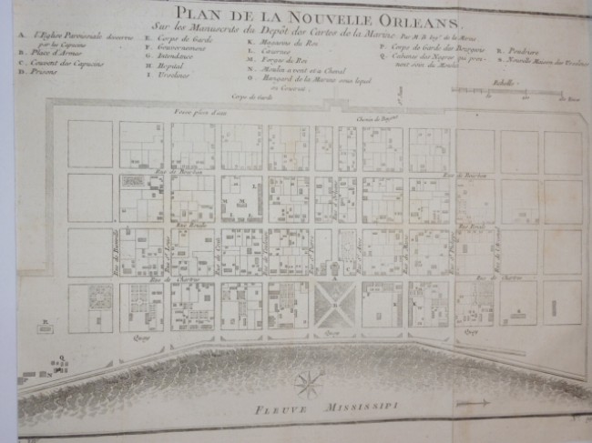
Paris: 1757. A pleasing example of this attractive mid-18th century engraved plan. Key locates churches, town hall, and numerous points of military importance. Sheet measure 11 3/4" W x 10" H. Image measure 11" W x 7 1/2" H.In near excellent condition. Original fold line as issued. Bellin's superbly detailed street plan of mid 18th-century New Orleans (today's French Quarter), with an 18-point key to the city's major sites and monuments, from the atlas of Prevost d'Exiles' influential travel book, Histoire Generale des Voyages.
- Sold By: El Arte de la Memoria SCP
- Contact Person: Maite Muns
- Country: Spain
- Email: [email protected]
- Telephone: +34628208909
- Preferred Payment Methods: paypal, bank transfer
- Trade Associations: LILA-ILAB, IMCOS, IMTA,


