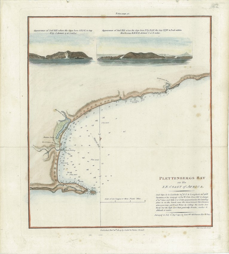
Attractively coloured example of the plan and hydrographic soundings of Plettenberg Bay. The survey was conducted in 1797 by Lieu. McPhersono on behalf of the governor of the Cape Colony. This chart was engraved by Samuel Neele and published in John Barrows Travels into the interior of Souther Africa.
The Government Storehouse is the old VOC wood store that is now in ruins. Below the title of the chart, there is an interesting comment on delivering fresh water in barrels through the surf at the landing place ... apparently not often very successful.
This grubby chart is being cleaned non-chemically and de-acidfied.
- Overall Condition: Fine
- Size: 20.5 x 23.5
- Sold By: Thorolds Legal & Antiquarian Booksellers
- Contact Person: Kim Roberts
- Country: South Africa
- Email: [email protected]
- Telephone: 0118759991
- Preferred Payment Methods: Cash; EFT; Credit Card
- Trade Associations: Antiquarian Bookseller's Association


