


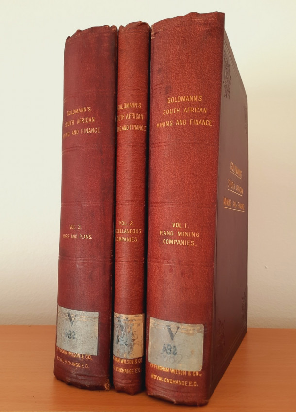


A complete copy all with 99 folding maps & plans.
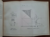
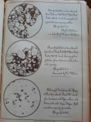
This stunning study from 1895-1896 contains a detailed and complete report about all South African gold and diamond mines, gold and diamond companies, finance and investment companies, land companies and miscellaneous companies. With 99 folding maps & plans (including plans of mining properties and large scale maps of the Rand divided into Farms, many coloured and folding/multiple folding) and 8 plates & illustrations. The complete work in 3 volumes is now very uncommon with Copac listing, only ten complete copies in British institutional holdings, the only available complete copy selling on internet sells for $6,500.
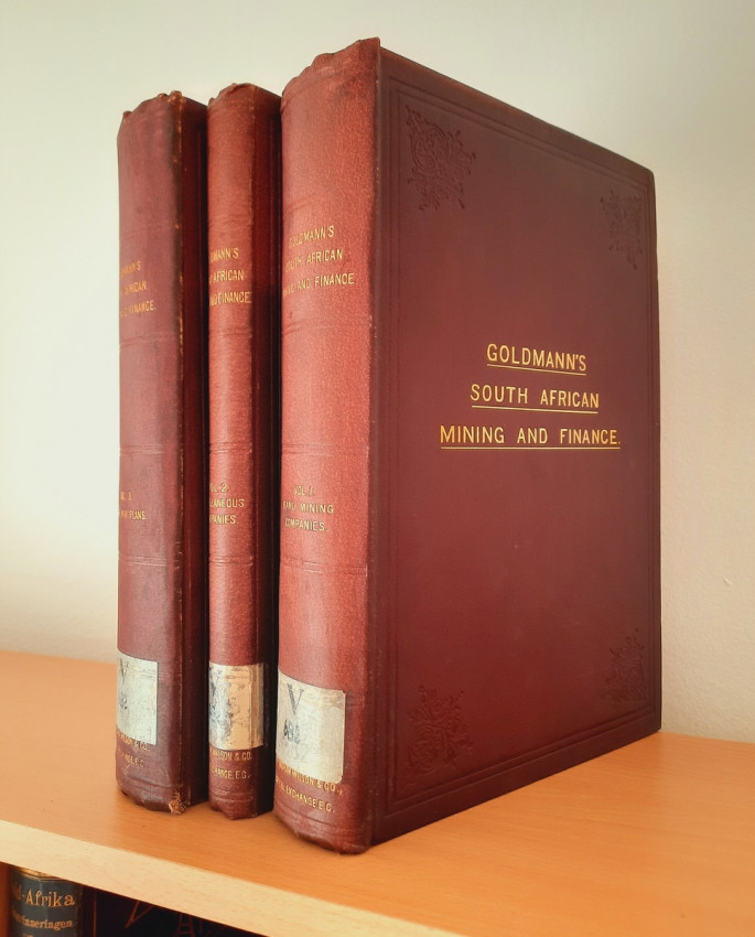
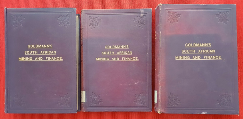
The work consists of 3 volumes:
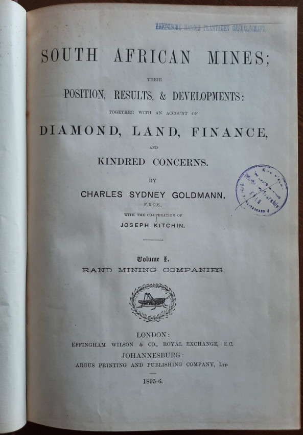
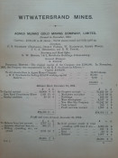
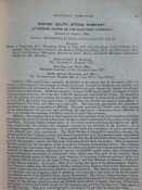
# Volume 1: RAND MINING COMPANIES
Contents:
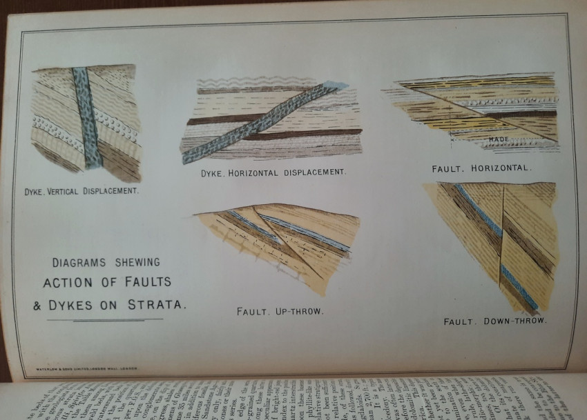
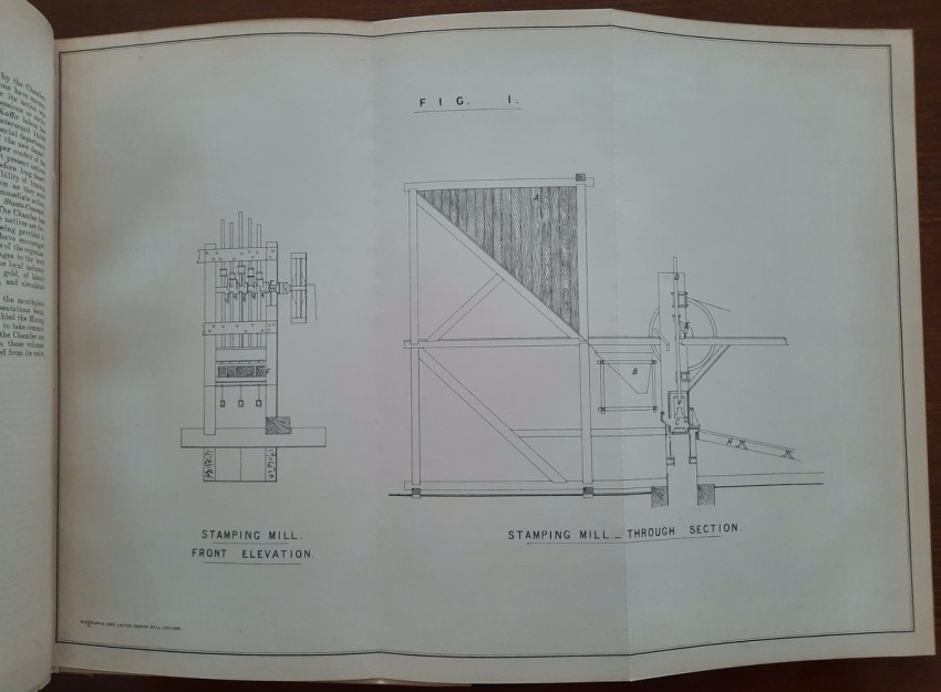
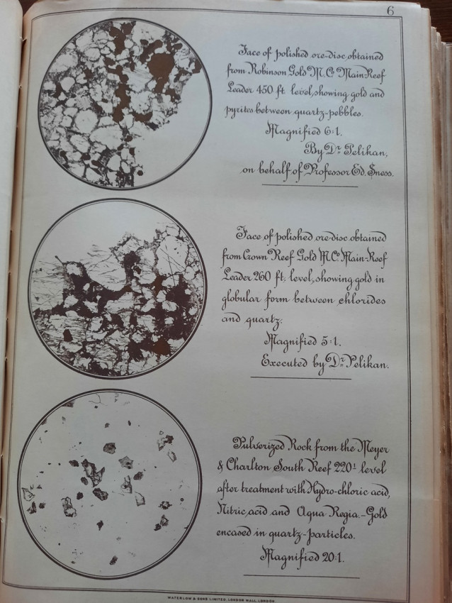
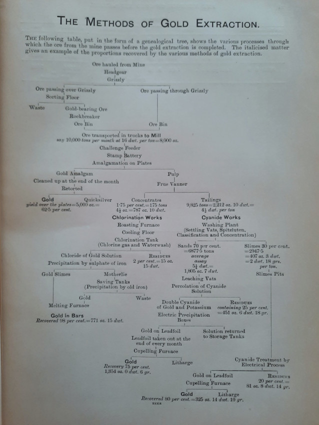
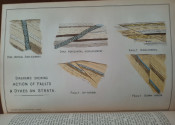
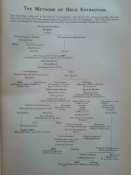
- Introduction (The Geology of the Witwatersrand; The Witwatersrand Chamber of Mines; Metallurgical Processes; The Methods of Gold Extraction);
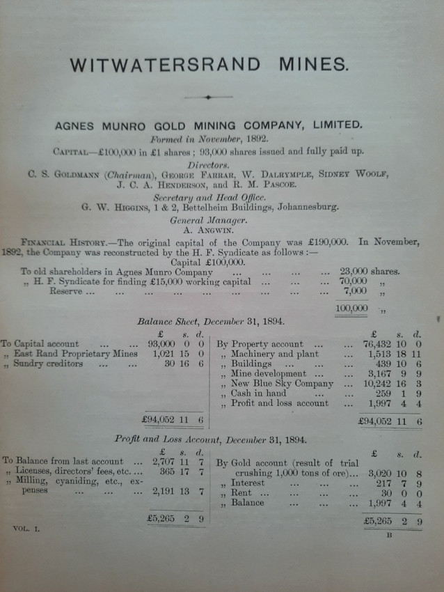
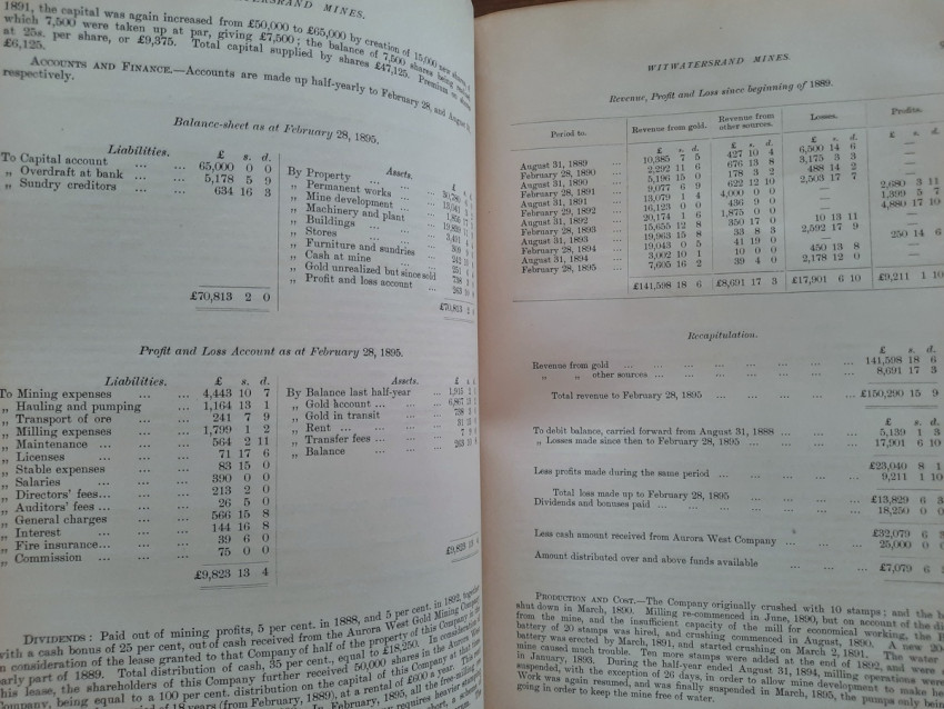
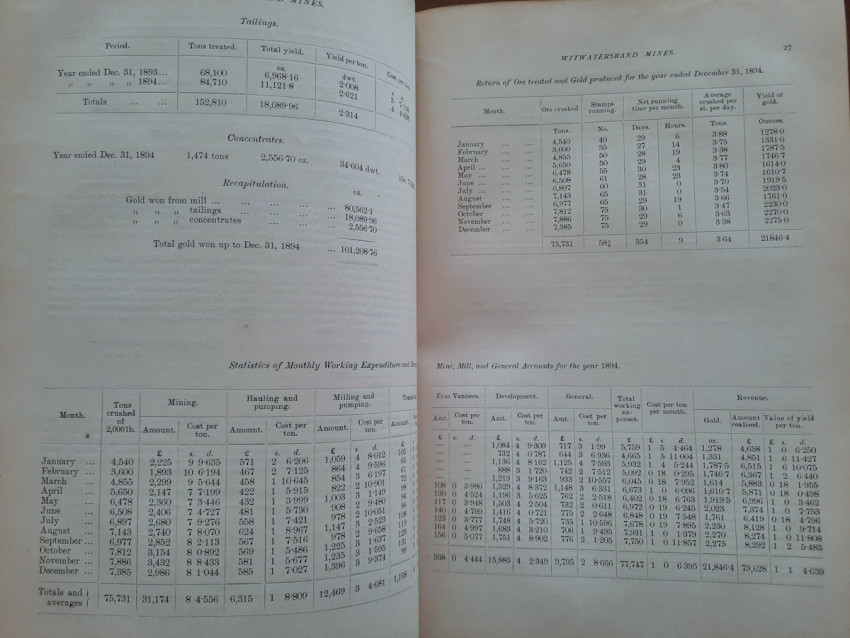
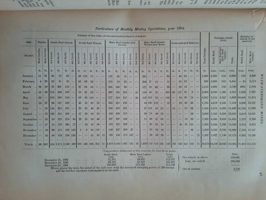
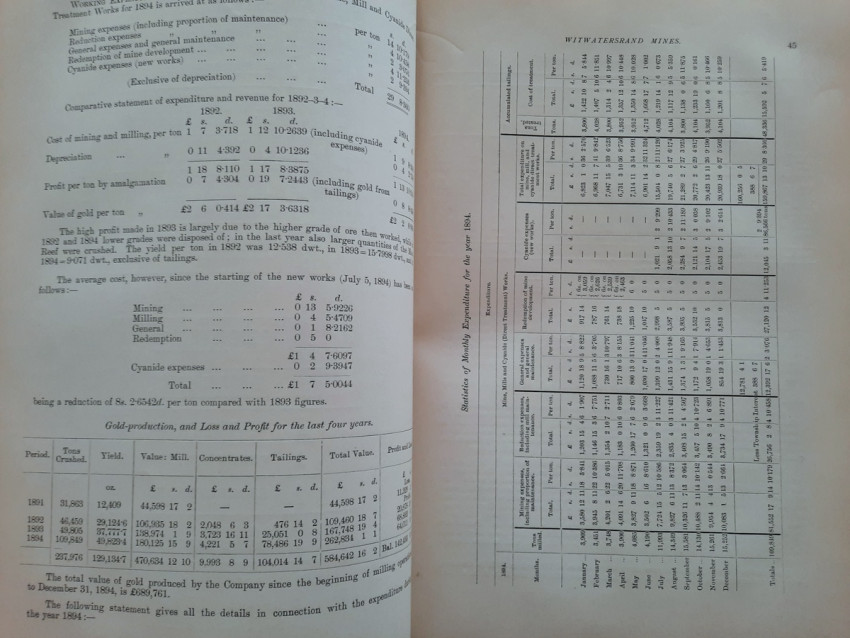
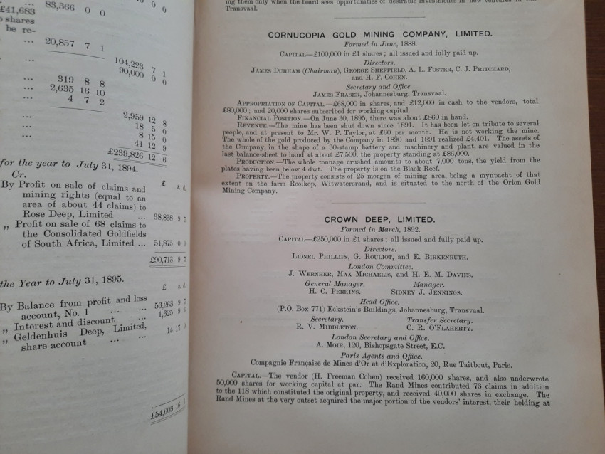
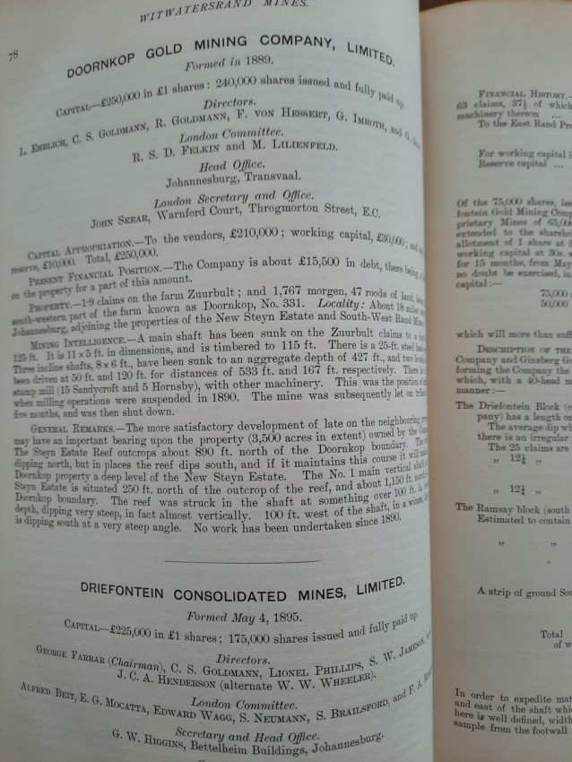
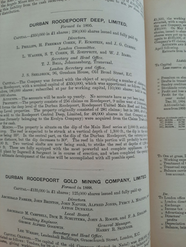
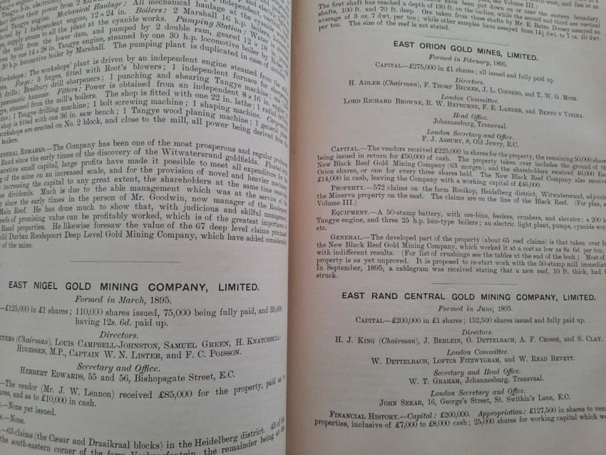
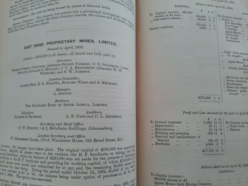
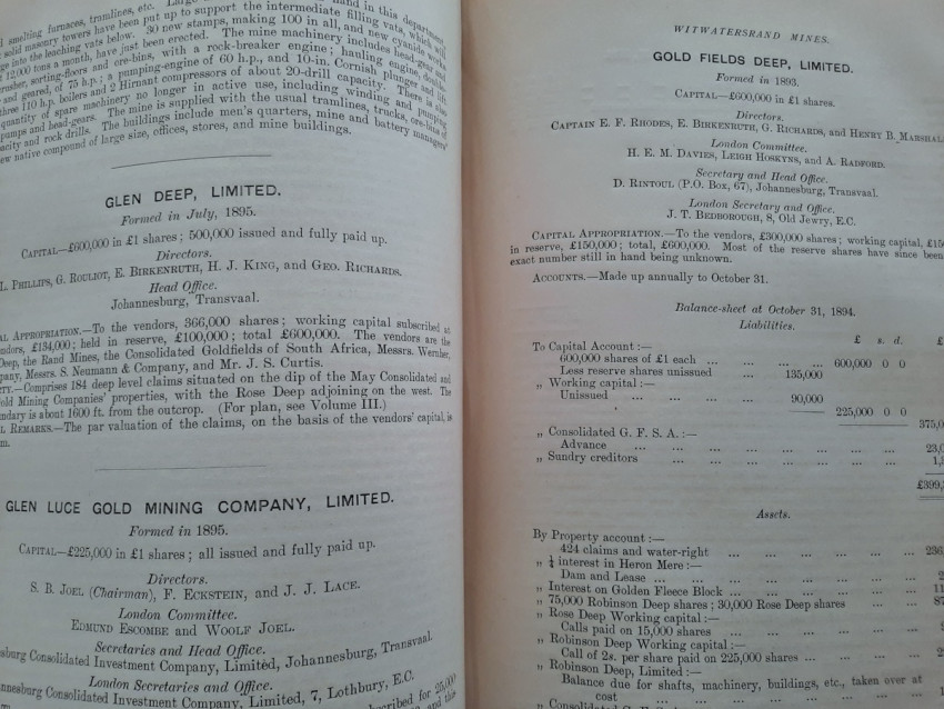
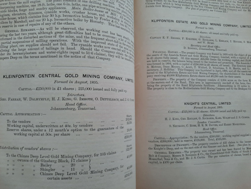
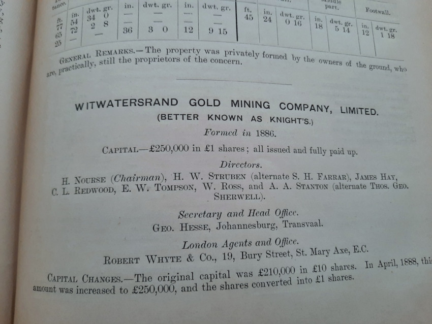
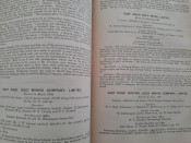
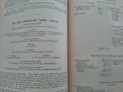
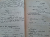
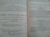
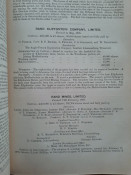
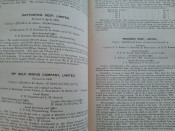
- Witwatersrand Mines (full descriptions on 484 pages, arranged in alphabetical order);
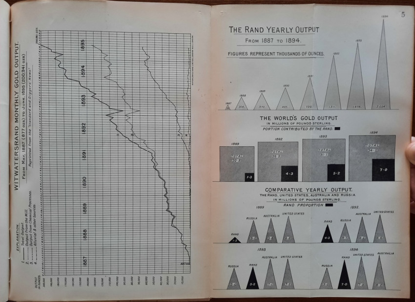
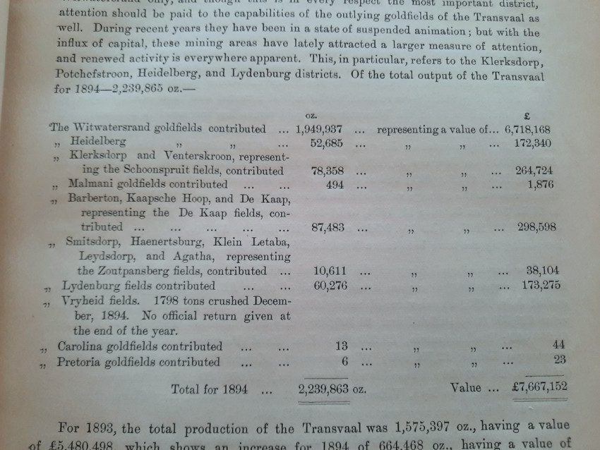
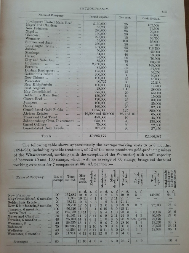
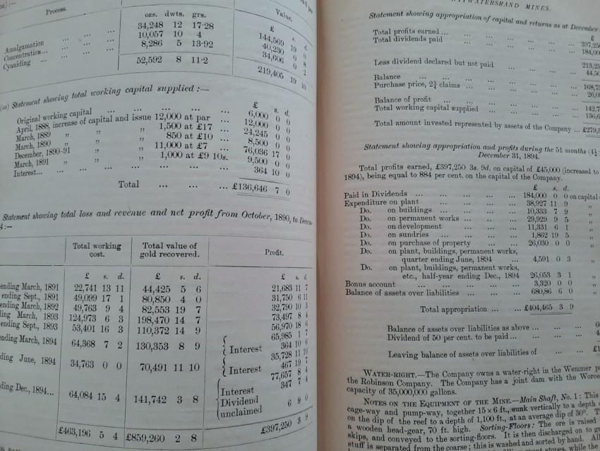
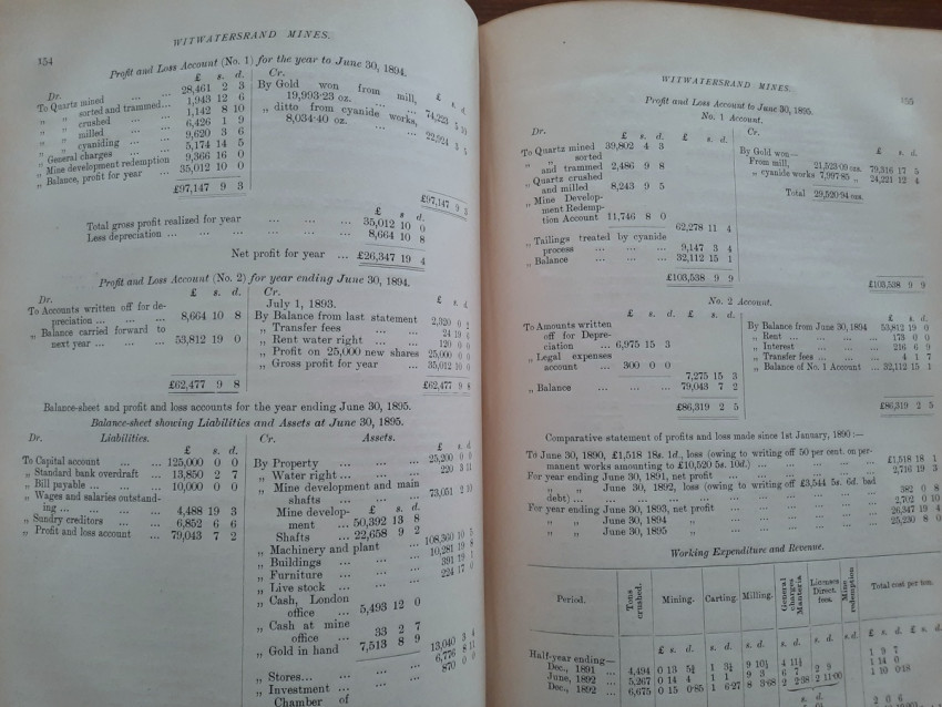
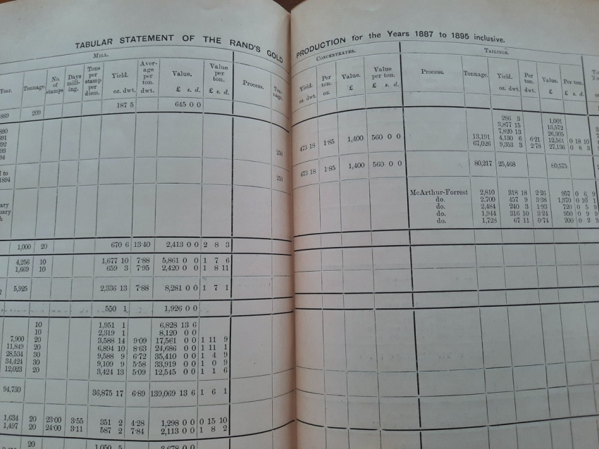
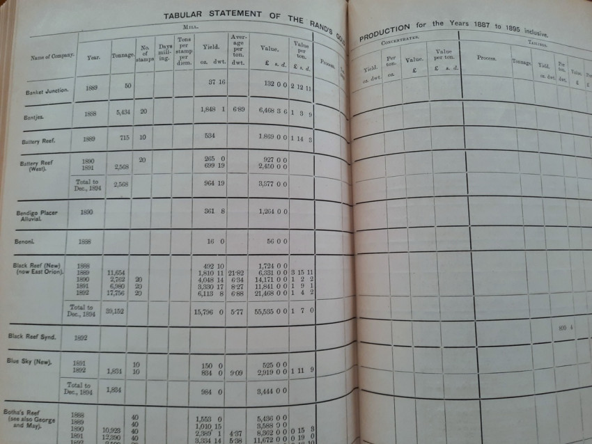
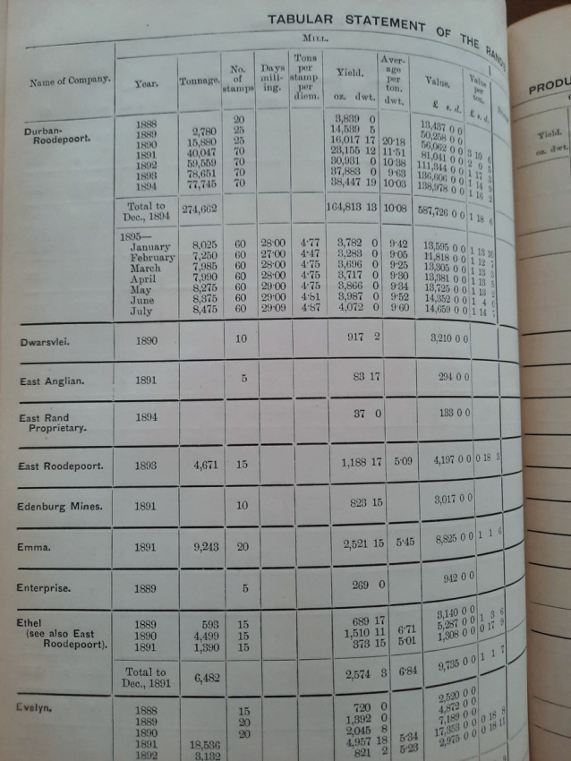
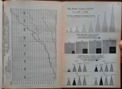
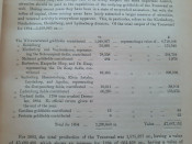
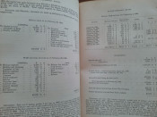
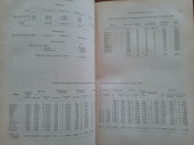
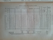
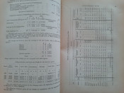
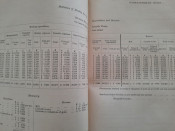
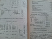
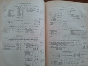
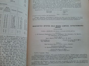
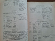
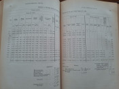
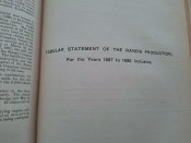
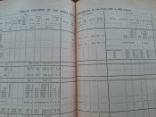
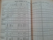
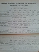
- Tabular statement showing the Gold Production of each Rand Mine from 1887 to July 31, 1895;
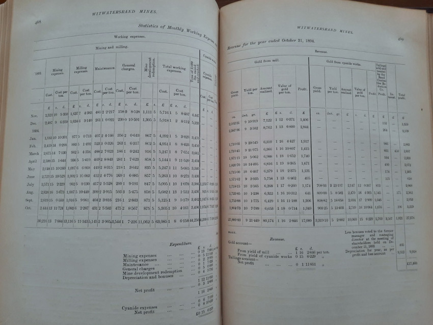
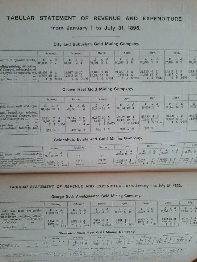
- Tables of monthly Revenue, Expenditure, Profits, and Working Costs of leading mines;
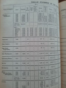
- Tables of Highest and Lowest Prices for the past four years.
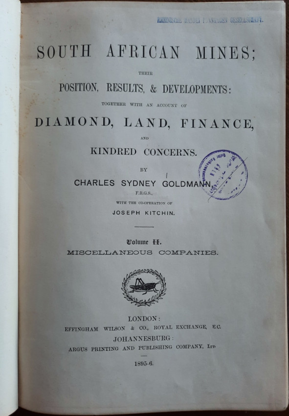
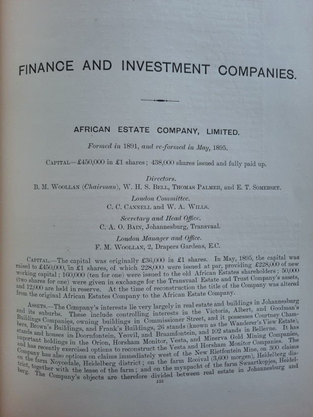
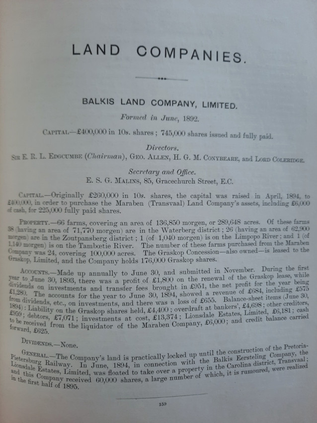
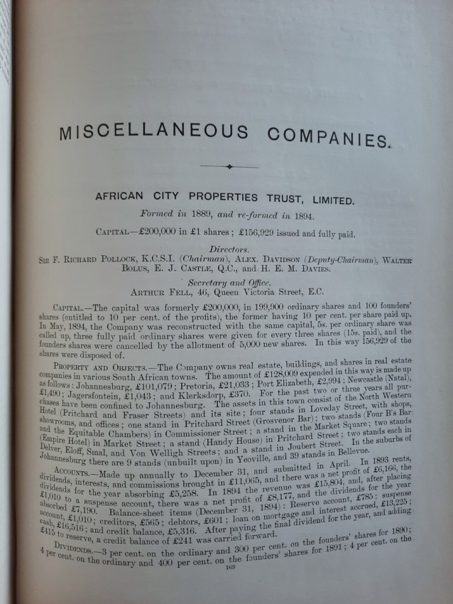
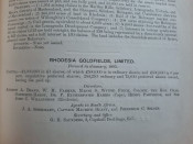
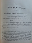
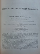
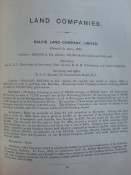
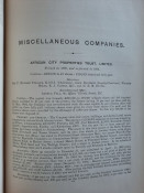
# Volume 2 : MISCELLANEOUS COMPANIES
Contents:
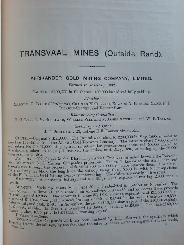
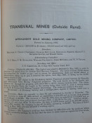
- Transvaal Mines (outside Rand);
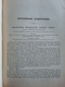
- Rhodesian Companies;
- Diamond Companies;
- Finance and Investment Companies;
- Land Companies;
- Miscellaneous Companies.
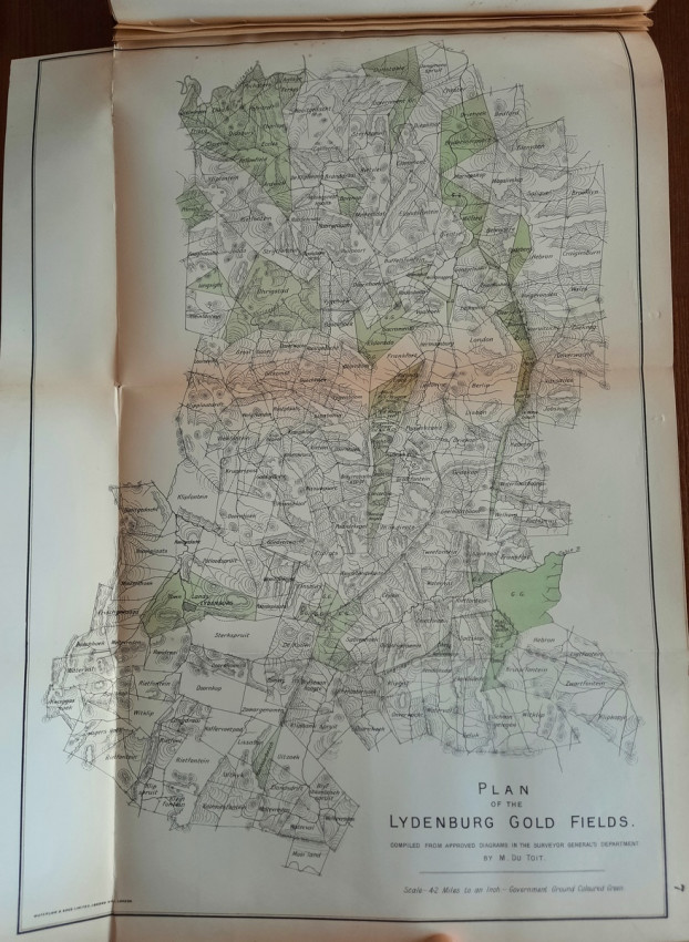
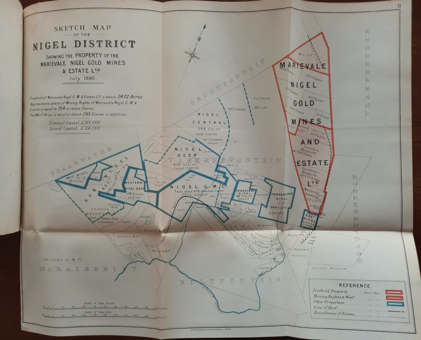
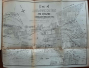
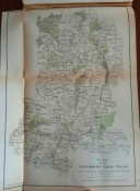
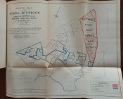
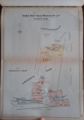
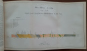
# Volume 3: MAPS AND PLANS
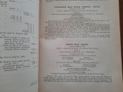
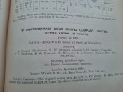
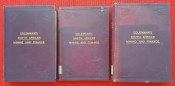
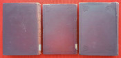
"South African Mines; Their Position, Results, & Developments. Together with an Account of Diamond, Land, Finance and Kindred Concerns."; London, Effingham Wilson & Co., Royal Exchange E.C. / Johannesburg, Argus Printing and Publishing Company Ltd., 1895-1896; 3 volumes; Quarto (28,5 x 20 cm); Original hard cover red linen bindings; Text in English; Collation complete – Vol. 1: Title page, XXXVIII, 583 pages, 8 plates & illustrations, some coloured and folding, Appendix, Index; Vol. 2: Title page, V, 210 pages, Index; Vol. 3: Title page, VI, 17 pages, 99 folding maps and plans including plans of mining properties and large scale maps of the Rand divided into Farms, many coloured and folding; CONDITION: Ex-library. Original bindings are tight and firm, bindings are strong and secure, slightly rubbed and partially faded, edges slightly bumped. The lower edge of the spine of Volume 3 is slightly damaged, the head cut is dusty, boards more bumped because of irregular shape of the content (folding maps and plans). Pages/text block and maps are very bright and clean, no marks or foxing throughout, only slightly age toned and title pages with minor light foxing, partly a little finger-stained. Maps and plans in Volume 3 in very good condition, very bright and clean, apart from scattered foxing and occasional fingermarks. A sound copy of this sought after book. Heavy item (circa 5,5 kg).
IMPORTANT informations regarding shipping: This is a heavy item (circa 5,5 kg). Shipping to South Africa possible only via Fedex/DHL Express service ($150-180). Shipping to Australia possible only via Fedex/DHL Express service ($165-180). Shipping to US via FedEx ($130-150). Shipping to EU via national postal services ($50-80). Shipping to UK possible only via Fedex/UPS service ($100-120). For other countries please ask.
- Binding Condition: Good
- Overall Condition: Very good
- Size: Quarto (28,5 x 20 cm)
- Sold By: The Antiquarian Book
- Contact Person: Mariana Deric
- Country: Croatia
- Email: [email protected]
- Telephone: 0919071122
- Preferred Payment Methods: Paypal (no additional charges); Bank (WIRE) transfer via IBAN/BIC/SWIFT
- Trade Associations: AA Approved