Sidney Hall was a respected and prolific engraver who worked mainly for authors and publishers. Therefore map published by him are relatively rare and scarce. His wife, Selina, was also an engraver and she continued his business after his death.
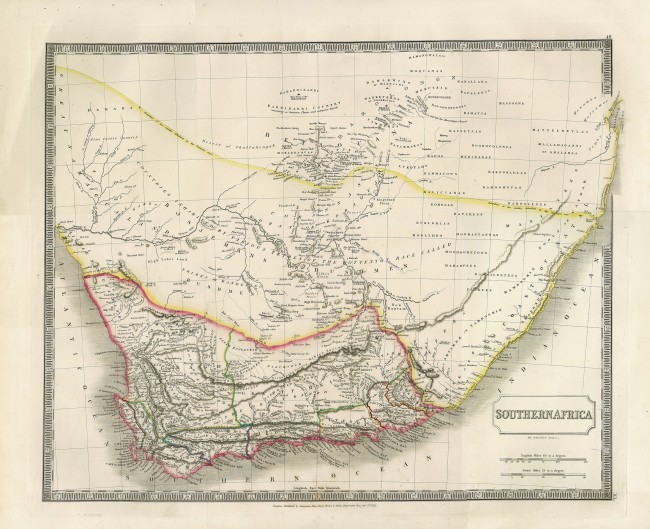
This finely engraved map was published as map XL (bottom right corner) in the double elephant folio sized A new general atlas, with the divisions and boundaries carefully coloured; Constructed entirely from new drawings, and engraved by Sidney Hall. (1st ed.). This quit large map is printed from a copperplate on to a single page of heavy paper.
Hall engrave William Burchell's map that was drawn from accurate data he obtained during his travels. Hall clearly draws from Burchell's map but also extends it to beyond the Great Fish River (Burchell had no confidence on information of the interior east of the Great Fish. Hall also extends the map further north, into today's Botswana, for which he relied on information from later travellers that extended further north than Burchell. hall also attempts to indicate where numerous indigenous groups lived; within the cape Colony he shows the magisterial districts of the time.
The historically interesting map has attractive outline colouring and wide margins that make it particularly suitable for archival framing.
References
Tooley p. 48
- Size: 41.5am x 51cm
- Sold By: Thorolds Legal & Antiquarian Booksellers
- Contact Person: Kim Roberts
- Country: South Africa
- Email: [email protected]
- Telephone: 0118759991
- Preferred Payment Methods: Cash; EFT; Credit Card
- Trade Associations: Antiquarian Bookseller's Association


