


Nine papers.
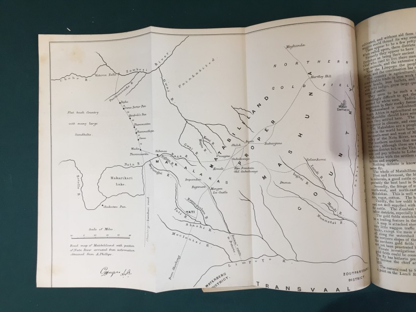
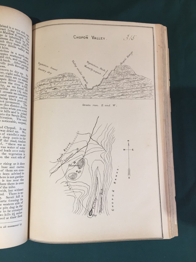
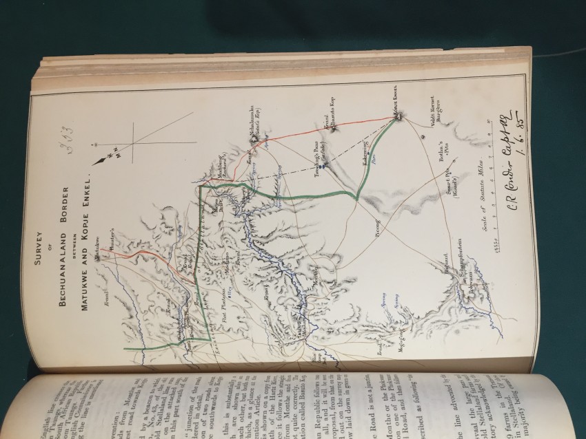
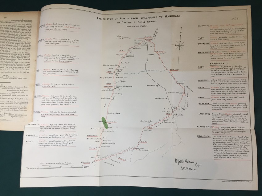
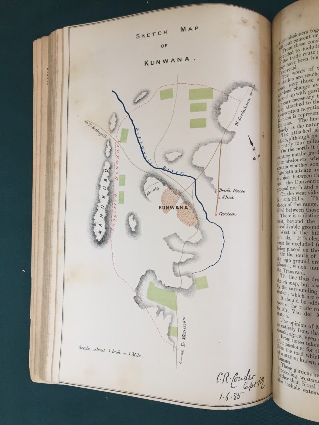
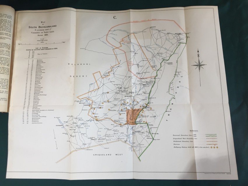
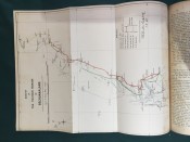
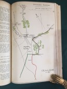
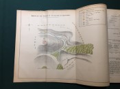
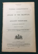
Further Correspondence respecting the Affairs of the Transvaal and Adjacent Territories. (In continuation of [C.-4588] of August 1885.) Presented to both Houses of Parliament by Command of Her Majesty. February 1886. pp.viii+251. Folding coloured map of “South Bechuanaland to accompany Report of Committee on Native Lands August 1885.” (overall 50 x 62cm.) Map of section of “Chopoñ Valley.” (overall 32 x 20cm.) Folding map of “Matibililand with position of Nata River corrected from information obtained from A. Phillips.” (overall 32 x 43cm.) Map of “Survey of the eastern border of Bechuanaland.” (overall 32 42cm.) Coloured sketch map of Lotlakana Gardens. (32 x 21cm.) Coloured sketch map of Kunwana. (32 x 21cm.) Coloured map of “Survey of Bechuanaland border between Matukwe and Kopje Enkel.” (32 x 21cm.) Diagram of the flag of the Stellaland Republic. (32 x 21cm.) Folding coloured map of roads from Molopolole to Mangwato by Captain H. Goold Adams. (44 x 55cm.) [52197]
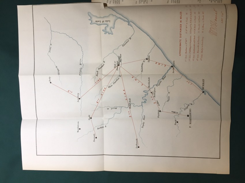
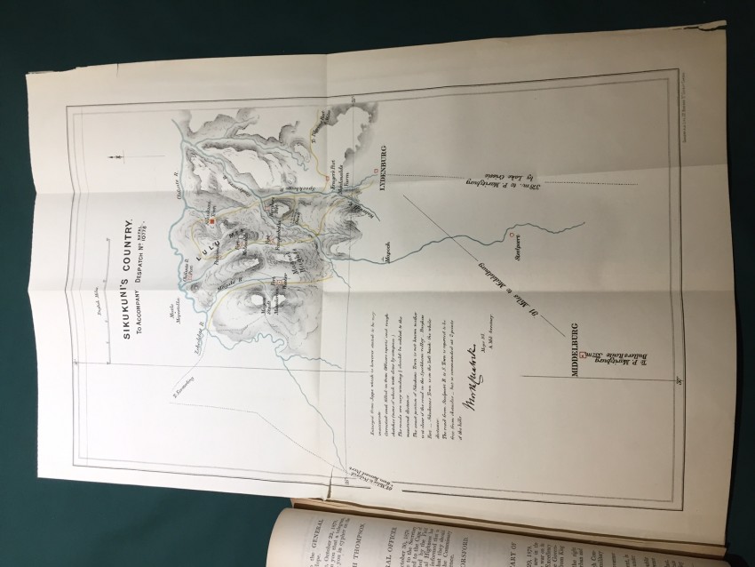
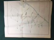
South Africa. Correspondence relative to the Military Affairs in Natal and the Transvaal. War Office, 13th February 1879. Presented to both Houses of Parliament by Command of Her Majesty. pp.41. Folding coloured maps (overall 49.3 x 41.6cm) Natal, from Surban (S) to Lake St Lucia (E) to Derby (N) and Ladismith (W). (Overall 55.6 x 37cm.) “Sikukuni’s Country. To accompany Despatch No. 10778.” [52241]
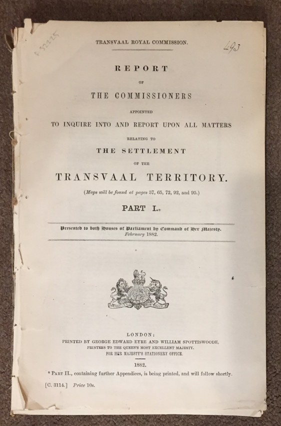
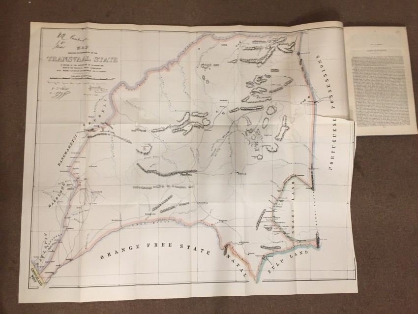
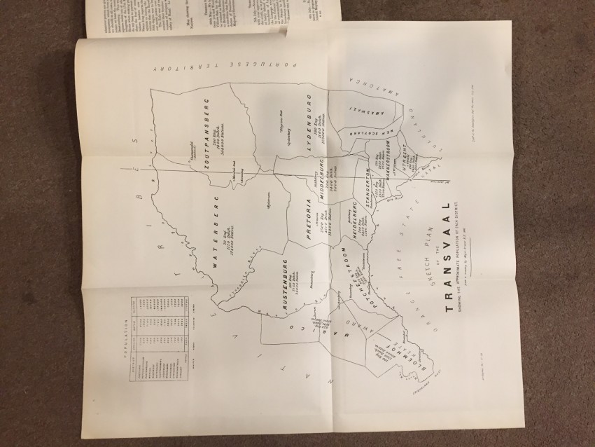
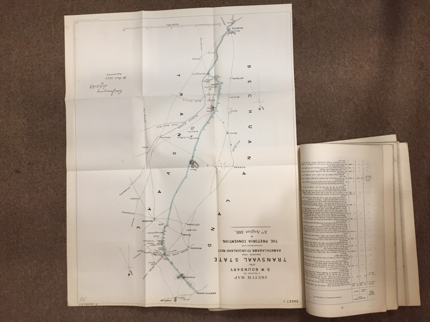
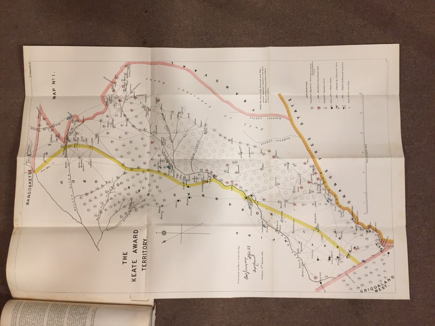
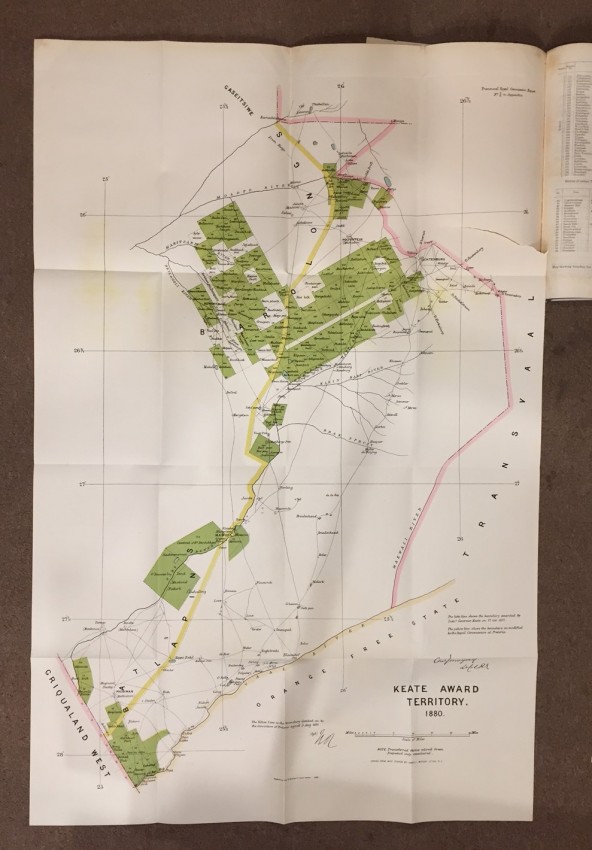
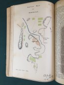
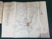
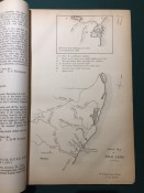
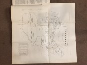
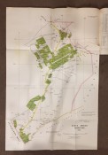
Transvaal Royal Comission. Report of the Commissioners Appointed to inquire into and Report upon all Matters relating to The Settlement of the Transvaal Territory. PART I. Presented to both Houses of Parliament by Command of Her Majesty. February 1882. pp.224. Folding coloured map (overall 75 x 89cm.) “Map showing Boundaries of New Transvaal State”. Folding map (overall 53.5 x 50.5) “Sketch plan of the Transvaal showing the Approximate Population of Each District. From a traaing by Major Fraser R.E. 1881.” Folding coloured maps (overall 62 x 49cm, 56 x 42.6cm.) “Sketch map to illustrate the S.W. Boundary of the Transvaal State beaconed from Ramathlabama to Griqualaland West in accordance with The Pretoria Convention. Of 3rd. August 1881.” Sheet 1 & 2. Folding coloured maps “Keate Award Territory” No. 1, 2, 3 & 4. (overall 91 x 60cm.) (overall 32.3 x 44.2cm.) (overall 32.5 x 44cm.) (overall 32.5 x 44cm.) Folding coloured map (overall 101 x 66.2cm.) “Keate Award Territory 1880.” [52225]
Further correspondence respecting the affairs of South Africa. (In continuation of [C. 2000] of 1878.) Presented to both Houses of Parliament by Command of Her Majesty. July 1878. [Bound with] South Africa. Further Correspondence respecting the Affairs of South Africa. (In continuation of [C.-2079.] 1878.) Presented to both Houses of Parliament by Command of Her Majesty. July 1878. [Bound with] Further Correspondence respecting the Affairs of South Africa. (In continuation of [C.-2100.] 1878.) Presented to both Houses of Parliament by Command of Her Majesty. August 1878. [Bound with] Transvaal. Letter from Messrs. Krügwe and Joubert, Delegates from the Transvaal, to the Secretary of State for the Colonies; with the Reply. Presented to both Houses of Parliament by Command of Her Majesty. August 1878. pp.viii+242; viii+110; xi+307; 19. “Sketch Map of Zululand.” (overall 32 x 21cm.) Folding coloured map of “the ground of the action at Quintana.” (overall 32 x 43cm.) in first part. Folding coloured map in tgird part (overall 32 x 44cm.) Orange Free State (N) to Natal (E) to Port Elizabeth (S) to Cape Colony (W). [52199]
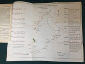
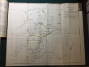
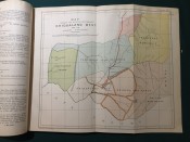
Transvaal. Further Correspondence respecting the Affairs of the Transvaal and Adjacent Territories. (In continuation of [C.-4432] of May 1885.) Presented to both Houses of Parliament by Command of Her Majesty. February 1886. pp.viii+251. Folding coloured map (overall 55.1 x 67.2.cm.) “Sketch map showing Territories claimed by Khama, Sechele & Gasitsiwe.” [52197]
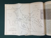
Correspondence respecting the War between the Transvaal Republic and Neighbouring Native Tribes, and generally with reference to Native Affairs in South Africa. Presented to both Houses of Parliament by Command of Her Majesty. April 1877 [Bound with] Further Correspondence respecting the War between the Transvaal Republic and Neighbouring Native Tribes and generally with reference to Native Affairs in South Africa. (In continuation of [C.-1748.] April 1877.) Presented to both Houses of Parliament by Command of Her Majesty. April 1877. [Bound with] Transvaal. Further Correspondence respecting the Affairs of South Africa. (In continuation of [C.-1776.] June 1887.) Presented to both Houses of Parliament by Command of Her Majesty. July 1877. pp.xv+255; x+166; 15. Folding coloured map (overall 32 x 38.3cm.) “Map shewing the relative positions of Griqualand West and the Adjoining Territories.”, Folding coloured map with inset map of South Africa. (Overall 32 x 71cm.) “Map of a portion of the Transvaal Republic showing the scene of the late operations against Secocoeni chiefly from Merensky’s Map. 1875.” [52247]
- Binding Condition: Disbound
- Overall Condition: Very good
- Size: Folio. (32 x 21cm.)
- Sold By: Robert Frew Ltd.
- Contact Person: Rebecca Swales
- Country: United Kingdom
- Email: [email protected]
- Telephone: +442075906650
- Preferred Payment Methods: PayPal, bank transfer, cheque, credit card with faxed security code, card no., expiry date & billing address.
- Trade Associations: Robert Frew Ltd


