

Copper engraved, 375 x 220 mm, later hand colouring, good plate mark, printed on good quality laid paper, very good.
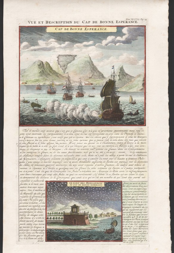
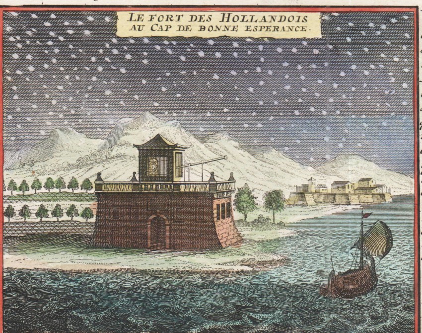
This copperplate engraving is of two views of the Cape. Above is Table Bay, with shipping in the foreground flying the Dutch flag, and separating the two views is an engraved descriptive text which refers mainly to the Company’s gardens, 'the most beautiful and curious to be seen in a country that is sterile and frightful.' The lower engraving shows the Dutch fort at the Cape and an observatory established by the Frenchman Tachard and the Jesuit Fathers to observe the southern skies.
The engraving comes from the seven-volume Atlas Historique et Méthodique, published by Chatelain and Guedeville in 1705 - 20 (with a second edition in 1732). These views are copies of earlier illustrations in Tachard's Voyage de Siam des Père Jésuits in 1685.
Norwich (Oscar) MAPS OF AFRICA, 1983, Map 210.
- Sold By: Clarke's Africana & Rare Books
- Contact Person: Paul Mills
- Country: South Africa
- Email: [email protected]
- Telephone: 021 794 0600
- Preferred Payment Methods: Visa & Mastercard via PayGate secure links and Bank transfers.
- Trade Associations: ABA - ILAB, SABDA


