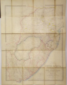
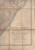
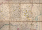
From the River Limpopo to Algoa Bay, Embracing The Transvaal, Orange Free State, Natal, Zulu and Griquala-Land West. Shewing the British Settlements & Native Locations, by James Wyld Geographer to the Queen
820 x 630 mm, coloured in outline, mounted on linen in panels, folding into paper -covered boards (with a simulated leather grain), there is a list of his publications on the front end papers, paper title label on the upper cover, the boards are rubbed at the edges but the map is in good condition.
James Wyld (1812–1887) was a British geographer and map-seller, best known for Wyld's Great Globe.On his father's death in 1836, Wyld became the sole owner of the thriving family mapmaking business based in Charing Cross. His maps, which covered regions as diverse as London and the gold fields of California, were regarded highly, and Wyld himself had an excellent reputation as a mapmaker; he was elected as a fellow of the Royal Geographical Society in 1839, and he was appointed Geographer to Queen Victoria and Prince Albert (as had been his father before him) https://en.wikipedia.org/wiki/James_Wyld
- Overall Condition: A Good Copy
- Size: 8vo (190 x120mm) folded
- Sold By: Clarke's Africana & Rare Books
- Contact Person: Paul Mills
- Country: South Africa
- Email: [email protected]
- Telephone: 021 794 0600
- Preferred Payment Methods: Visa & Mastercard via PayGate secure links and Bank transfers.
- Trade Associations: ABA - ILAB, SABDA


