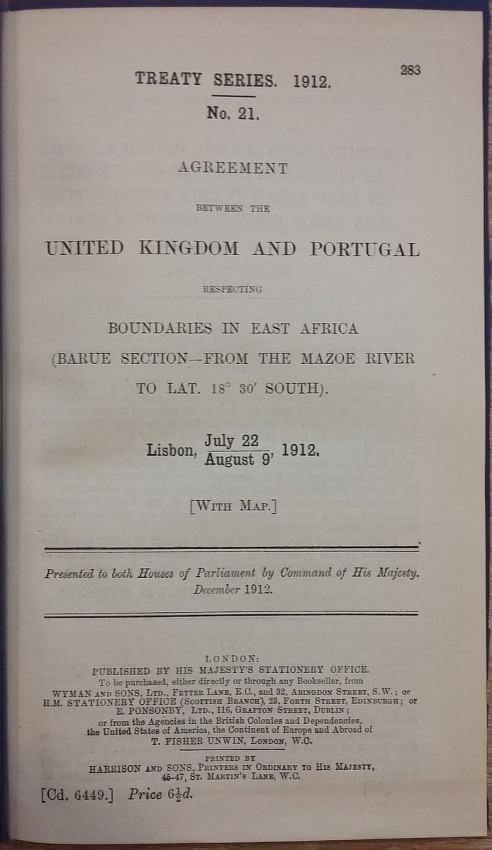
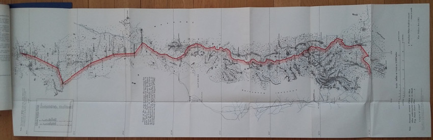


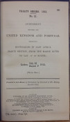
These three rare items contains agreements between the United Kingdom and Portugal, including 3 large folding maps showing boundary between Mozambique & Zimbabwe, boundary between Mozambique & Malawi and boundaries in South-East Africa.
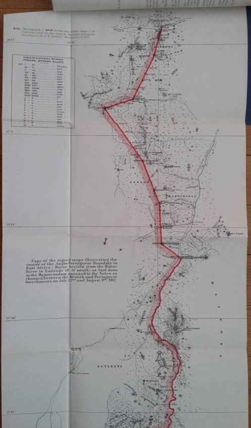
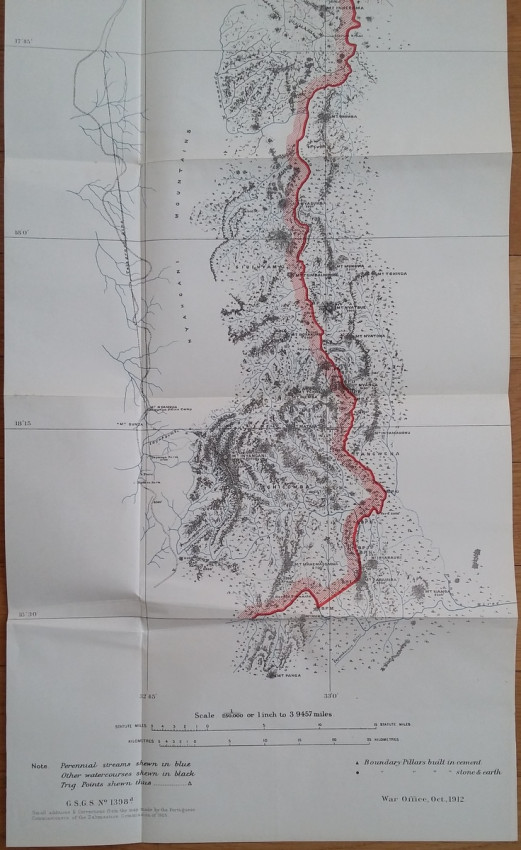
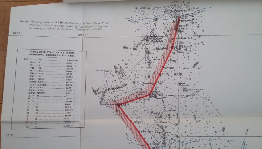
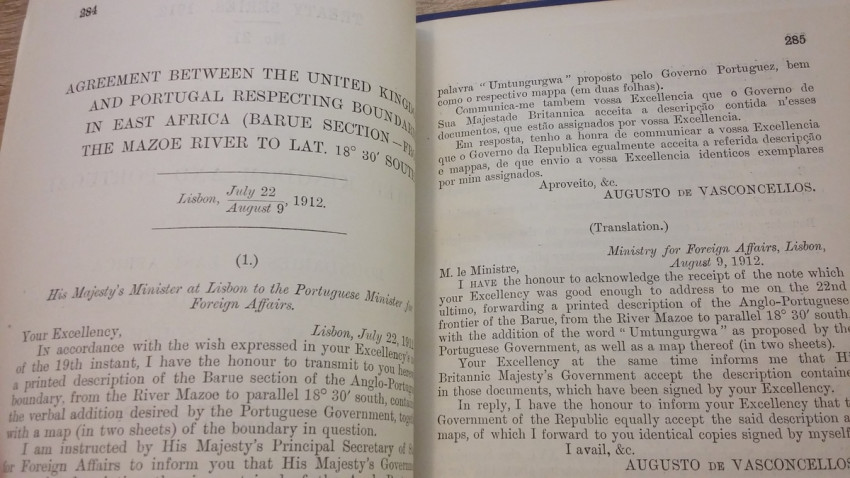
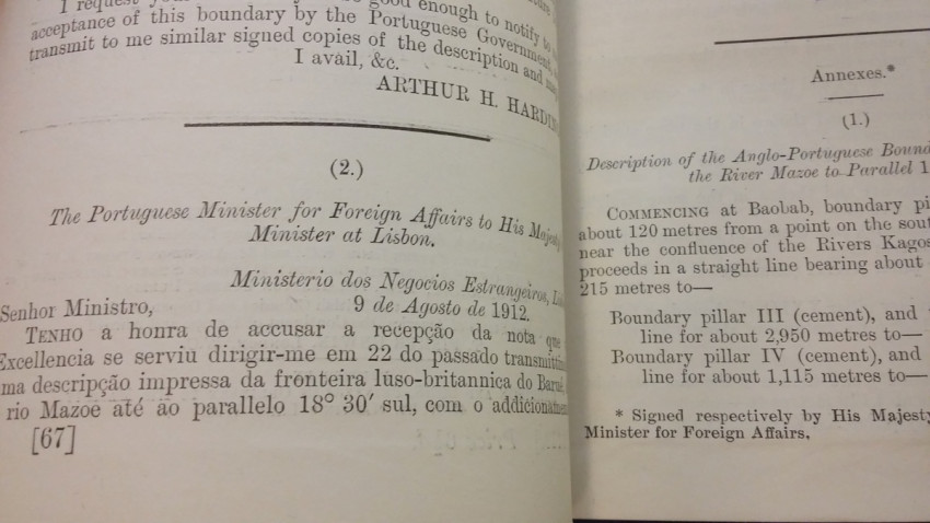
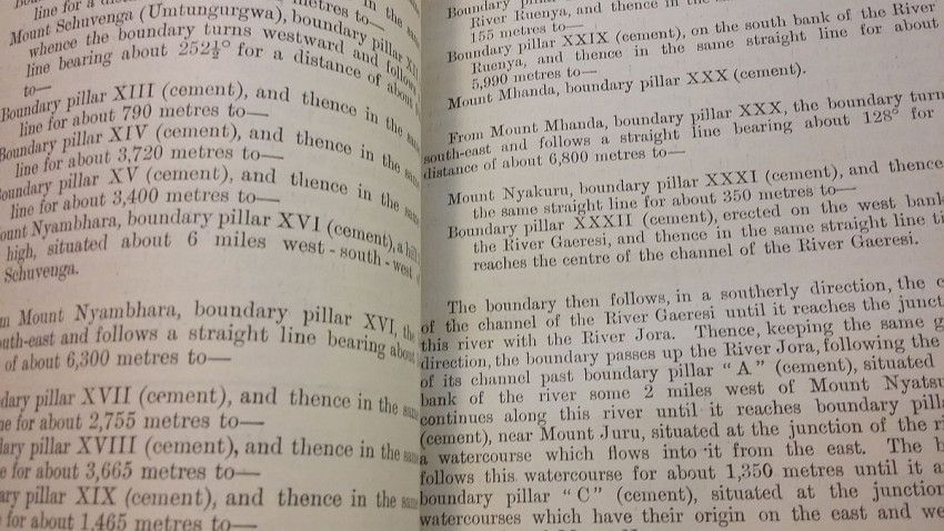
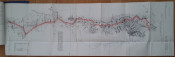
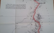
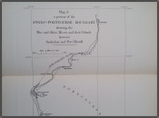
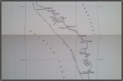
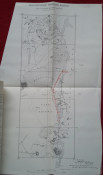
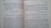
1) "Agreement between The United Kingdom and Portugal respecting Boundaries in East Africa (Barue Section - from the Mazoe River to Lat. 18°30' South). Lisbon, July 22, and August 9, 1912. [WITH MAP.]"; London, His Majesty's Stationery Office, 1912; British Parliamentary Paper [Cd.6449.]; Rebound in card covers; 23,5 x 14,5 cm; Collation complete - 5 pages, with colored folding map (94 x 29 cm); Text in English and Portuguese; A clean copy, no marks of foxing throughout; Boundary between Mozambique & Zimbabwe agreed. With large colored folding map (94 x 29 cm) illustrating the course of the Anglo-Portuguese Boundary in East Africa (drawn at the War Office - Southampton, October 1912). This is the only copy of this item selling on internet!
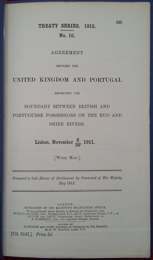
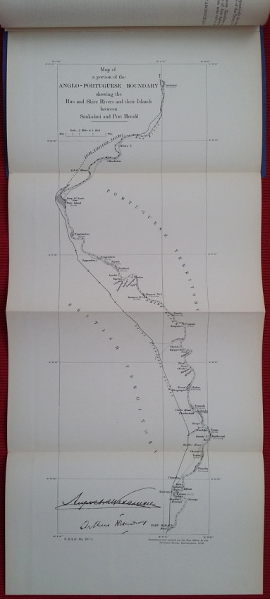
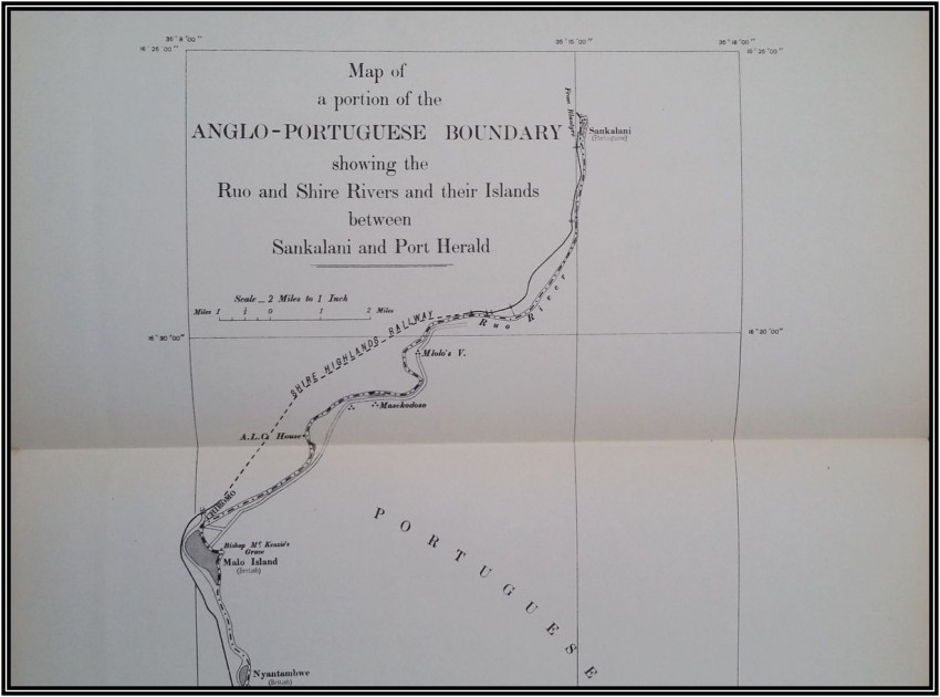
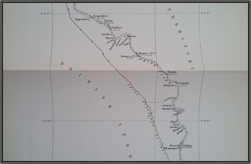
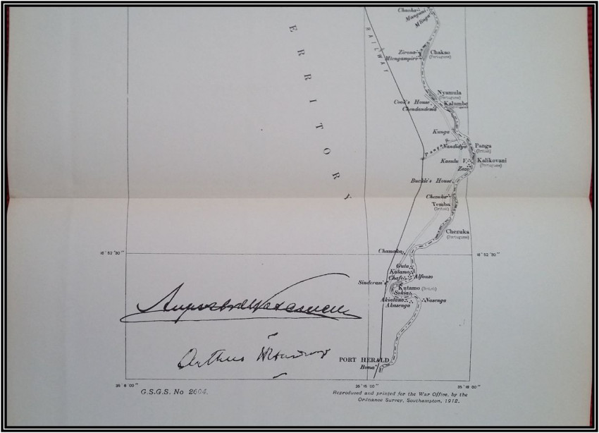
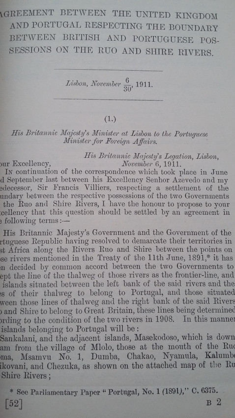
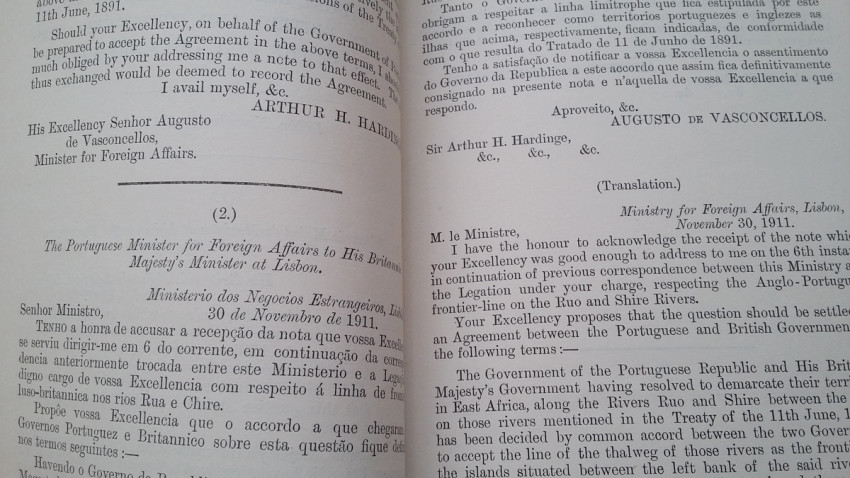
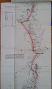
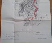
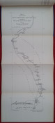
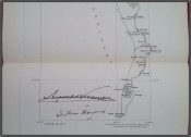
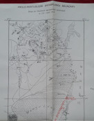
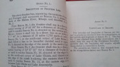
2) "Agreement between The United Kingdom and Portugal respecting The Boundary between British and Portuguese possessions on the Ruo and Shire rivers. Lisbon, November 6, and November 30, 1911. [WITH MAP.]"; London, His Majesty's Stationery Office, 1912; British Parliamentary Paper [Cd.6147.]; 24,5 x 15,5 cm; Rebound in card covers; Collation complete - 4 pages, with folding map (54 x 24 cm); Text in English and Portuguese; A clean copy, no marks of foxing throughout; Boundary between Mozambique & Malawi agreed. With folding map (54 x 24 cm) of a portion of the Anglo-Portuguese Boundary showing the Ruo and Shire Rivers and their Islands between Sankalani and Port Herald (drawn at the War Office - Southampton, 1912). This is the only copy of this item selling on internet!
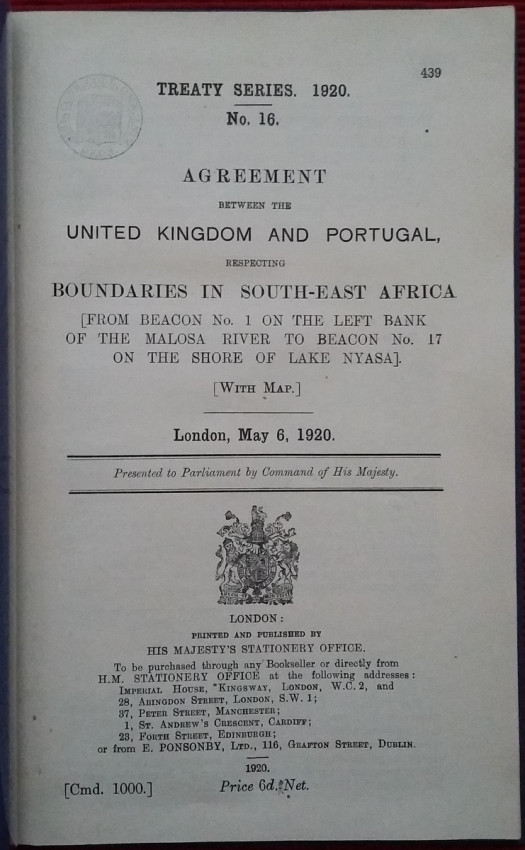
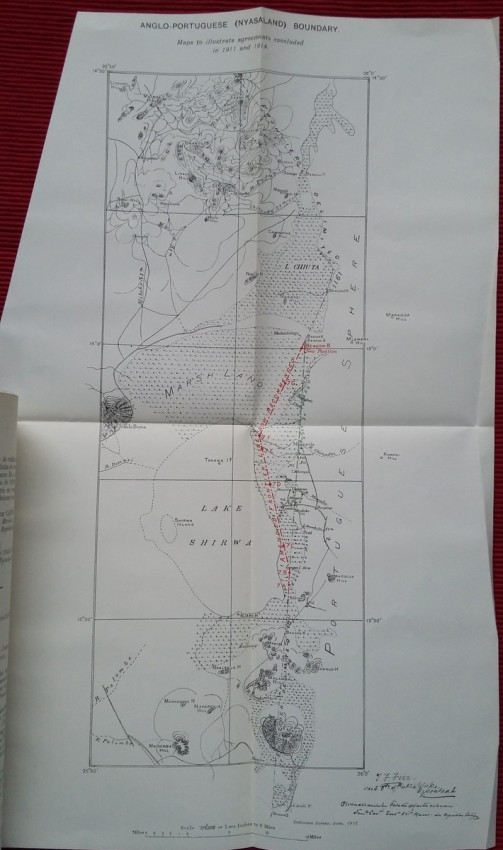
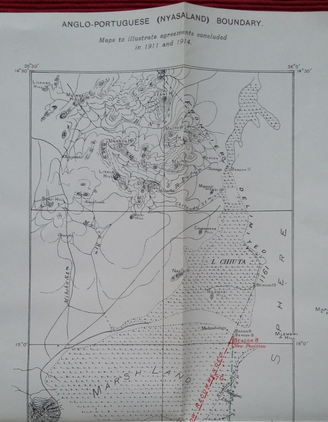
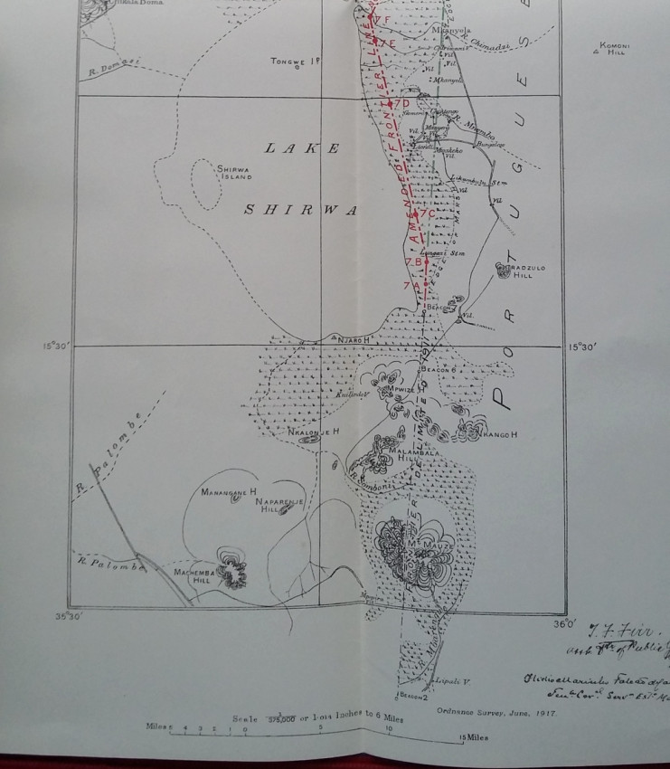
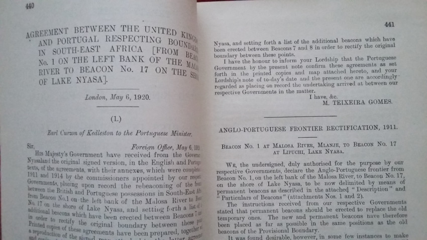
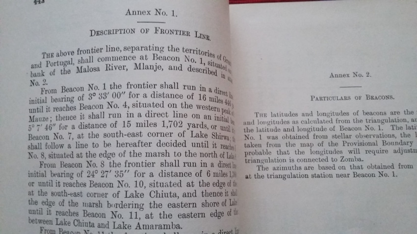
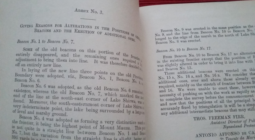
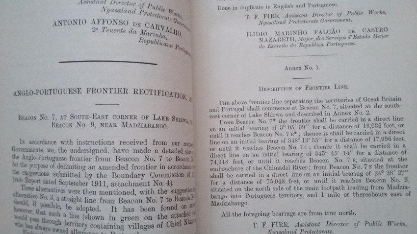
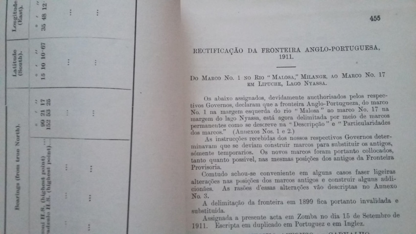
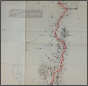
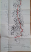
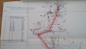
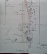
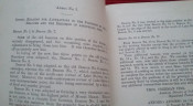
3) "Agreeement between the United Kingdom and Portugal, respecting (from Beacon No.1 on the left bank of the Molosa River to Beacon No.17 on the shore of Lake Nyasa. [With Map.]. London, May 6, 1920."; London, His Majesty's Stationery Office, 1920; British Parliamentary Paper [Cmd. 1000]; Rebound in card covers; 24 x 14,5 cm; Collation complete - 25 pages, with folding map (27,5 x 44 cm); Ex-libris stamp to the title page. A clean copy, no marks of foxing throughout; With folding map (27,5 x 44 cm). This is the only copy of this item selling on internet!
IMPORTANT information regarding shipping: Shipping to South Africa possible via national post ($40) or Fedex/DHL Express service ($80-100). Shipping to EU & UK via registered Airmail trackable parcel ($30-40). Shipping to US via USPS ($40). For other countries please ask.
- Binding Condition: Very good
- Overall Condition: Very good
- Size: 24 x 15 cm