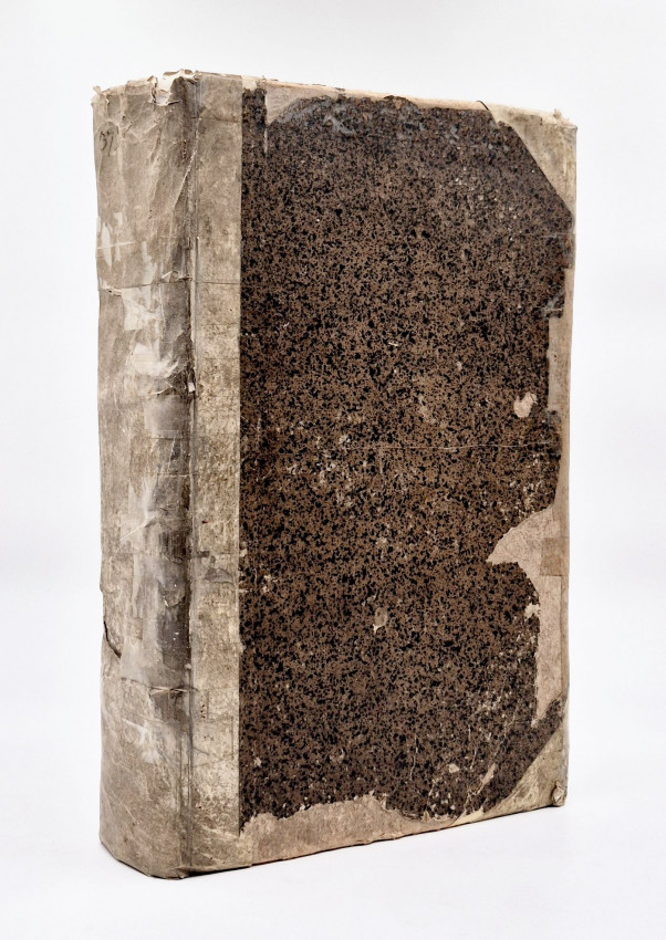
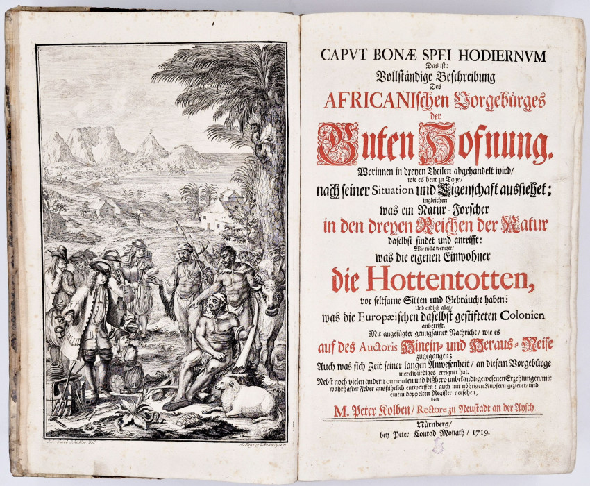
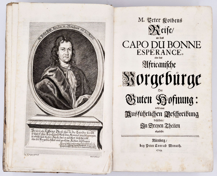
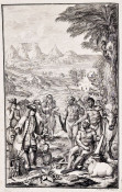
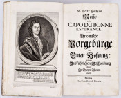
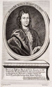
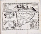
First German Edition: Title page printed in red and black, complete with the engraved frontispiece, portrait of Kolben, engraved double-page map of South Africa and 23 engraved plates, half vellum with sprinkled paper sides - very worn and simply repaired with clear tape, lacks the half title page, bookplate on the front paste-down endpaper, text slightly browned but the portrait, map of Africa and plates are clean and crisp.
The bookplate is Ex-libris James Hamilton Russell. This copy was last sold by Sotheby's, Cape Town, Tuesday, 29th January 1980.
S2A3 Biographical Database of Southern African Science (https://www.s2a3.org.za/bio/Biograph_final.php?serial=1560)
Born: 10 October 1675, Doerflas, near Marktredwitz, Germany.
Died: 31 December 1725, Neustadt an der Aisch, Germany.
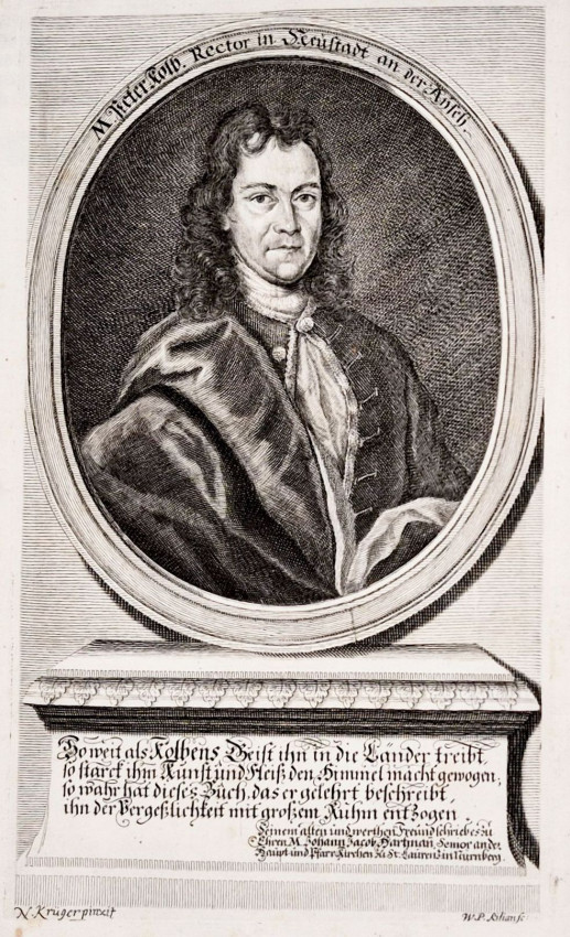
'Peter Kolb (also Kolbe, Kolben), German writer on the Cape, received his early education at Marktredwitz and from 1688 at Wunsiedel, where he completed his schooling in 1694. He then attended the Sebaldus Gymnasium and subsequently the Egidius Gymnasium at Nuremberg, but his financial position became precarious some years after the death of his father in 1691. After working for some time as an assistant to the astronomer G.C. Eimmart he enrolled at the University of Halle in 1700, where he studied philosophy, mathematics, physics, logic, oriental languages and theology. He was awarded an advanced degree in 1703 for a thesis, De natura cometarum, on the nature of comets as natural phenomena. He then became the private secretary of Freiherr Bernhard F. von Krosigk, and tutor to the latter's son. Von Krosigk was interested in astronomy and decided to send Kolb to the Cape of Good Hope to undertake astronomical observations and study its physical features and natural history. His astronomical work was to include the determination of the geographical position of the Cape, and observations of the moon that would be used in combination with similar observations made in the northern hemisphere to determine the earth-moon distance. He obtained the necessary astronomical instruments in Amsterdam, the Netherlands.
'Kolb left the Netherlands on 8 January 1705 in the Unie, a ship of the Dutch East India Company. The company offered him some support for his work at the Cape, including a pendulum clock, provided that he would leave his instruments there and train an assistant to continue his observations. Having learned some Dutch during the long voyage, he arrived at the Cape on 11 June 1705. He was well received by Governor W.A. van der Stel and provided with accommodation and facilities for his studies. His astronomical observatory was situated in the Buren bastion of the Castle. Fairly soon after his arrival he determined the latitude, longitude and magnetic declination of his observatory. His latitude (34 deg 15' S) placed Cape Town about 20' too far south, but his longitude was more accurate than the value found by Father Guy Tachard in 1685. The magnetic declination he found to be 11 deg 55' W in 1707. These results were reported to Baron von Krosigk for possible publication.
'However, in general little progress was made with his astronomical observations and his relations with the authorities deteriorated when he sided with the colonists in their grievances against Governor van der Stel. None the less he collected much information about the colony, and particularly about the local Khoi. Though von Krosigk died in 1709 and Kolb's stipend ended, he remained at the Cape. In February 1710 the authorities threatened to deport him unless he started paying taxes and doing burgher duty; as a result he accepted an appointment by the Dutch East India Company in 1711 as secretary to the Court of the Landrost at Stellenbosch. Here he continued collecting information, until failing eyesight led to his discharge and forced him to return to Europe in April 1713. He does not seem to have travelled into the interior beyond Stellenbosch, but did visit the warm baths at "Black Hill" (near present Caledon).
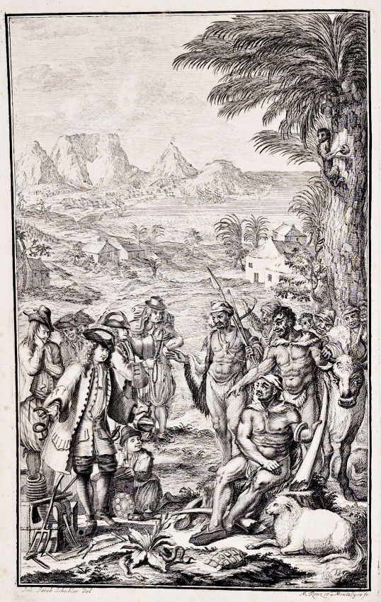
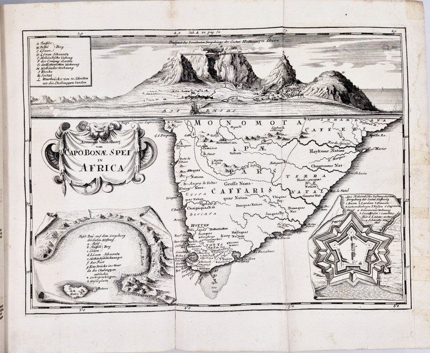
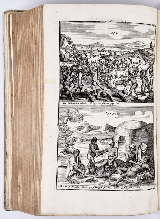
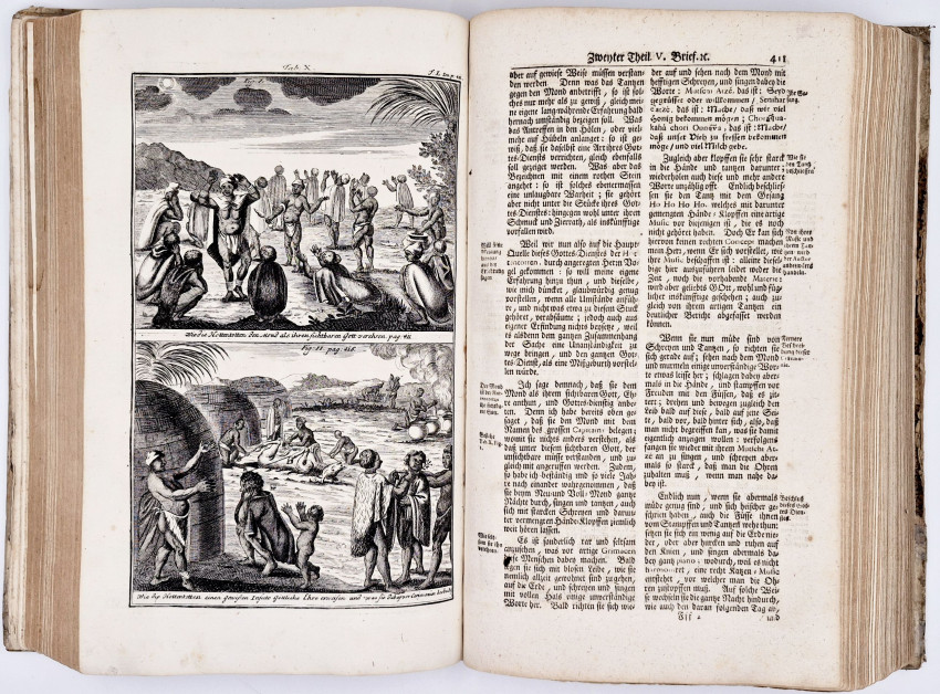
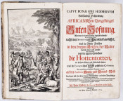
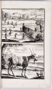
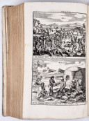
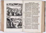
'After treatment in Rastatt, Germany, his vision improved and he returned to his home in 1715 to spend the next few years writing. In 1718 he became principal of a secondary school at Neustadt an der Aisch, where he remained for the rest of his life. His major work on the Cape, Caput Bonae Spei hodiernum, das ist: Vollstaendige Beschreibung des Afrikanischen Vorgebuerges der Guten Hofnung... was published in Neuremberg in 1719. His portrait forms the frontispiece of the book, which contains 846 pages. The first part deals extensively with the Khoi. This is followed by chapters on the natural history of the Cape. From a historical point of view his description of the Khoi and their way of life is the most important part of the book, as their culture had not yet been much changed by European influences. However, his account contains various unfounded speculations and seems to be partly based on earlier descriptions by Guy Tachard and others.
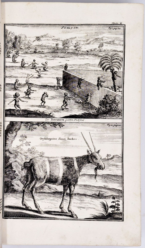
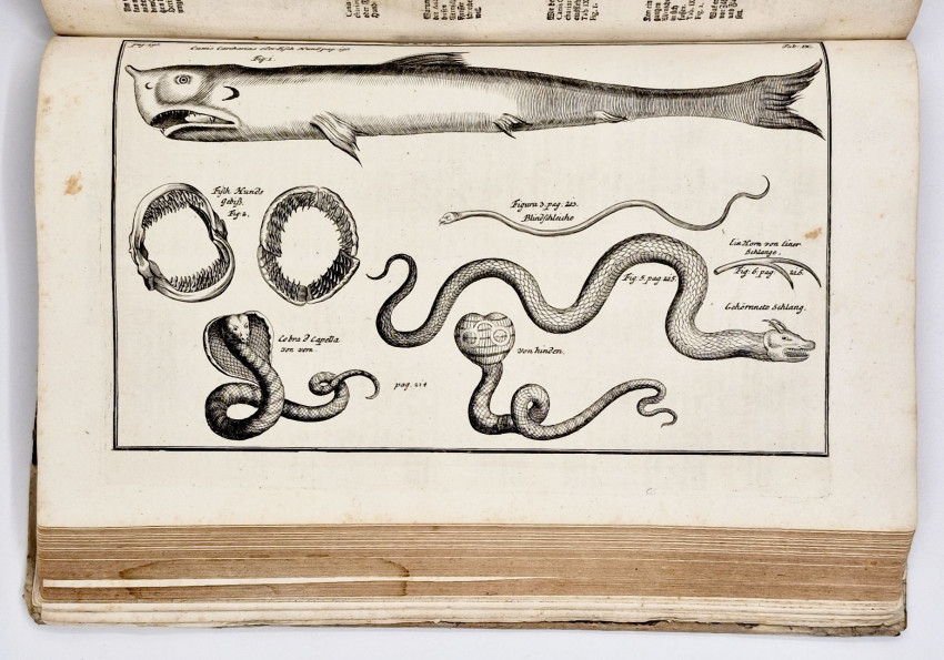
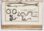
'Though Kolb had no training or special interest in natural history, his book contains the first published lists of the Cape fauna, with a number of illustrations. The lists of mammals, birds, reptiles, land invertebrates, fishes and other sea animals are quite extensive, but his brief descriptions contain little specific or new information. None the less they were of considerable interest at the time. Kolb's memory is perpetuated in the popular name of the Cape or Kolbe's vulture. He also lists some 400 species of trees and other plants, having learnt something about the subject from J. Hartog, the Dutch East India Company's gardener, but his list is largely based on existing manuscripts and books. In a section on the rocks, soils and minerals of the colony mention is made of peat, limestone and sand, but most space is devoted to speculative theories according to which the Cape should be rich in minerals. In other sections he describes the production of salt, the weather at the Cape, hot springs (including his personal observations of those near present Caledon), and diseases among the settlers and their cures.
'A Dutch translation of the book was published in 1727, an abridged English translation in 1731, and a French edition in 1741. It was the most comprehensive description of the Cape to date, and remained very influential for several decades despite criticism of the accuracy and originality of its information by F. le Vaillant, N.L. de la Caille, A. Sparrman and others.
'Kolb was not married and lived with his sister. He died of a lung complaint.
Mendelssohn (Sidney) South African Bibliography, volume 1, pages 843/844: 'Exact and detailed description of the Cape of Good Hope, containing a very circumstantial account of the present state of that celebrated country, its settlements, harbour, fortress, form of government, extent, and the regions recently discovered in its vicinity ; together with an erudite description of the climate and soil of the territory ; of its animals, fishes, birds, plants, and herbs ; likewise of various prodigies of Nature discovered in the country ; to which is added a very accurately compiled account of the Hottentots from the author's own personal investigations : followed by a remarkable report on their language, religion, manner of living, singular traditions, customs, marriage ceremonies, circumcisions, and education ; also many other curious observations concerning the manners of the nation ; the condition of the colony of the European inhabitants, not to be found in any other description of the country.
'Written with a strict attention to veracity, during a long residence in the aforesaid Cape of Good Hope, by Peter Kolben, M.A., who was sent to the Cape through a distinguished minister, with letters of introduction from the late Right Hon. Lord Nicholas Witsen, Burgomaster of the town of Amsterdam, for the purposes of this compilation, and for mathematical and astronomical research, and who afterwards became Secretary for Stellenbosch and Drakenstein, and is now headmaster of the celebrated school at Neustad. . . . Augmented and embellished with useful, new, and curious maps and many illustrations.'
Kennedy R.F.) Africana Repository, Juta & Company, 1965, page 58, ‘The first issue, the German edition of 1719, is a very fine folio with 23 full pages of illustrations, most of these plates having two pictures to the page.’
Howgego (Raymond John) Encyclopedia of Exploration, Volume I, K34, pages 577/8.
- Size: Folio 350 x 220 mm)
- Sold By: Clarke's Africana & Rare Books
- Contact Person: Paul Mills
- Country: South Africa
- Email: [email protected]
- Telephone: 021 794 0600
- Preferred Payment Methods: Visa & Mastercard via PayGate secure links and Bank transfers.
- Trade Associations: ABA - ILAB, SABDA


