(1).jpg)
.jpg)
(1).jpg)
.jpg)
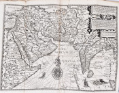
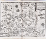
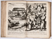
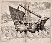
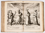
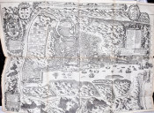
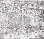
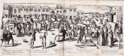
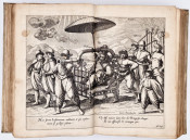
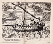
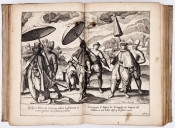
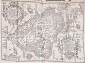

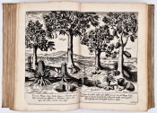
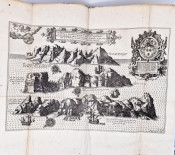
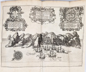
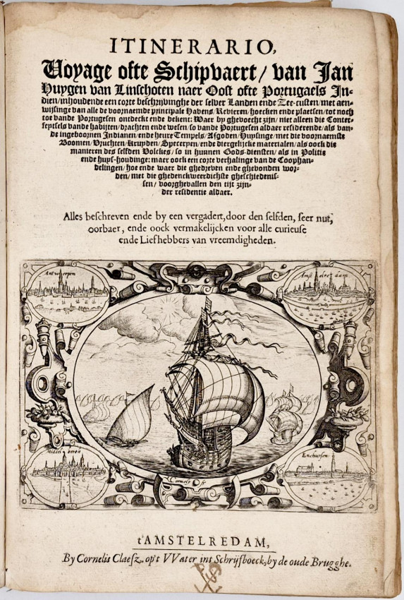
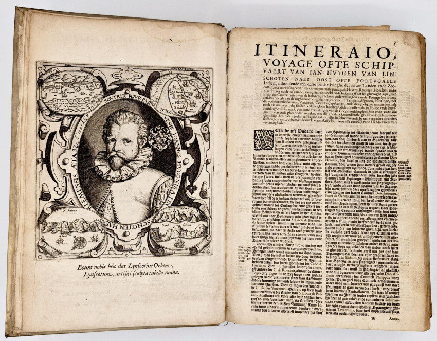
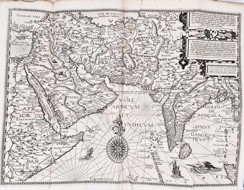
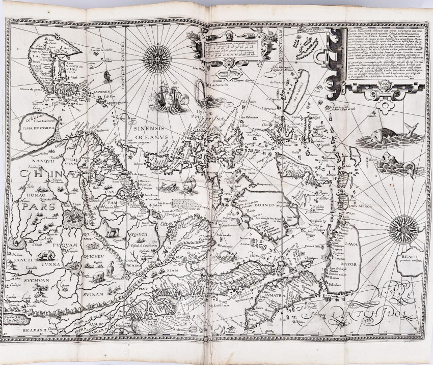
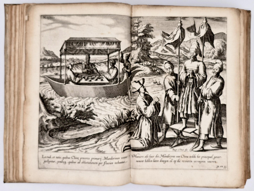
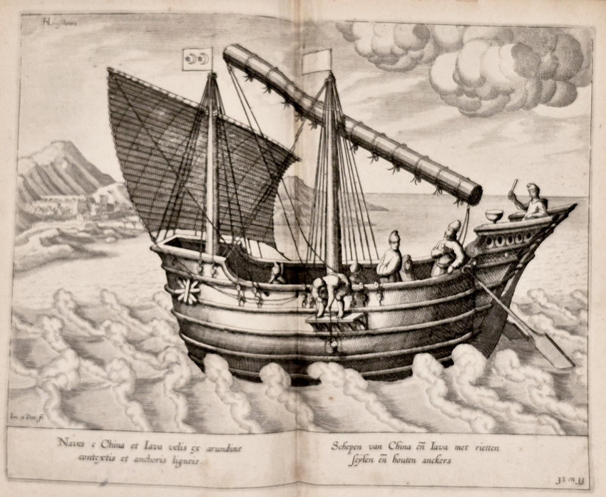
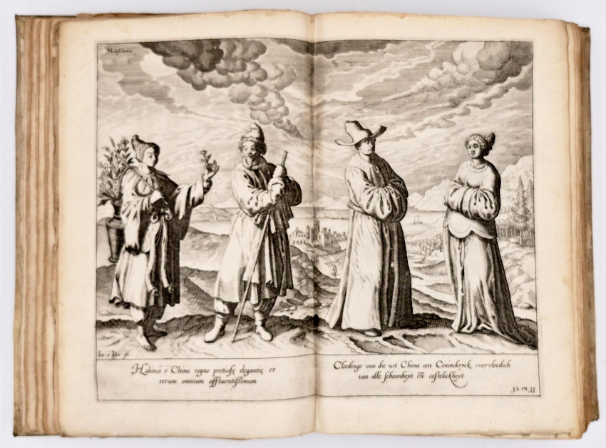
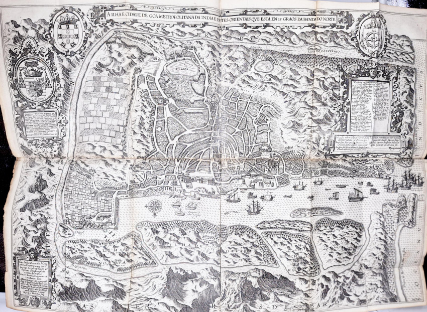
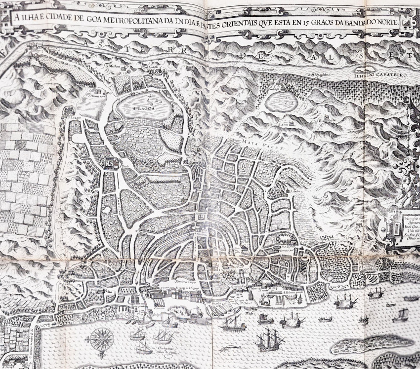
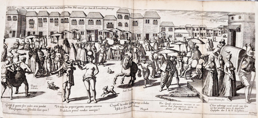
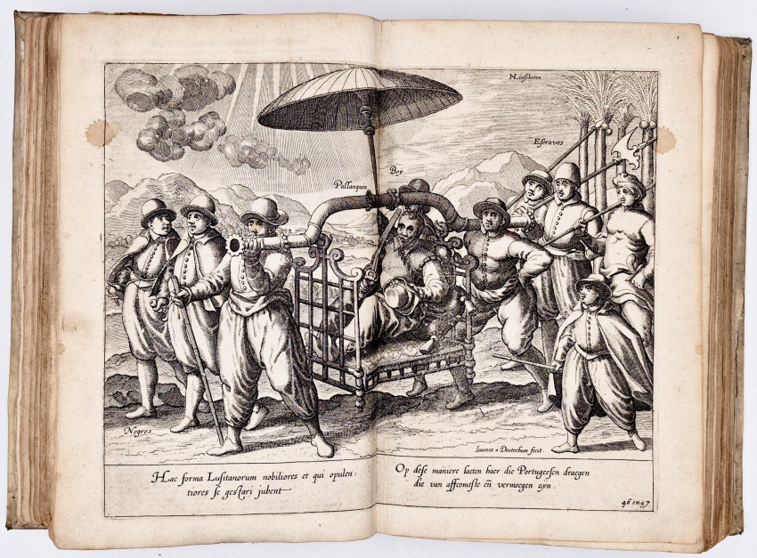
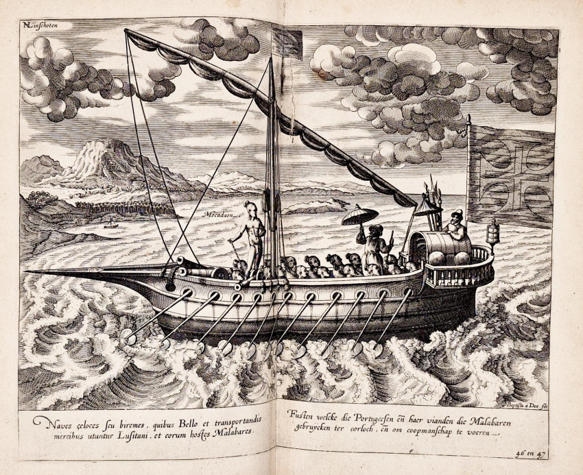
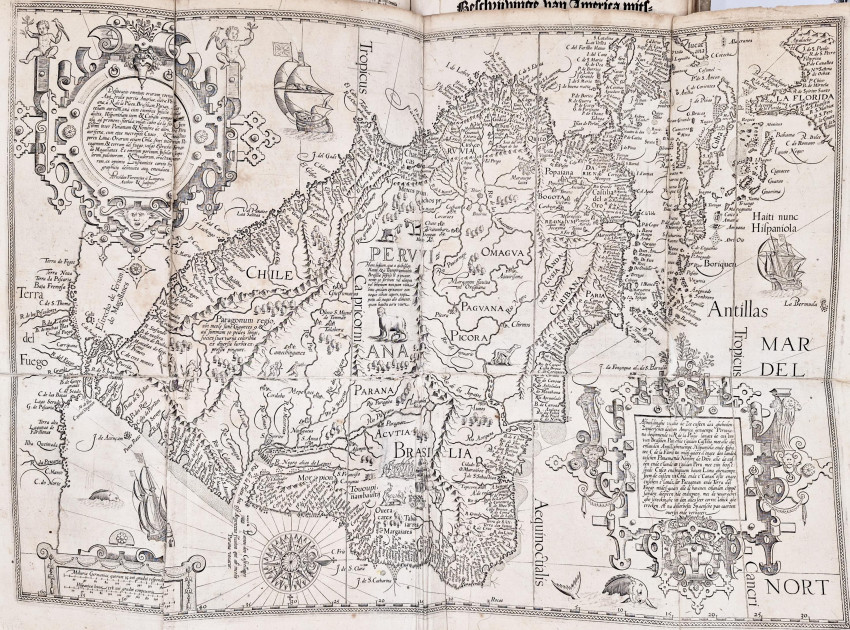
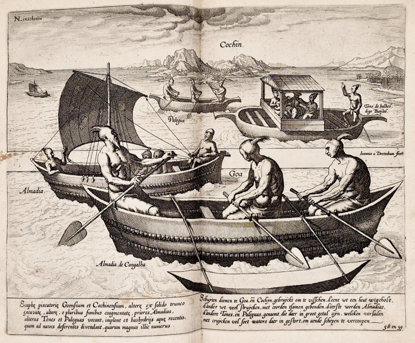
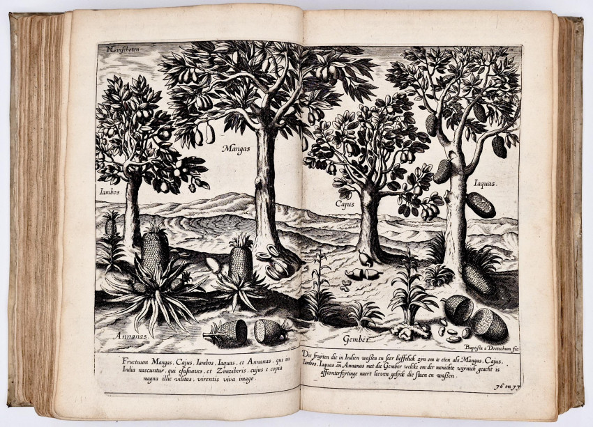
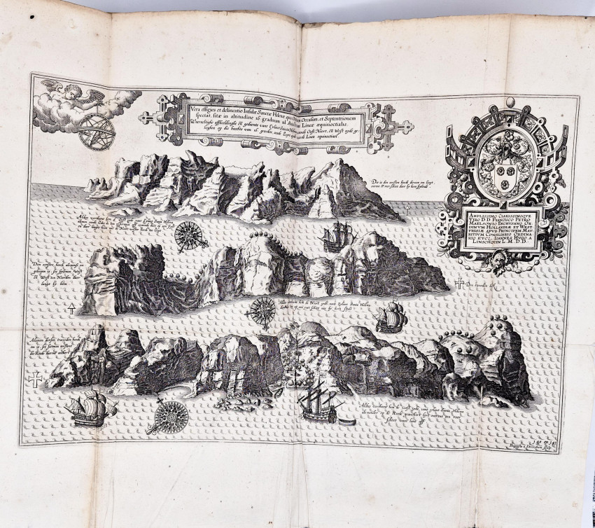
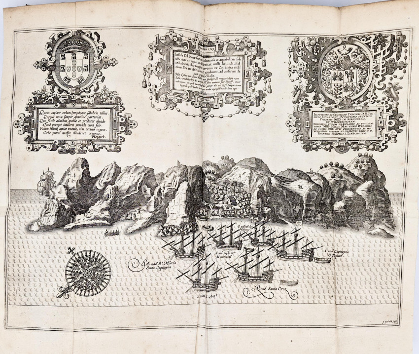
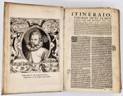
Second Dutch Edition: 3 parts in 1 volume, (vi),160, 147, (80), (ii blank), (8 index) pages, 3 title page vignettes, portrait of the author, large folding map of the world (Orbis Terrarum) repaired at the folds, 2 folding maps of East and West coasts of Africa, large folding plan of Goa (A Ilhae Cidade de Goa) repaired at the folds, 2 large folding plates of St Helena (1.Vera effigies et delineation insulae Sanctae Helenae. 2.insula D.Helenae sacra coeli clementia.),large folding plan of Cidadea de Angra with minor repairs, 31 double page plates (each numbered and placed correctly, some with repairs at the centre folds), text is lightly browned with occasional finger staining in the margins but generally the maps, text and plates are clean and free of foxing, full contemporary vellum, a very good copy.
Jan Huygen van Linschoten (1563-1611): An Annotated Bibliography.
(https://rutter-project.org/wp-content/uploads/2021/09/vila-santa_tn9.pdf)
‘Jan Huygen van Linschoten (1563–1611) was a key-personality in the beginning of the Dutch overseas expansion. His 1596 Itinerario provided the young Dutch Republic with the nautical, commercial, political, economic and social knowledge of Asia that enabled its first voyage to Asia: that of Cornelis de Houtman between 1595 and 1597. The rapid translation of the Itinerario into English, German, Latin and French, alongside its several re-editions during the 17th century, also ensured that Van Linschoten’s book had a crucial role in the launch of the English and French maritime enterprises to Asia. For these reasons, Van Linschoten is widely known by experts from multiple disciplines, including history, history of science and cultural studies.’
- Overall Condition: A very good copy
- Size: Folio (300 X 195 mm)
- Sold By: Clarke's Africana & Rare Books
- Contact Person: Paul Mills
- Country: South Africa
- Email: [email protected]
- Telephone: 021 794 0600
- Preferred Payment Methods: Visa & Mastercard via PayGate secure links and Bank transfers.
- Trade Associations: ABA - ILAB, SABDA


