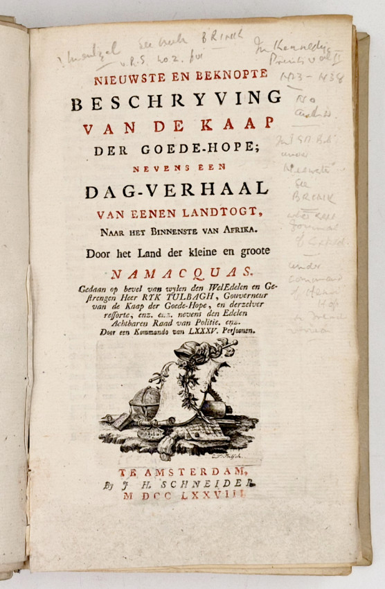


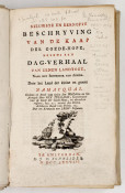

nevens een Dag-Verhaal van eenen Landtogt. Naar het Binnenste van Afrika. Door het Land der kleine en groote Namaquas. Gedaan op bevel van wylen den Wel Edelen en Gestrengen Heer Ryk Tulbagh, Gouverneur van de Kaap der Goede-Hope, en derzelver ressorte, enz. enz. nevens den Edelen Achtbaren Raad van Politie, enz. Door een Kommando van LXXXV persoonen.
Two parts in one volume:
Dag-verhaal gehouden op een landtogt, door het land der kleine en groote Namaquas, Op bevel van den Gouverneur, Door een gezelschap van lxxxv persoonen, onder Commando van den Capitain Hendrik Hop.
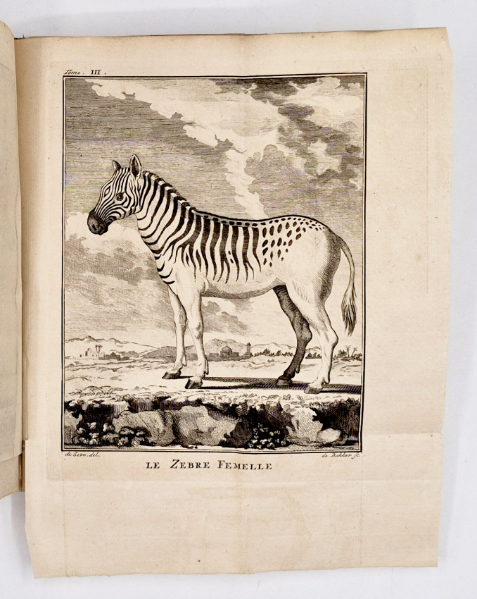
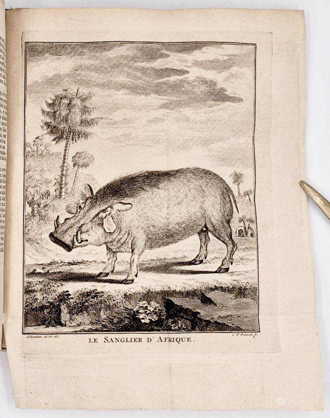
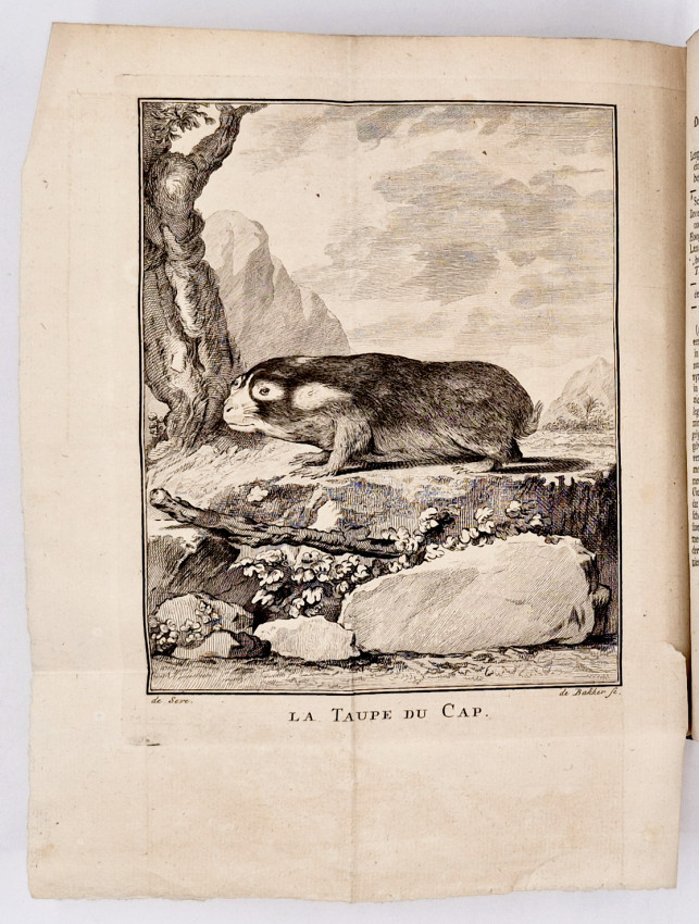
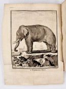
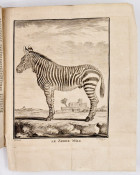
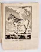
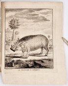
First Edition: part I. iv, 140. part II. (iii), 114 pages, 16 engraved folding plates of animals all in part II, complete with the half title pages, edges uncut, later full vellum with a red leather title label on the spine, book plate on each front endpaper, contents crisp, a particularly good copy.
S2A3 Biographical Database of Southern African Science (https://www.s2a3.org.za/bio/Biograph_final.php?serial=360) Brink, Mr Carl Friedrich (surveying, cartography)
Carl Friedrich Brink (known among the Dutch as Karel Frederik Brink) arrived at the Cape of Good Hope from Berlin in 1758 as a soldier. In December 1760 he took the oath as a surveyor of the Dutch East India Company. He was promoted from assistant surveyor to chief surveyor in 1762, succeeding Joseph Ponte. In 1769 he became a military ensign, and in 1773 ensign and adjutant of the castle. When Lieutenant-engineer C.D. Wentzel died in 1776, Brink performed his duties until December 1779, when he retired as a lieutenant. During his years as a surveyor he produced 125 property diagrams (Cape of Good Hope, 1859). Following the death of his wife he returned to Europe with his five children in 1784.
In 1761-1762 Brink accompanied the expedition led by Hendrik Hop to the vicinity of Keetmanshoop in present day Namibia. His role was that of cartographer and journalist. His journal of the expedition, covering the period from 16 july 1761 to 27 April 1762, was published in 1778 as part of a work edited by J.N.S. Allamand and J.C. Klockner, Nieuwste en beknopte beschrijving van de Kaap der Goede-Hope. French and German translations appeared in 1778 and 1779, while an English translation by Dr. E.E. Mossop was published in 1947. Brink's original map of the journey is in the Dutch archives. A copy made in 1785 forms part of the Van de Graaff Collection (Map 220). Two version's of the map were reproduced in C. Koeman's Tabulae Geographicae in 1952. The map is sufficiently accurate for most of the features to be identified today. However, the appearance of the west coast is odd and seems to represent an enlargement of an earlier inaccurate map, while the erroneous course of the Orange River is probably based on hearsay. It was probably the first land map to depict a part of what is now Namibia.
In 1768 Brink accompanied J.W. Cloppenburg on a journey eastwards as far as present day George and north as far as Piekenierskloof (near Citrusdal) - all well within the settled portions of the Colony. One of the maps in the Van de Graaff Collection (No. 221) is a copy of Brink's map compiled to illustrate this journey; however it does not show the route they followed as is claimed in an inscription on the map, but shows a journey made by Swellengrebel in 1776. It is the first reasonably accurate map of the entire settled area of the Cape Colony in the second half of the eighteenth century. Brink also produced an important map of Cape Town and its fortifications in 1767. In 1778 Governor van Plettenberg ordered him, with others, to survey Robben Island and chart the surrounding sea.
Mendelssohn (Sydney) South African Bibliography, volume I, pages 185/6, describes the French edition published in the same year.
Mossop (Dr.E.E.) The Journals of Brink and Rhenius, Van Riebeeck Society (now Historical Publications Southern Africa), first series, number 28, Cape Town 1947.
- Overall Condition: Very good
- Size: 8vo (225 x 140 mm)
- Sold By: Clarke's Africana & Rare Books
- Contact Person: Paul Mills
- Country: South Africa
- Email: [email protected]
- Telephone: 021 794 0600
- Preferred Payment Methods: Visa & Mastercard via PayGate secure links and Bank transfers.
- Trade Associations: ABA - ILAB, SABDA


