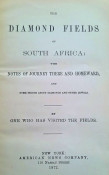


We are offering here an extremely rare first edition copy of this historical work that describes southeastern Africa (present-day Zimbabwe/Mozambique). It offers insights into the geography, inhabitants, and colonial history of the region.
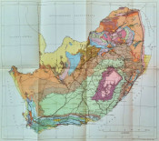
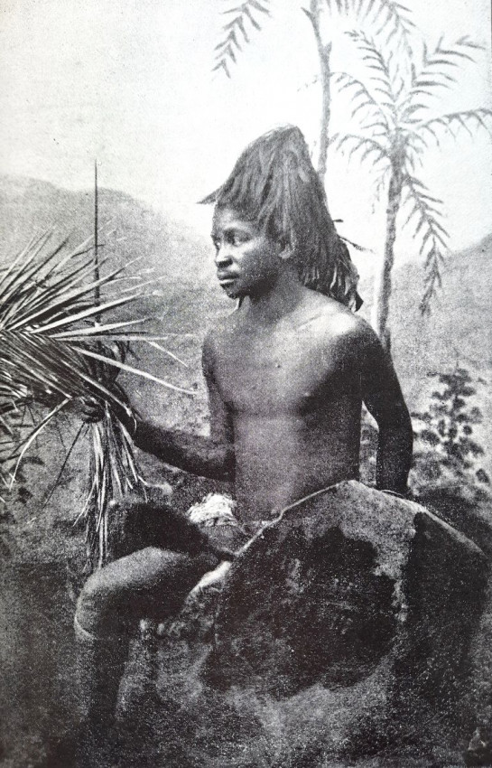
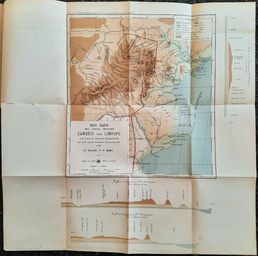
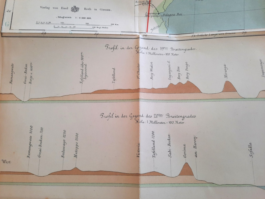
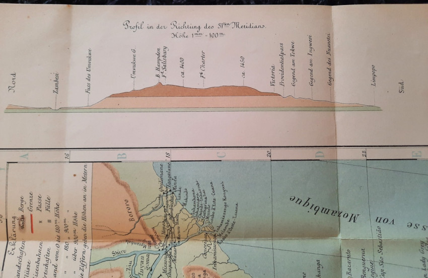
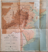
With 12 b&w photographic illustrated plates and color folding "New Map of the Country Between Zambezi and Limpopo (Compiled by D. Hendrik P. N. Muller based on available map material and his own knowledge)" (54 x 54 cm).
"The region of Southeast Africa discussed in this work is bounded: north by the Zambezi River, east by the Indian Ocean, or rather the Mozambique Channel, south by the Limpopo River, and west by the Gwai (a tributary of the Zambezi) and Shashi (a tributary of the Limpopo).
It was not possible for me to describe this region with a single word, as it can only be suggested by several names. The name Mozambique also encompasses an area north of the Zambezi, thus outside the region discussed here. Gazaland, a name originating from the name of an ancestor of the current reigning King Gungunyana, refers only to the coast and not the Zambezi region. The English territory comprises the land of the Matabili and Mashona peoples, but is usually simply called Mashonaland. Attempts are sometimes made to introduce the names Zambezi and Rhodesia (after the founder of the new British colony), but these have not yet been universally successful; and besides, these two names would also extend to land north of our region.
Part of our region, due to its healthy climate, its rich soil, often containing gold, and other very favorable conditions, has a great future, also for European emigrants.
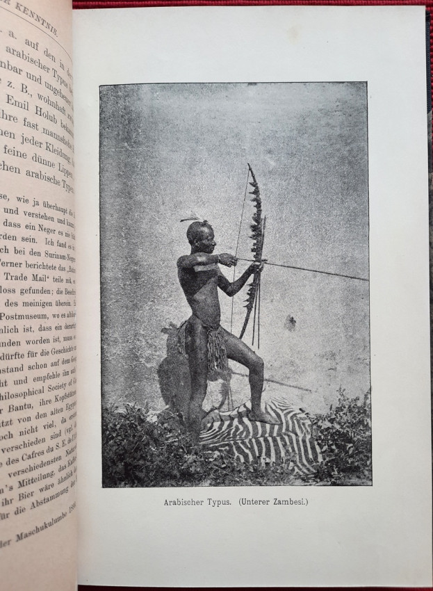
The information contained in the following pages is partly based on experiences I gained during my first African journey, which I undertook 12 years ago. I did not visit the English part of the region discussed here. Much of what is presented here is based on written and oral accounts from other travelers, collected over many years.
My aim in this work has been to create as clear a picture as possible based on the material available to me. Nevertheless, it will take years and a long series of investigations before an exhaustive description of these countries and peoples, one that meets the standards of science, can be provided. Currently, contradictions are constantly encountered in the various accounts. Precise geographical observations have rarely been made, and what little is available cannot always be considered reliable."
(from the Preface by the Author)
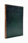
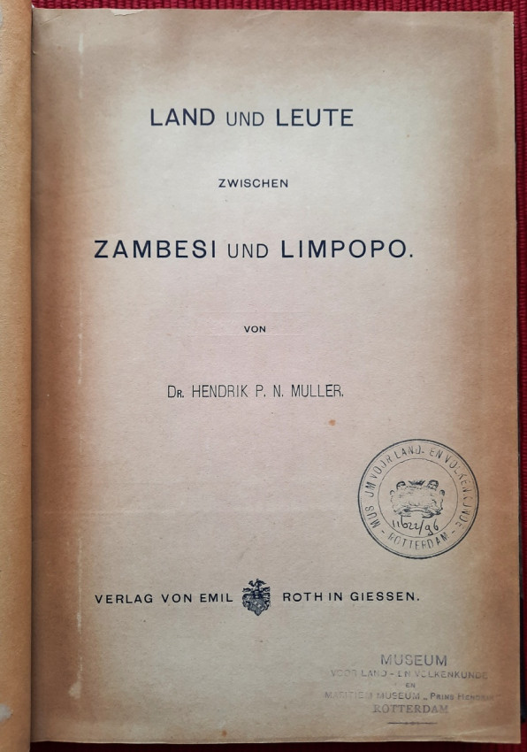
"Land und Leute zwischen Zambesi und Limpopo."; Contemporary ex-library hardcover binding with marble boards and cloth spine and corners, gilt lettering to the spine; Text in German; Collation complete - Title page, 165 pages, with 12 b&w photographic illustrated plates and color folding map at the rear (54 x 54 cm); A well preserved ex-library copy. The only markings are ex-library stamp to the title page and a discard stamp from a closed library. Binding with a negligible shelf wears, overall tight, firm and secure, slight fading of marbled boards, almost invisible trace of an detached ex-library label to the bottom of the spine. Text block clean, but with age tanning (except all 12 plates which are perfectly bright and clean), sporadic light foxing to few pages, otherwise no markings or annotations throughout. Slightly restored attachment to the binding at pages 15 and 162-163. A sound copy of this extremelly rare title.
IMPORTANT informations regarding shipping: Shipping to South Africa possible via national post ($40) or Fedex/DHL Express service ($100-120). Shipping to EU & UK via registered Airmail trackable parcel ($30-50). Shipping to US via DHL/Fedex ($100-120). For other countries please ask.
- Binding Condition: Very good
- Overall Condition: Very good
- Size: 23,5 x 16 cm