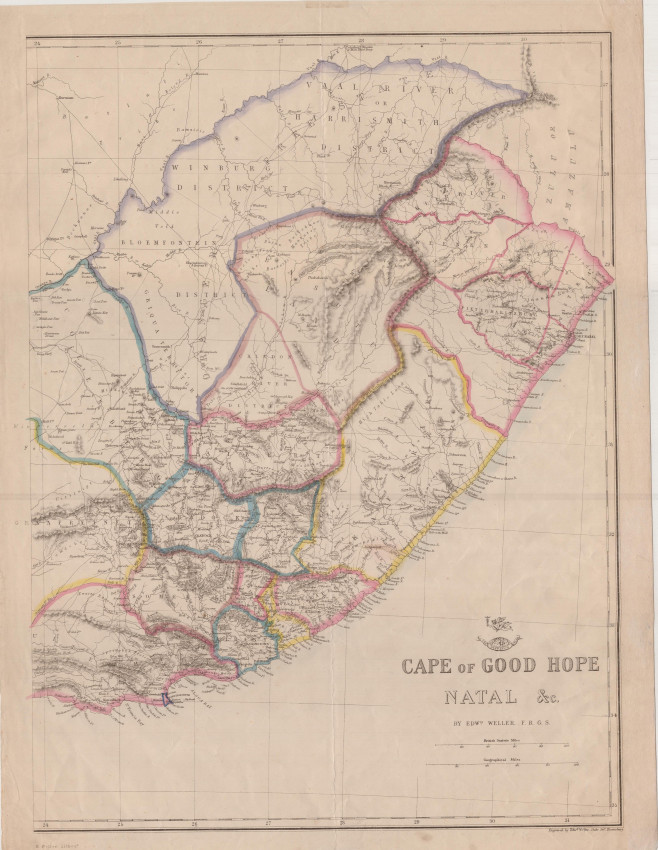


Outline coloured lithograph from Edward Weller, an engraver and map seller who was one of the pioneers of lithography in map-making. He contributed to Cassell's Weekly Dispatch Atlas (c. 1862). This map was printed in two parts that, in this example, have not been joined - will be joined at the purchaser's request. T
A large detailed map that outlines the numerous magisterial districts of the Cape, Natal and "Orange River Free State" c. 1860 - includes the short-lived Albert, Klein Rivier & Weenen.
The margins of the map were tatty and have been professionall restored and reversibly extended to enble framing.
- Overall Condition: Good (restored)
- Size: 43 x 32 cm each half map
- Sold By: Roger Stewart Antiquarian
- Contact Person: Dr. Roger Stewart
- Country: South Africa
- Email: [email protected]
- Telephone: +27836541081
- Preferred Payment Methods: LOCAL: EFT; INTERNATIONAL: Bank Transfer; Visa and Mastercard via PayFast
- Trade Associations: IMCOS


