
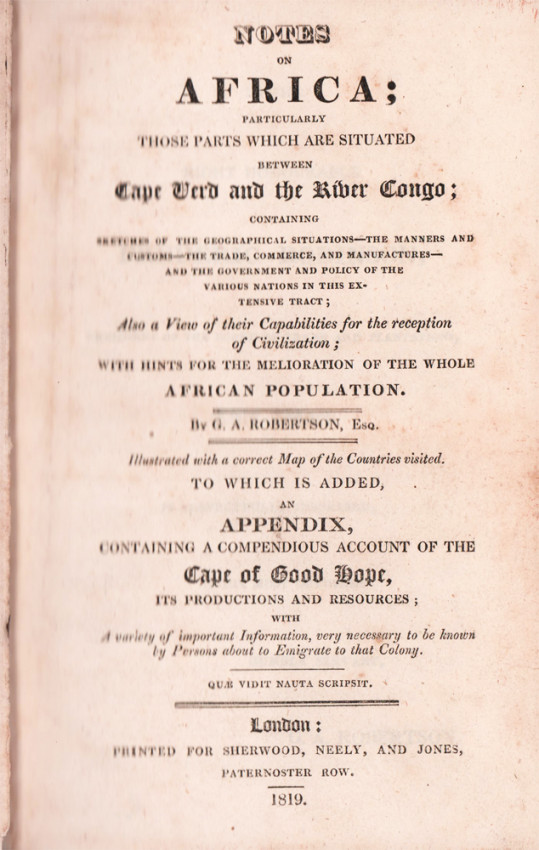

Particularly Those Parts Which are Situated Between Cape Verd and the River Congo.
Containing sketches of the geographical situation....
Also a view of their capabilities for the reception of civilization; with hints for the melioration of the whole African Population.
To which is added an appendix containing a compendious account of the Cape of Good Hope.
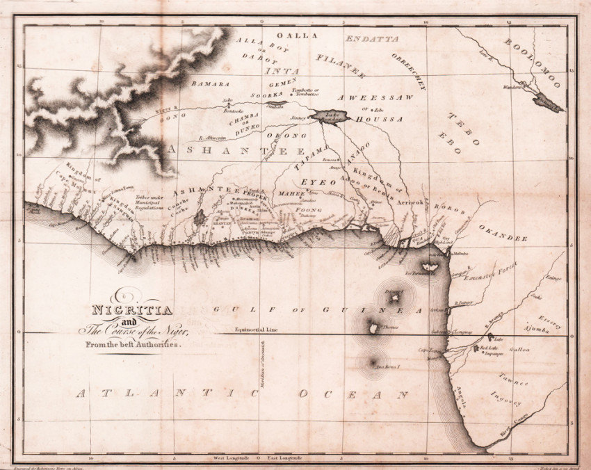
First edition: xvi, folding map as frontispiece, 460 pages, book plate on front paste down end paper, starting to wear at the back hinge, rebound in half brown leather with matching marbled boards, red title label gilt on the spine, a good copy.
Extracted from A South African Bibliography volume 4 page 55: The appendix on the Cape pages 365 - 460 was not drawn up by Mr Robertson according to the prefatory note.
- Overall Condition: A Good Copy
- Size: 8vo (200 x130mm)
- Sold By: Clarke's Africana & Rare Books
- Contact Person: Paul Mills
- Country: South Africa
- Email: [email protected]
- Telephone: 021 794 0600
- Preferred Payment Methods: Visa & Mastercard via PayGate secure links and Bank transfers.
- Trade Associations: ABA - ILAB, SABDA


