This small map is arguably the most important landmark in the history of the surveying and mapping of the Cape of Good Hope! It is also the first generally available map from the first quantitative science experiment in southern Africa, the results of which were published in France in 1755.
This English editionof Lacaille's map was published in 1755 in the Gentleman’s Magazine, the first publication to use ‘magazine’ in the context of a periodical publication. The English map was engraved by John Gibson after the map published in the same year Memoires of the French Academy of Science.
The map illustrated an article on Nicolas-Louis de Lacaille's pioneering survey to determine the shape of earth at the Cape of Good Hope. Lacaille used a triangulation method (see the triangles on the map) in 1752 -3 to determine the length across one degree of latitude of the terrestrial meridian through his observatory in Strand Street, near its intersection with today's Adderley Street.
Despite precise measurements and faultless calculation, his result indicated that Earth was pear-shaped, an error caused by Lacaille’s failure to take into account the Newtonian gravitational effect of the Cape Mountains on the plumb bob on his instruments. (This error was important because, at that time, the meter was defined as 1/10 000 000 the distance, through Paris, between the North Pole to the equator). Lacaille was surprised and disturbed by the result, re-measured his baseline in the Swartland flats, near today's Darling, and checked his calculations. George Everest (of Mt Everest fame) identifed Lacaille's error and Thomas Maclear, the Astronomer Royal at the Cape, later repeated Lacaille's experiment but corrected the error.
This was the first edition of Lacaille's map that was generally available to the public and it illustrates the dawn of quantitative science in South Africa. This map records Lacaille's pioneering work at the Cape of Good Hope: his triangles; the peaks, and his baseline he measured on the flats of the Swartland a short distance to the north of Darling; it records the year of the survey and the length of the arc of the meridian through Cape Town result.
The map was copied by numerous cartographers as it was the first accurately to record the longitude of Cape Town and, although it has its errors, it had changed the shape on maps of the Cape of Good Hope.
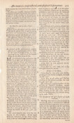
This example of the map, with later colouring, is in fine condition. It is accompanied by two pages of text from the Gentleman's Magazine that report Lacaille's survey at the Cape.
References:
R Stewart. A mystery resolved. Lacaille’s map of the Cape of Good Hope. IMCoS Journal 2009; 119: 7 – 11
R Stewart. Lacaille pioneer of scientific cartography in Southern Africa. Maps in History January 2020, 66, 29 – 33
Norwich's Maps of Africa, map #220 (the version of the map that appeared in Lacaille’s Journal Historique, published in 1763)
Roger Stewart's video describing the map.
- Overall Condition: Fine
- Size: 11.0 x 18.2cm
- Sold By: Roger Stewart Antiquarian
- Contact Person: Dr. Roger Stewart
- Country: South Africa
- Email: [email protected]
- Telephone: +27836541081
- Preferred Payment Methods: LOCAL: EFT; INTERNATIONAL: Bank Transfer; Visa and Mastercard via PayFast
- Trade Associations: IMCOS

Similar lots in the current auction View all
Click on an item to view more details and to bid.


