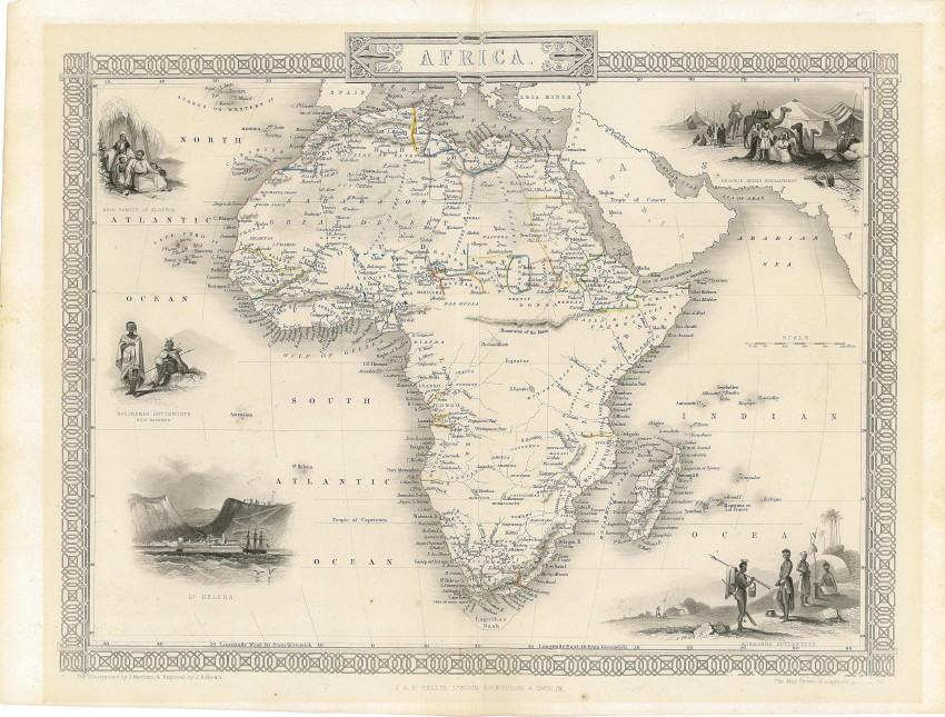
Map of Africa with decorative border and five vignettes - uncoloured as printed for John Tallis in one of the last decorative antique atlases. The map featured in a recent exhibition at Princeton University.
This map was printed from a steel engraving by John Rifkin for John Tallis’s The Illustrated Atlas, and Modern History of the World, Geographical, Political Commercial & Statistical, which was edited by R. Montgomery Martin (London, 1851). The map was issued to coincide with the Great Exhibition of 1851 in London. Tallis’s atlas was regarded as a tour-de-force of the mapmaker’s art, scientific in intent but visually attractive: one of the most decorative atlases of the nineteenth century. "The maps were drawn and engraved by John Rapkin, and the vignettes were created and engraved by various prominent artist-illustrators.About the continent of Africa, Martin writes in a note accompanying the map in the atlas:More than five-sixths of the region are still unknown to European geographers. . . . Of the alleged Mountains of the Moon we know nothing. Vast sandy wastes with occasional green and habitable spots characterize Africa. . . . The chief streams of which we have any definite and accredited account are the Nile, Niger, Joliba, Senegal, Gambia, Congo, Orange, Quilimane and the Haines. The Nile rises in Abyssinia and enters the Mediterranean at Rosetta. The Niger has its source in the (mythical) Kong Mountains and enters the Atlantic after 1,660 miles. Charting its course has cost many British lives. . . . In the known parts of Africa alone 150 languages are spoken.Between the time of this and Cary’s map, British explorers have crossed the Sahara, descended the Niger to its outlet in the Gulf of Guinea, and visited large areas of west and southern Africa. Not surprisingly then, the map’s vignettes show an Algerian family, a Bedouin Arabs’ desert encampment, two different Hottentot tribes (Bosjeman and Korranna) of southern Africa, and a view of the island of St. Helena. Important as a port of call for ships returning to Europe from the East Indies, the island declined in importance after the Suez Canal opened in 1869.The map is in very good condition and it uncoloured, as issued."
This decorative map is in very good condition, on firm paper that is slightly aged toned.
References:
Princeton University Exhibition catalogue (To the Mountains of the Moon:Mapping African Exploration, 1541-1880);
Tooley's Collectors' Guide to the Maps of Africa, p 115
- Overall Condition: Very good
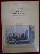
- Size: 30cm x 20cm
- Sold By: Roger Stewart Antiquarian
- Contact Person: Dr. Roger Stewart
- Country: South Africa
- Email: [email protected]
- Telephone: +27836541081
- Preferred Payment Methods: LOCAL: EFT; INTERNATIONAL: Bank Transfer; Visa and Mastercard via PayFast
- Trade Associations: IMCOS

Similar lots in the current auction View all
Click on an item to view more details and to bid.