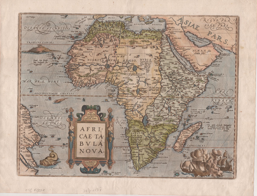

This is a beautiful example of a landmark map of Africa by Abraham Ortelius. This is the 1598 French edition of the map that first appeared in 1570 in the first true modern Atlas: Theatrum Orbis Terrarum.
It was the cartographic creation of Abraham Ortelius, who produced the most expensive book published to 1570 - and it was very popular. The map of Africa was printed from one copper plate, engraved by Frans Hogenberg, from 1570 until 1641. The map shows well (in the title cartouche) the effect of the crack that developed in the copper plate in the late 1590's - as a consequence of the number of maps printed from the plate. This map is from the fourth state (i.e. minor changes to the plate were made three times after the original print run).
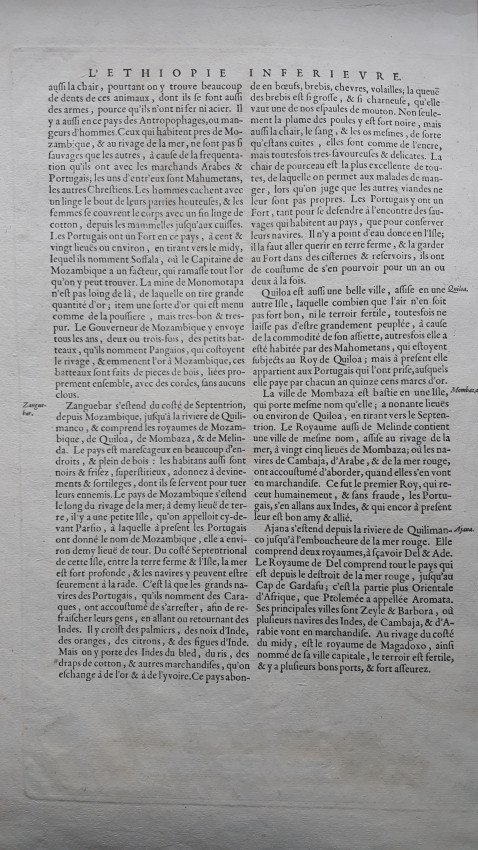
The map has French verso text and it was published in 1598 (525 copies printed in that year). The Otelius map is a significant advance on Münster’s map of the continent. Ortelius acknowledged his sources in Catalogus Auctorum: he had been able to draw on information from the Portuguese, other European travellers and from Arabs.
The geography was based largely on Gastaldi's 1564 wall map. Ortelius's map has fewer decorative elements but those he does include are stunningly beautiful: three sea monsters a raging sea battle at bottom right (but the ghost monster cannot be seen in 1598 - it was off the coast of today's Yemen) - it faded away in the mid 1580. The Cape of Good Hope is more pointed that in contemporary maps. However the E-W and N-S distance are much more accurate. He did not have the Niger as a tributary of the Nile, thus differing from Mercator. He also omitted the Mountains of the Moon which were a typical feature of maps of the 16th and 16th centuries. He uses Zanzibar in SW Africa to denote a people and Zenzibar as the toponym for the island off the East coast.
The famous crack: the plate used for this map began to crack in the title cartouche between 1595 and 1598. Then the top right I and second right A began to join. Later the third and fourth A on the right join as well. These unintentional "states" of the plate can be used to date the map more precisely over the period 1598-1612.
A beautiful example of this landmark map that is in fine condition.References:
Marcel van den Broecke at http://www.orteliusmaps.com/book/ort8.html
Richard Betz, The Mapping of Africa, #12, pp. 118 - 125
Tooley's Collectors' Guide to Maps of the African Continent, p. 88;
- Overall Condition: Fine
- Size: 51x38cm
- Sold By: Roger Stewart Antiquarian
- Contact Person: Dr. Roger Stewart
- Country: South Africa
- Email: [email protected]
- Telephone: +27836541081
- Preferred Payment Methods: LOCAL: EFT; INTERNATIONAL: Bank Transfer; Visa and Mastercard via PayFast
- Trade Associations: IMCOS

Similar lots in the current auction View all
Click on an item to view more details and to bid.