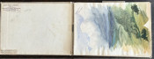
Very uncommonly available after thought map of Le Vaillant's travels in South Africa.
Le Vaillant’s successful Voyage dans l’Interieur de l’Afrique first was published in 1790.Although the book on his first journey was popular, he was criticised for not including a map. The French Revolution and his imprisonment during the Reign of Terror prevented a quick response from Le Vaillant. Consequently, the publication of Le Vaillant’s equally successful Second voyage dans l’Interieur de l’Afrique, and a map, was delayed until the third year of the Republic (September 1794 to August 1795).
Carte de la Partie Meridionale de L'Afrique is a large map that was signed Perriez Sculp and Levaillant Delin. Perriez is almost certainly a misspelling (probably by one of a team of engravers) of Perrier, an engraver (fl. 1760 – 1824), who was one of the designers of the manuscript map. The map was not bound in the first edition of Second voyage book, but printed contemporaneously and sold separately: ‘elle se vendra séparément’ ; apparently, the map cost almost as much as the book.
In the fourth year of the Republic, i.e. 1796, Le Vaillant’s map was bound in the second (French) edition of Second voyage. The map was also included in Déterville’s edition (1797) of le Vaillant’s first book, in volume three of an edition of Second voyage by Desray (1803, not in his 1798 edition) and in his Atlas of Le Vaillant’s illustrations (1818).
Although he declared his intent to map the country, Le Vaillant did not record any details of his cartographic method and his published map was a belated afterthought. He had a compass and quadrant on his travels, but he did not have the survey skills to produce good cartographic data. Le Vaillant’s routes on the map, are not everywhere consistent with the text; furthermore, the veracity of parts is doubtful and some are clearly impossible.
This attractive large map is in very good condition. A couple of small marginal tears have been professionally repaired.
References
Forbes, V. Pioneer Travellers in South Africa. A geographical commentary upon Routes, Records, Observations and Opinions of Travellers at the Cape 1750 - 1800. Cape Town, A.A. Balkama; 1967 117 – 127
Norwich's Maps of Africa, map #181
- Overall Condition: Very good
- Size: 88cm x 60cm
- Sold By: Roger Stewart Antiquarian
- Contact Person: Dr. Roger Stewart
- Country: South Africa
- Email: [email protected]
- Telephone: +27836541081
- Preferred Payment Methods: LOCAL: EFT; INTERNATIONAL: Bank Transfer; Visa and Mastercard via PayFast
- Trade Associations: IMCOS

Similar lots in the current auction View all
Click on an item to view more details and to bid.