


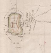
Capetonians may be fascinated to know that the map's J'an Busses Kraal' became Milnerton (horse) Race Course; Fort Knokke was demolished to make space for Woodstock Station;the beautiful Amsterdam battery was demolished in an act of civic delinquency and only a small part of one wall remains off Port road; Society House became the President (now Protea President) Hotel in Sea Point.
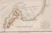
This chart was published in the second volume of the second edition of John Barrow's Travels into the Interior of Southern Africa (1801 & 1804; 1806). The original hand colouring has been sensitively enhanced.
A short tear outside the chart border, along the lower plate line, has been professionally repaired.
Reference: M F Cartwright Maps of the South Western Cape of Good Hope, 1992, p 117.
Not in Tooley or Norwich
- Size: 24cm x 37cm
- Sold By: Roger Stewart Antiquarian
- Contact Person: Dr. Roger Stewart
- Country: South Africa
- Email: [email protected]
- Telephone: +27836541081
- Preferred Payment Methods: LOCAL: EFT; INTERNATIONAL: Bank Transfer; Visa and Mastercard via PayFast
- Trade Associations: IMCOS


