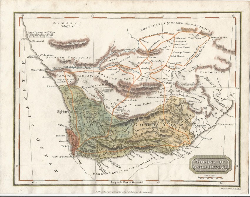
This small map of the Colony of Good Hope is a fascinating glimpse into the geography of the Cape Colony c. 1815. The map was used to illustrate the Jane Austin Gazetteer in the second decade of the 1800s.
The map is from Christopher Kelly's Universal Geography published in c. 1817. It shows the route taken by the Scottish missionary, John Campbell on behalf of the London Missionary Society; he was on a tour of mission stations.
The map also shows the border of the Cape Colony at that time, with the volatile eastern border extending from Van Plettenberg's Beacon near Colesberg in the north to the mouth of the Great Fish River in the South. Annotations reveal some geographical detail and some history, such as that adjacent to Angra Pequena, i.e. today's Luderitz. The map also shows the location of the indigenous groups as the English understood it at the time.
The map is printed on firm paper has been hand coloured and is in fine condition.
References: Not in Tooley or Norwich
- Overall Condition: Fine
- Size: 18.2cm x 23.7cm
- Sold By: Roger Stewart Antiquarian
- Contact Person: Dr. Roger Stewart
- Country: South Africa
- Email: [email protected]
- Telephone: +27836541081
- Preferred Payment Methods: LOCAL: EFT; INTERNATIONAL: Bank Transfer; Visa and Mastercard via PayFast
- Trade Associations: IMCOS


