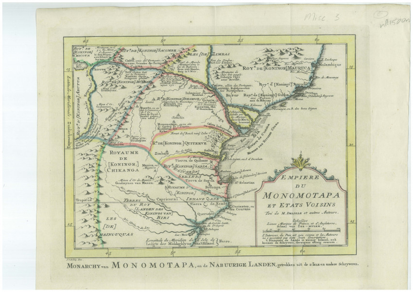
This fascinating mid-18th century map features the legendarily rich, central-east African Kingdom of Monomotapa, mostly in today's Mozambique and the area of the Empire of Zimbabwe (c.1450-1629). Its capital was the 'Great Zimbabwe'. The basis of their wealth was the numerous gold mines, believed to be the mines of King Solomon, but greater wealth was realised in the slave trade with the Portuguese in the Mozambique ports.
The map is based on maps by Delisle and other cartographers. Nevertheless, Bellin states within the title cartouche that "The interior of the country is little known and authors do not agree in their descriptions of it."
The map includes the Zambeze and Cuama Rivers and is bisected by the Tropic of Capricorn. It also shows the Portuguese settlements at Tete and Sena, and there are numerous annotations indicating the silver mines of Chicova, the gold mines at Asur and elsewhere, and various tribal grounds.
The map was produced by Jacques Nicolas Bellin and included in Prévost d' Exile's "Histoire des Voyages", published between 1738-1775. Jacques Nicolas Bellin (1703-1772) was one of the most important and proficient French cartographers of the mid-eighteenth century. He was appointed the first Ingenieur Hydrographe de la Marine, and also Official Hydrographer to the French King.
- Overall Condition: Fine
- Size: 96.5cm x 46.5cm
- Sold By: Roger Stewart Antiquarian
- Contact Person: Dr. Roger Stewart
- Country: South Africa
- Email: [email protected]
- Telephone: +27836541081
- Preferred Payment Methods: LOCAL: EFT; INTERNATIONAL: Bank Transfer; Visa and Mastercard via PayFast
- Trade Associations: IMCOS


