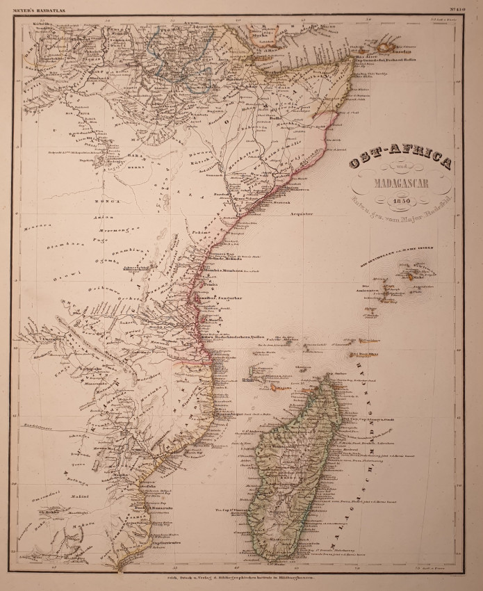
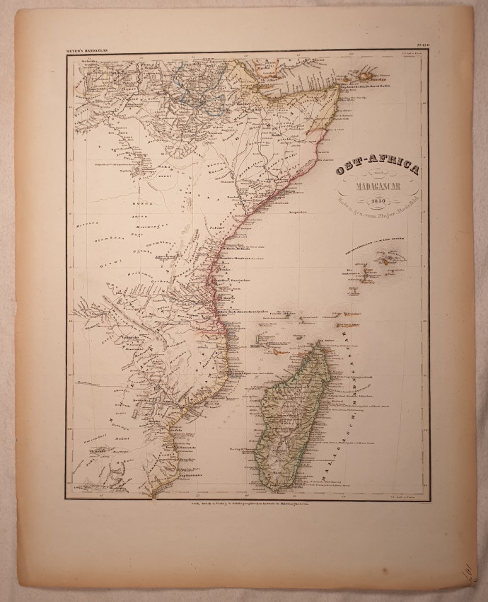
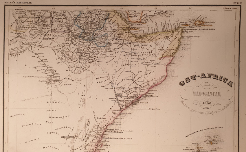
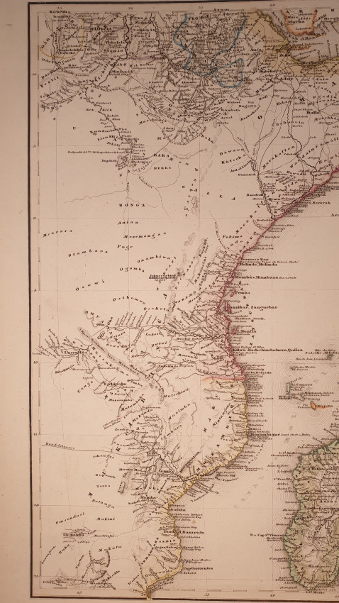
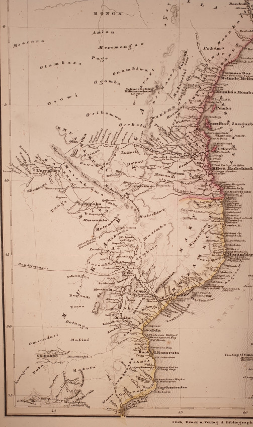
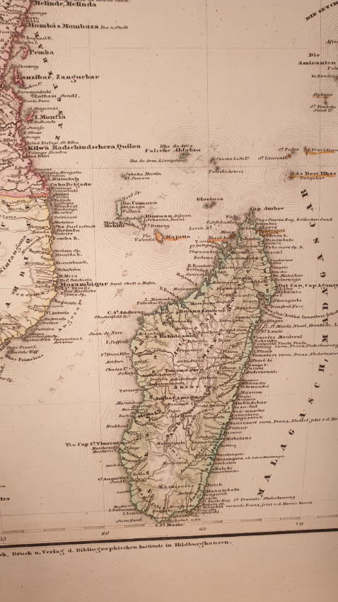

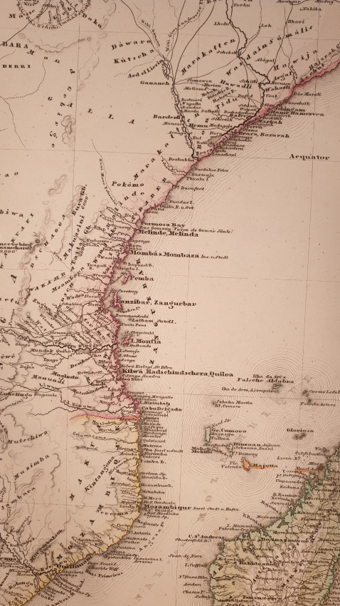

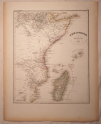
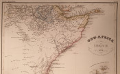
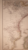
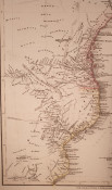
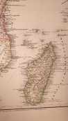
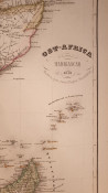
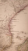
Very beautiful map of East Africa and Madagascar of 1850, coloured by hand, big size.
Author: J. Meyer
Atlas: Handatlas, Verlag des Bibl. Inst. In Hildburghausen
Date: 1850
Technique: etching on copper
Leaf Dimension: 37x46 cm (14.6x18.1 inches)
Engraving Dimension: 29x36 cm (11.4x14.2 inches)
Conditions: Very good conditions. Little tear in the left edge.
- Overall Condition: Good
- Size: 37x46 cm
- Sold By: Sephora Libri
- Contact Person: Elena Serru
- Country: Italy
- Email: [email protected]
- Telephone: 3492903979
- Preferred Payment Methods: paypal credit card
- Trade Associations: Sephora di Elena Serru


