

Images of Terra Sancta through Two Millenia.
164 pages, illustrated throughout in colour, black cloth, a very good copy in the dust jacket.
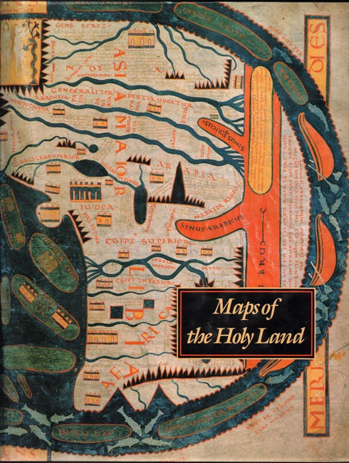
Sixty of the most beautiful and historically significant Holy Land maps, rare treasures of manuscript illumination and masterpieces of early printing, are presented here. The lavish survey begins with Claudius Ptolemy’s map o A.D. 150, the earliest extant Holy Land depiction and a stunning work that virtually defined the art of cartography in its first epoch. This is followed by a host of fantastic geographical imaginings produced in the Middle Ages, including the extraordinary maps drawn to aid Holy Crusaders, and the earliest sea charts – the work of Petrus Vesconte (ca. 1320).Editor’s note.
- Jacket Condition: Very good
- Binding Condition: Very good
- Overall Condition: Very good
- Size: Folio (390 x 305 mm)
- Sold By: Clarke's Africana & Rare Books
- Contact Person: Paul Mills
- Country: South Africa
- Email: [email protected]
- Telephone: 021 794 0600
- Preferred Payment Methods: Visa & Mastercard via PayGate secure links and Bank transfers.
- Trade Associations: ABA - ILAB, SABDA


