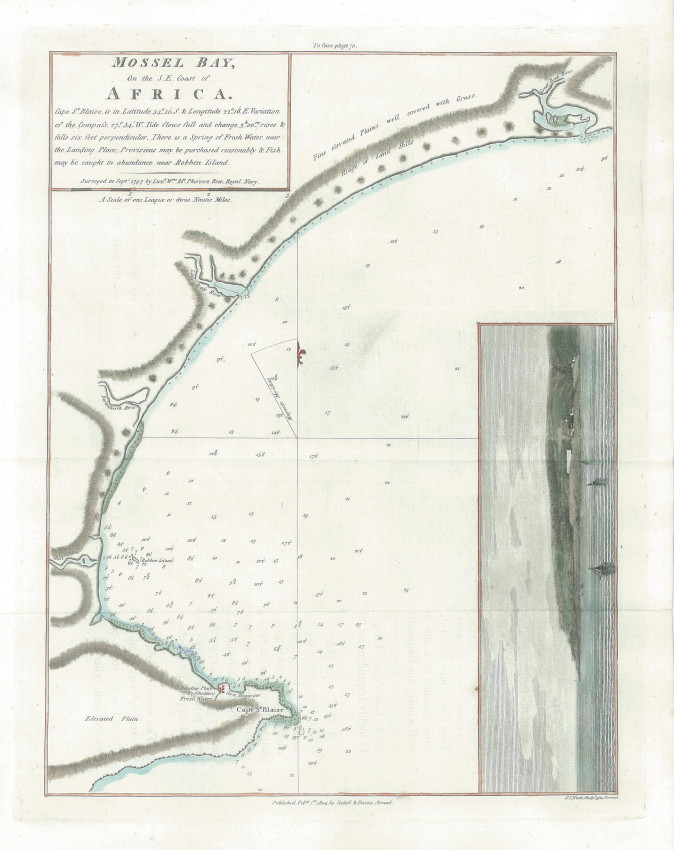
Chart of Mossel Bay published in John Barrow's Travels in South Africa.
The chart is from the Great Brak River to Vleesbaai. The landing and watering places, the postholder's residence and the corn warehouse are identified and also shown on the attractively coloured vignette of the village and the peninsula to Cape St. Blaise.
- Overall Condition: Fine
- Size: 20 x 26.2cm
- Sold By: Roger Stewart Antiquarian
- Contact Person: Dr. Roger Stewart
- Country: South Africa
- Email: [email protected]
- Telephone: +27836541081
- Preferred Payment Methods: LOCAL: EFT; INTERNATIONAL: Bank Transfer; Visa and Mastercard via PayFast
- Trade Associations: IMCOS


