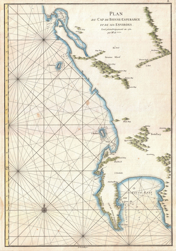
This chart was the beginning of accurate mapping of the coast of South Africa. It was published by Mannevillette, a famous hydrographer and ship's captain in the French East India Company, navigator and author.
Mannevillette is best known for his atlas of sea charts and his book of navigation, collectively known as Le Neptune Oriental. It first was published in 1745, an edition that did not include this map. The engraver was Guillaume de la Haye, who was highly regarded.
The chart relies for all non-hydrographic features on the small map of the Cape of Good Hope by Nicolas-Louis de Lacaille, the French astronomer who came to the Cape to chart the southern skies. He completed this laborious task in 1752 from his small observatory in Strand Street, Cape Town. Lacaille then set about determining the shape of the southern hemisphere; he did this by way of measurements and trigonometry calculations that allowed him to determine the length of 1 degree of latitude of the terrestrial meridian though his observatory. In presenting his findings to the Royal Academy of Science in France, he published a small map of the Cape that displayed the lines of his geometric method.
Mannevillette's sea chart is a larger version of Lacaille's map, without the triangles but with rhumb lines, hydrographic information and a compass rose, as one would expect in a sea chart by an accomplished hydrographer. All the place names on the chart are taken from Lacaille. Mannevilette also partially corrected Lacaille's too northerly location of Hanglip (now Hangklip), the southern-eastern cape at the entrance to False Bay.
He had visited the Cape and was captain of the ship on which Lacaille sailed to the Cape; and they also made some joint astronomical observations and measurements.
This chart has outline colour, is printed on heavy paper and is in fine condition.
References: Tooley's Collectors' Guide to the Maps of Africa; p.7; Norwich's Maps of Africa map #276
- Size: 33 x 48cm
- Sold By: Roger Stewart Antiquarian
- Contact Person: Dr. Roger Stewart
- Country: South Africa
- Email: [email protected]
- Telephone: +27836541081
- Preferred Payment Methods: LOCAL: EFT; INTERNATIONAL: Bank Transfer; Visa and Mastercard via PayFast
- Trade Associations: IMCOS


