
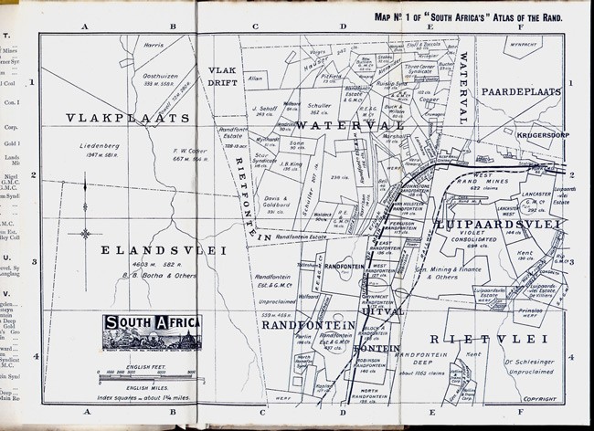
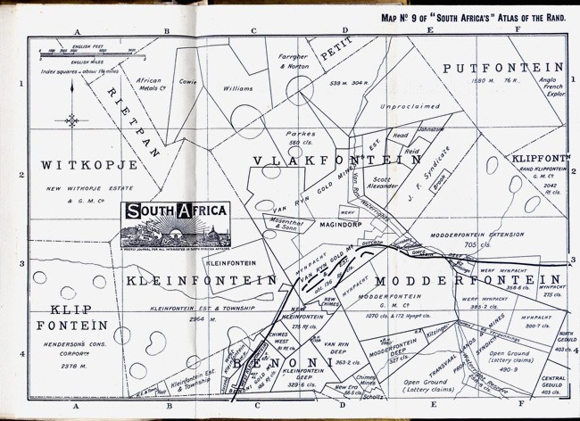

Being a Complete Map of the Witwatersrand Goldfields and Eastern Extensions, in Thirteen Convenient Indexed Sections with Key Map.
Price 3/6; with maps on cloth, 5/-. 13 linen-backed folding maps, each 210 x 285 mm, 7 page index, folds into yellow cloth covers which are a little soiled.
Published at the Offices of "South Africa," 39 Old Broad St., London, 1903.
"South Africa" was a weekly magazine founded and edited by Edward P. Mathers. In an advertisement on the back cover of the map it claimed to be, 'the only recognised European organ of the great South African Gold and other Mining Industries,' and that it enjoyed, 'The largest circulation of any South African Newspaper.' In ran from 1892 - 1928.
- Overall Condition: Good
- Size: 210 x 285 mm
- Sold By: Clarke's Africana & Rare Books
- Contact Person: Paul Mills
- Country: South Africa
- Email: [email protected]
- Telephone: 021 794 0600
- Preferred Payment Methods: Visa & Mastercard via PayGate secure links and Bank transfers.
- Trade Associations: ABA - ILAB, SABDA


