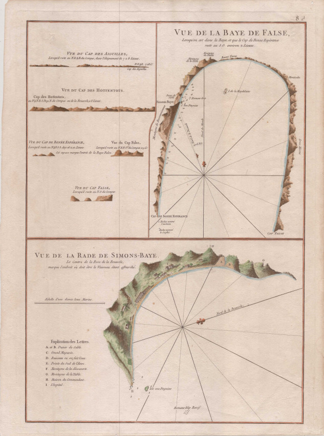
Beautiful 1775 sea charts and silhouette views of False and Simons Bays and the Cape Peninsula.
These two charts were printed from a single copper plate and produced by Apres de Mannevillette, an active ship's captain and the premier French Hydrographer of the eighteenth century.
Near fine condition: one small area (0.5 x 0.5cm) of thin paper top left that has been strengthened using archival materials
- Overall Condition: Near Fine
- Size: 33 x 47cm
- Sold By: Roger Stewart Antiquarian
- Contact Person: Dr. Roger Stewart
- Country: South Africa
- Email: [email protected]
- Telephone: +27836541081
- Preferred Payment Methods: LOCAL: EFT; INTERNATIONAL: Bank Transfer; Visa and Mastercard via PayFast
- Trade Associations: IMCOS

Similar lots in the current auction View all
Click on an item to view more details and to bid.