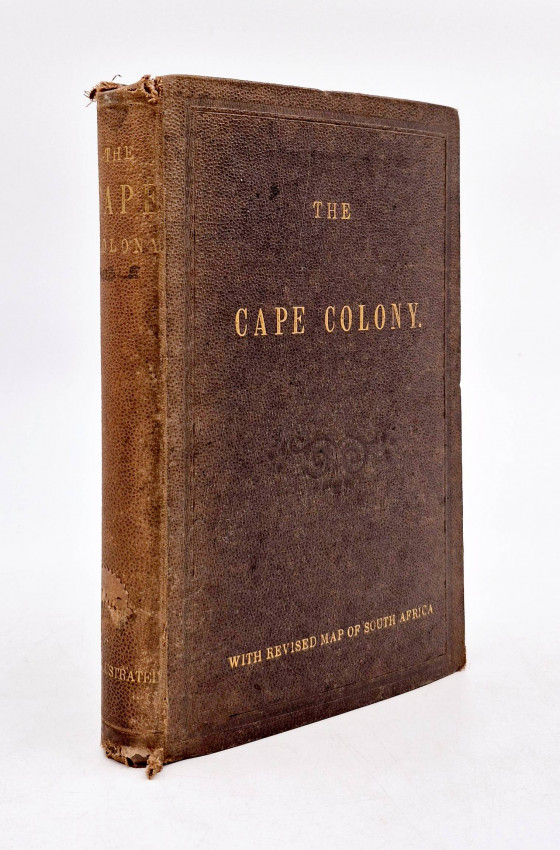
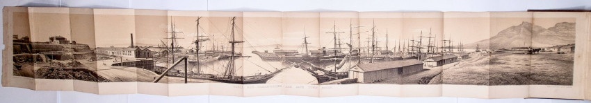

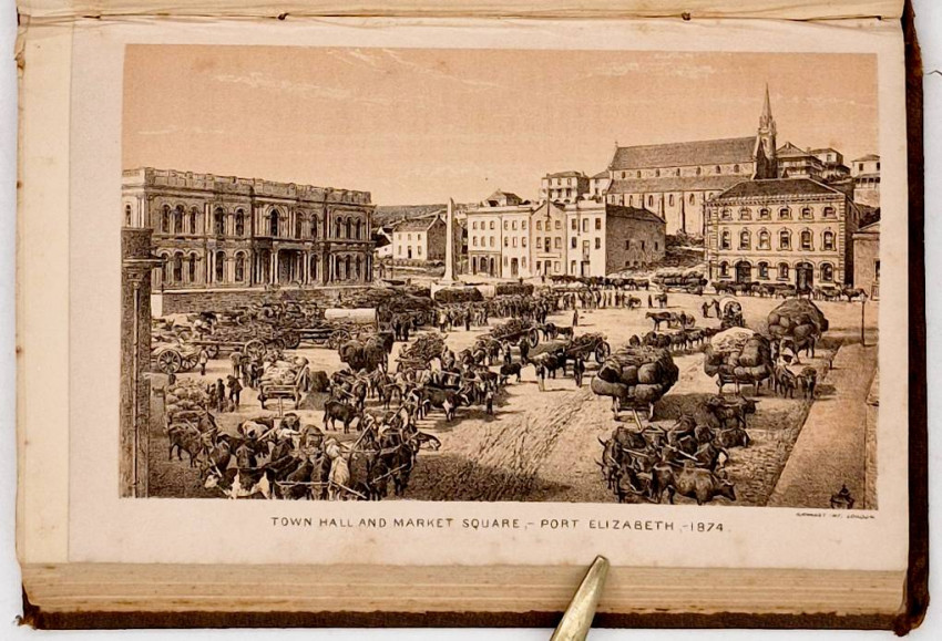

First Edition: 315 pages, fine tinted lithographic panorama as frontispiece (measures 1340 x 184 mm when folded out) titled Table Bay Breakwater and Cape Town Docks and lithographed in London by M. & N. Hanhart, tinted lithograph of Town Hall and Market Square, Port Elizabeth 1874, large coloured folding map of South Africa by Henry Hall, folding table of Cape of Good Hope Trade Returns, original brown pebble-grained cloth titled gilt on the upper cover and spine frayed at the top and bottom of the spine and hinges splitting, with book binder’s ticket of Saul Solomon on the front paste-down end paper.
ILLUSTRATIONS AND MAP (From the verso of the Contents page).
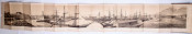
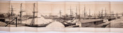
The Lithograph of the Alfred Docks is executed by Messrs. Hanhart of London, from a photograph taken by Mr. Moore of Cape Town, for the Table Bay Harbour Board. It shows distinctly the entrance and inner basin, with the mail packets lying at their usual berths,—the Union Company's steamer Nyanza at the East Quay, and the Donald Currie's steam-ship Windsor Castle, with the coasting steamer Florence alongside, at the North Quay. The excavations for the Graving Dock, now in progress, are noticeable at the left corner of the picture.
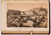
Port Elizabeth Market-square and Town-hall (page 170) is from a photograph by Mr. Bruton, of Port Elizabeth and Cape Town.
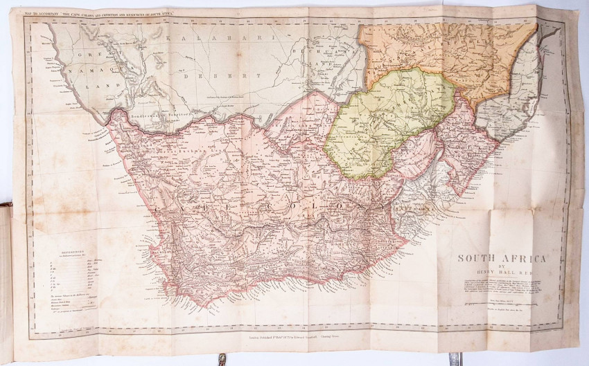
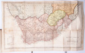
The Map of South Africa, originally compiled by H. Hall, Esq., R.E.D., but revised and corrected to date, is issued specially for this volume, from the geographical establishment of Mr. Stanford, London. It represents all the Districts into which the Colony is at present divided, and shows the lines of the proposed new railways. It also embraces the Territories and States adjoining the Colony, to nearly the 25th parallel of south latitude, and gives the territorial limits of each, as recognized by Her Majesty's Government.
Mendelssohn (Sidney) South African Bibliography volume 2, page 106: 'The official position of the author, and his personal acquaintance with the Cape Colony, particularly fitted him for the task of preparing this work, which affords an accurate view of the country at the commencement of the last quarter of the nineteenth century.
'The main objects of the publication, as set forth in the Preface, were "to present an impartial account of the aspect and condition of the various divisions of the Colony; to inform the reader of its liberal land laws, its agricultural and pastoral resources, its mineral wealth, its industries, and its commercial progress; and thus to direct attention to the favourable field it offers for the profitable employment of intelligent industry and moderate capital." In addition to the large amount of information thus provided, there is a folding lithographic view of the Table Bay Breakwater and of Cape Town Docks, an illustration of the Port Elizabeth Market Square and Town Hall, and a map of South Africa corrected up to the time of issue.'
- Size: 8vo (200 x 130 mm)