
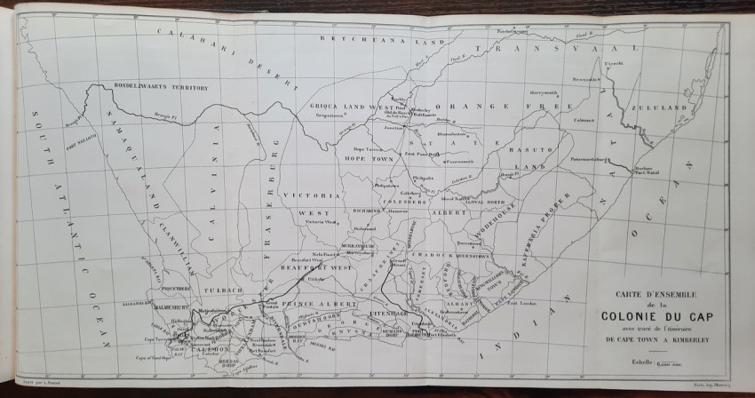
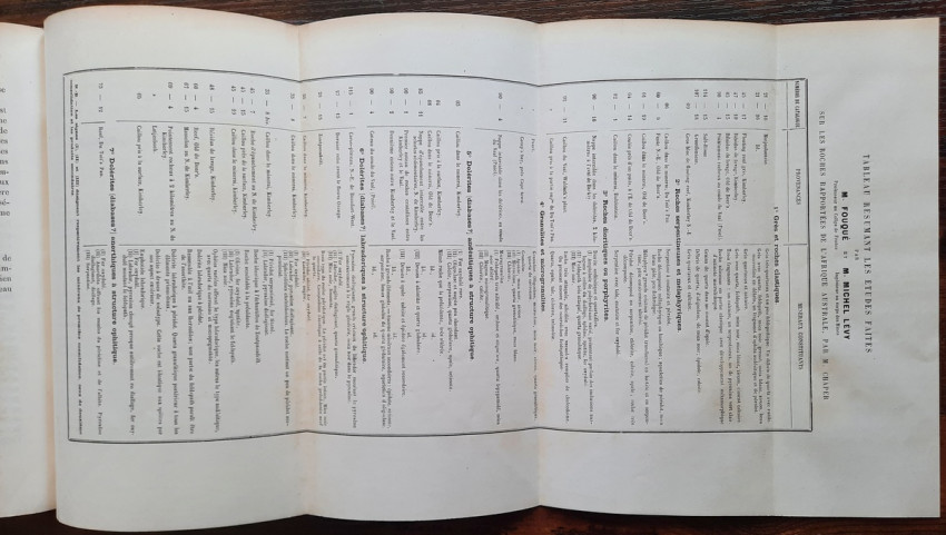
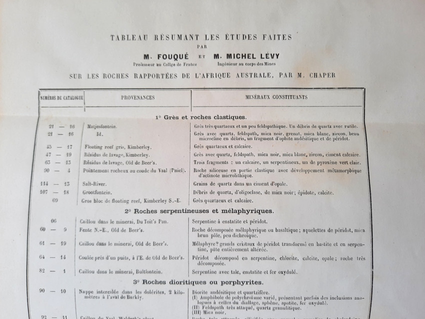
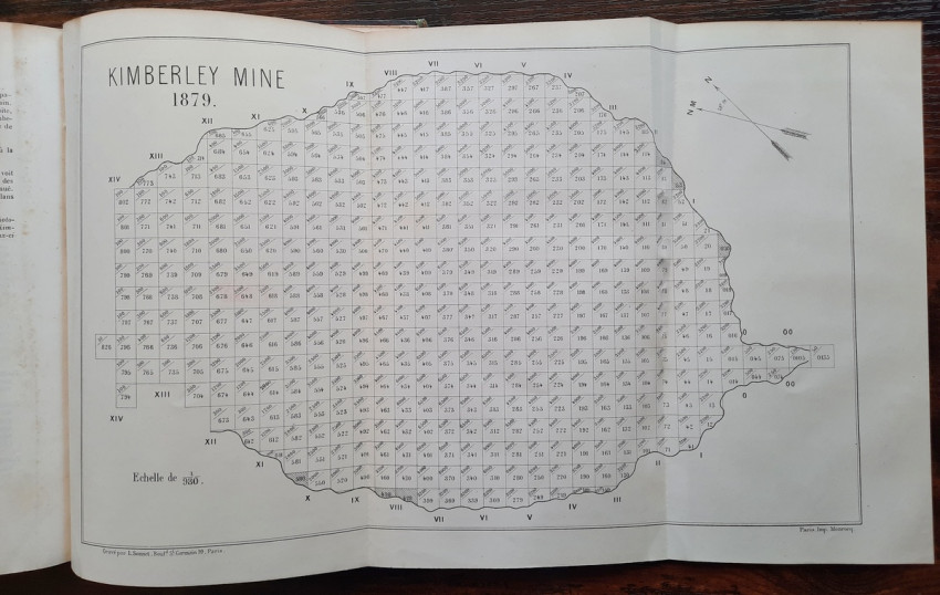
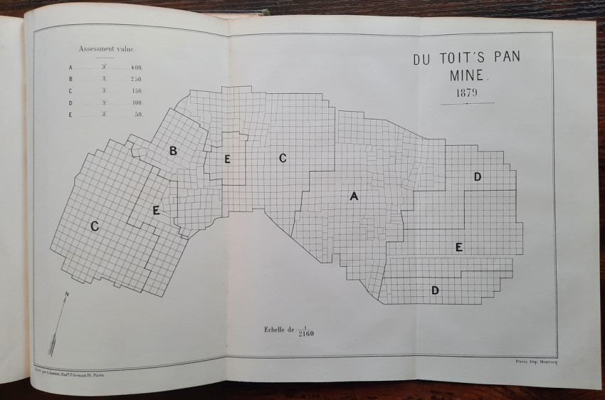
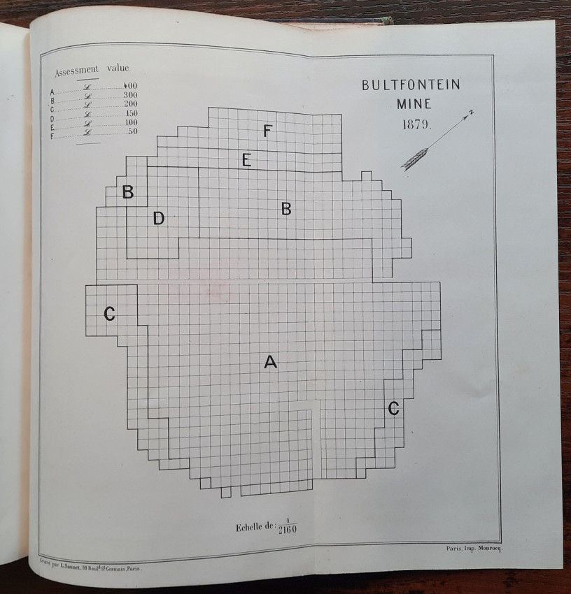


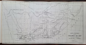
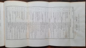
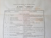
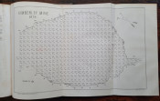
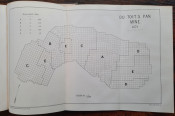
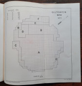


This scarce book contains the folding "Table summarizing the studies made on the rocks brought back from Southern Africa by the Maurice Chaper" by M. Fouque & M. Michel Levy; folding map "Overall map of the Cape Colony with a trace of the route from the Cape Town to Kimberley"; 3 folding plans (of Kimberley Mine from 1879, Du Toit's Pan (or Dutoitspan) from 1879 and Bultfontein Mine from 1879); and 8 b&w photolithographic plates at the rear (photolithographic reproductions of very fine photographs originally purchased from the Gray Brothers in Kimberley, mounted on strong paper).
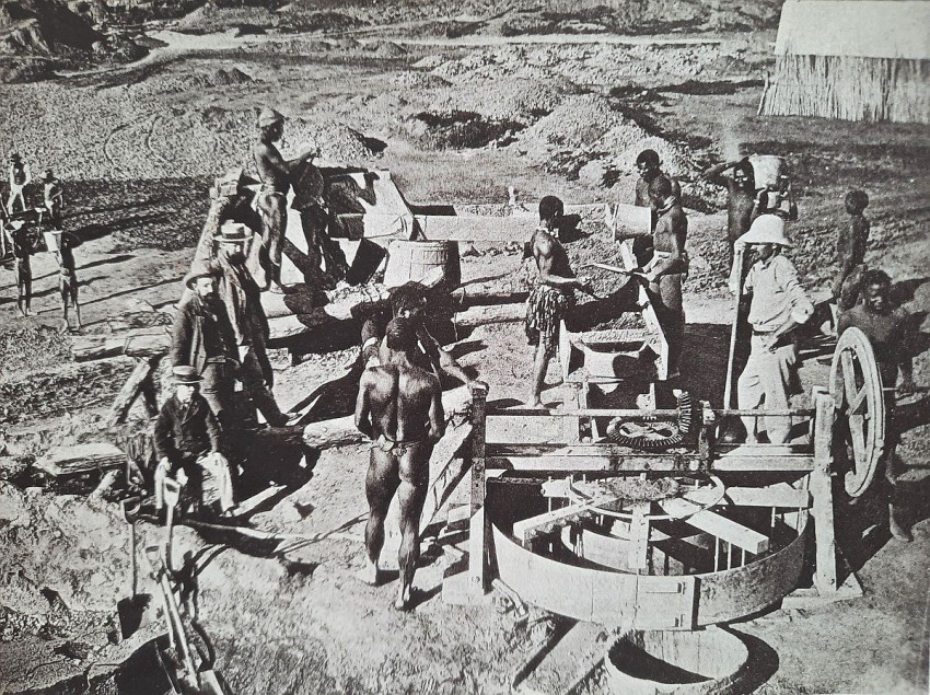
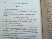
EXPLANATION OF THE PHOTOLITHOGRAPHIC PLATES:
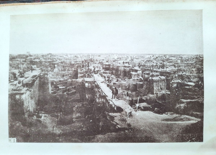
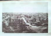
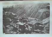
PLATE 1. View of the Kimberley mine when mining had reached a depth of only six to eight meters. On both sides of the "road" leading to the foreground, timbers planted obliquely in the ground to support the pulleys used for extraction can be seen. For almost its entire length, the road is reduced to half its width, or seven and a half feet. The division of the mined parcels is very apparent and shows how prevalent the number of owners was of a very small fraction of the claim: most of the visible parcels are no larger than 1/16 of a claim.
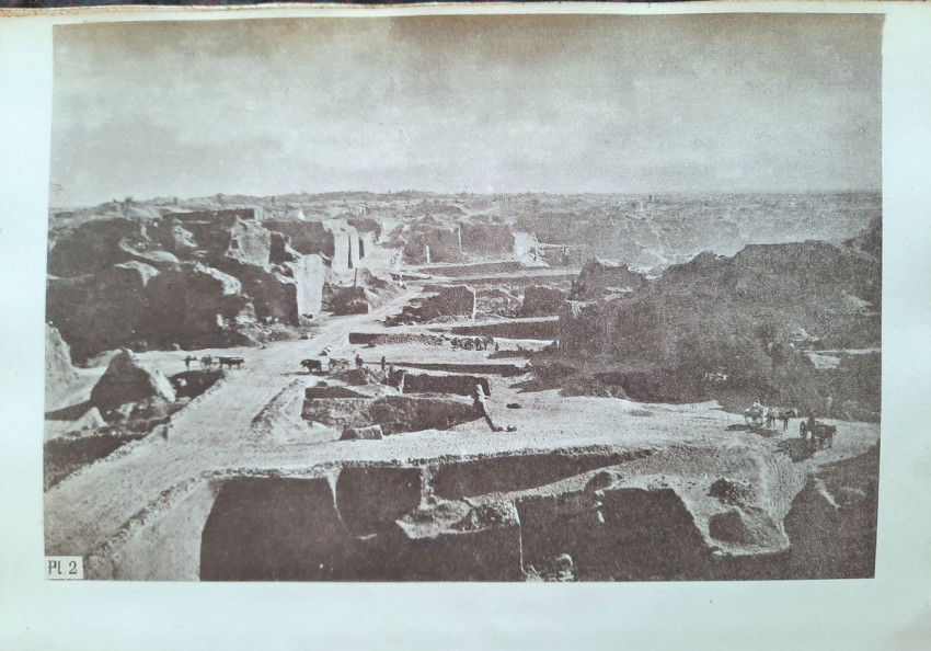
PLATE 2. View of the Bultfontein mine, taken from the south west inward, and showing the state of the mine around 1878. Its appearance has not changed significantly since that time. On the left and right, one can see large masses of ore (yellow) that have not yet been mined, or have barely been started, and are partly covered with the debris of the first miners. The mine is accessible everywhere via sloping roads.
PLATE 3. View of the Du Toit's Pan mine, NE excavation, around the beginning of 1879. The lower part of the workings is no longer accessible by road; on the left are the spoil heaps covering the reef.
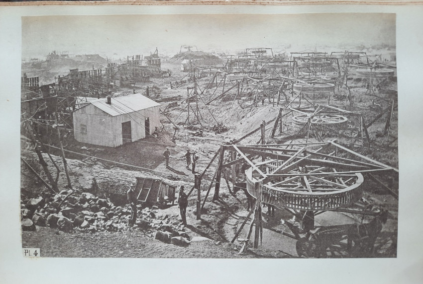
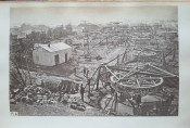
PLATE 4. View of the north side of the Kimberley mine. On the right are the winnowing machines for extraction using cable-driven winches, and on the left, the head frames over which the support and hauling cables pass. At the foot of these head frames are the ore receiving hoppers and the wagons receiving their loads; on the left, a corrugated iron shack housing one of the first steam engines.
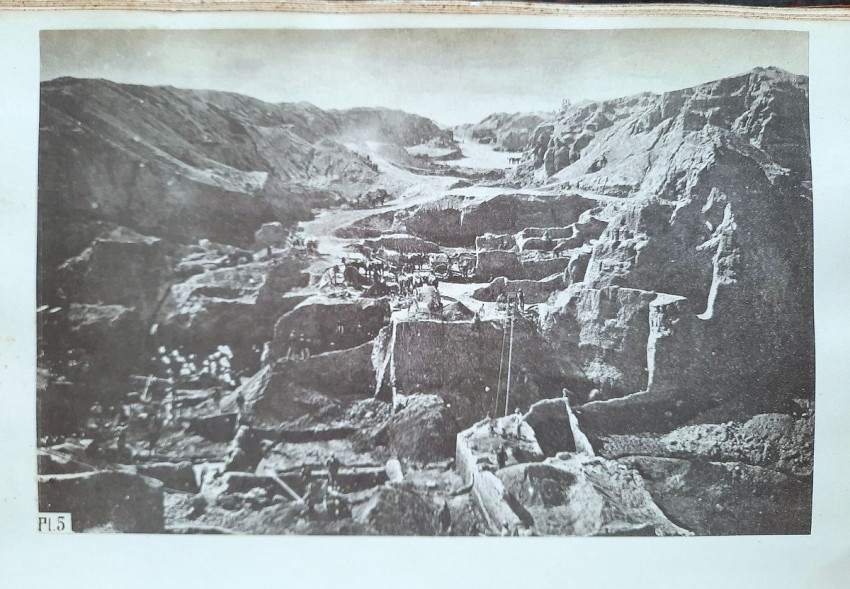
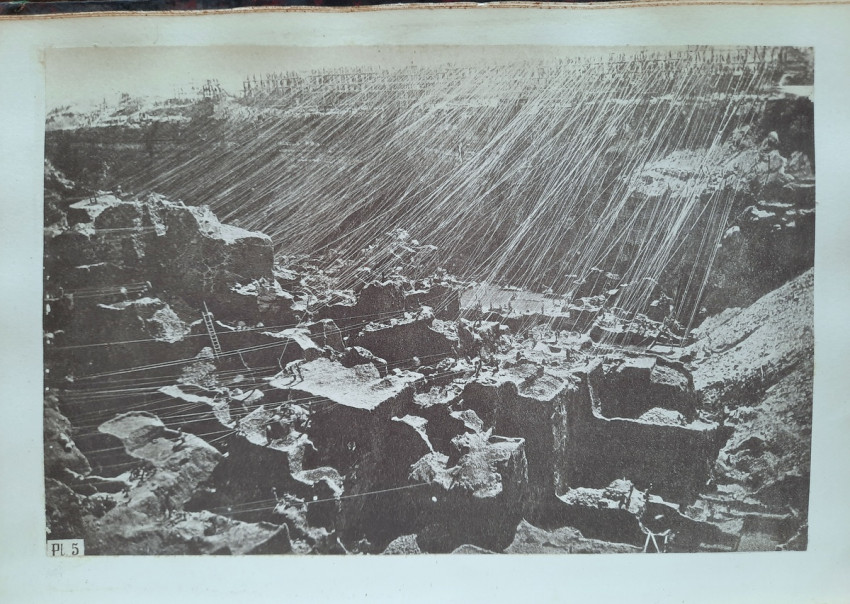
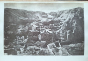
PLATE 5. View of the interior of the Kimberley mine after the abandonment of the road system; the property is still very fragmented and the number of hoists is considerable.
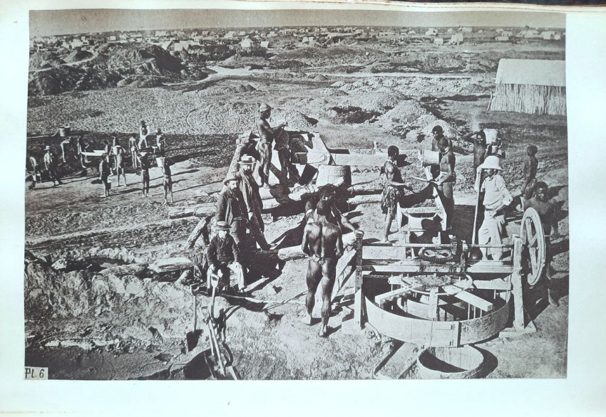
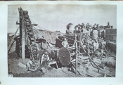
PLATE 6. View of a floor near the Kimberley mine and an early washing apparatus. All operations are done by hand. On the left, in the middle ground, the decomposed ore is spread out on the ground; on the right, in the background, are piles of unprocessed ore as dump trucks deposited it at the bottom, the corrugated iron houses of the town of Kimberley, and spoil heaps near the mine.
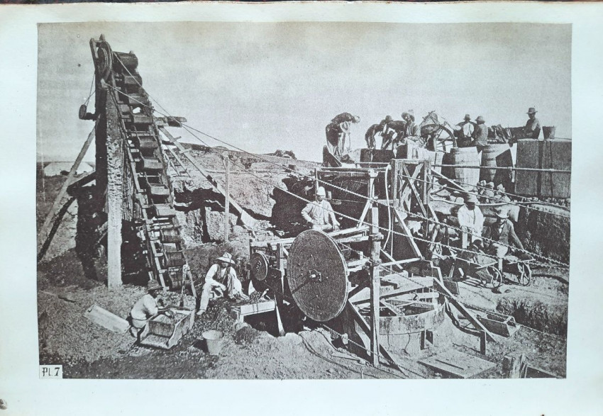
PLATE 7. Improved washing apparatus powered by a machine, where most operations are performed mechanically.
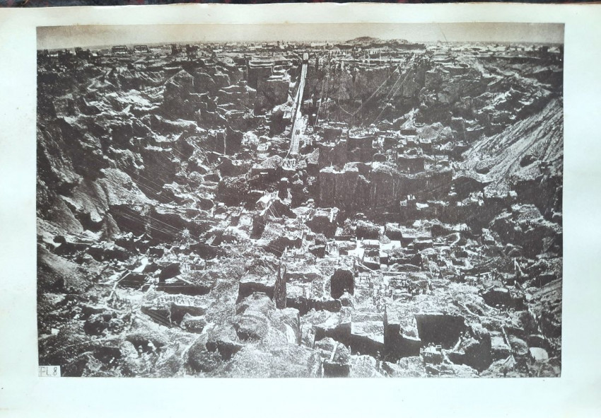
PLATE 8. View of the interior of the Kimberley mine from the east. It shows how far behind the exploitation of the edge claims is compared to that of the central claims. The number of trips back and forth has decreased considerably. Plates 1, 2, 6, and 8, in particular, show in the backgrounds just how bare and flat the landscape is.
N.B. All these plates are photolithographic reproductions of very fine photographs purchased from Messrs. Gray Brothers in Kimberley. Unfortunately, the reproductions do not have the sharpness of the originals, as these are only proofs on paper and not plate negatives - but still they are very scarce.
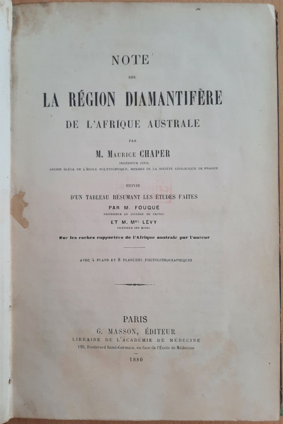
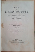
"Note Sur La Region Diamantifere De L'Afrique Australe, par Maurice Chaper. [Suive] D'Un Tableau Resumant les Etudes Faites sur les Roches Rapportees de L'Afrique Australe par L'Auteur, par M. Fouque & M. Michel Levy. Avec 4 plans et 8 planches photolithographiques."; Paris, G. Masson, 1880; Original bordeaux half leather binding with gilt title to the spine; 24 x 16 cm; Text in French; Collation complete - Half-title, Title page, 142 pages, with folding table, 4 folding plans and 8 photolithographic plates at the rear; Ex-libris copy, overall in very good condition. Binding is tight and firm, with worn boards and spine. Binding with some discoloration, bumpings and surface scuffing, boards slightly chipped to the extremities, corners crushed. Joints and hinges are whole and tight, except a short cracking to the bottom joints (0,5 - 1 cm), but binding remains strong and secure. Ex-libris number to the top of the half-title, small stamps to the blank page opposite to the first introduction page, white margin of the page 8 and to the rear of all maps and plates. Text block/pages are very bright and clear, only with a slight yellowing, title page and a few pages with a few small blurred stains to the white margins, otherwise no foxing or markings throughout. Photolithographic plates little wavy, free endpapers age tanned. A sound copy of this sought after book.
IMPORTANT informations regarding shipping: Shipping to South Africa possible via Fedex/DHL Express service ($100-130). Shipping to EU & UK via registered Airmail trackable parcel ($30-50). Shipping to US via DHL/Fedex ($120-180). For other countries please ask.
- Binding Condition: Good
- Overall Condition: Very good
- Size: 24 x 16 cm