


Wall Map of SALISBURY, Connecticut. - Lawrence FAGAN (surveyor). - Richard CLARK (publisher).
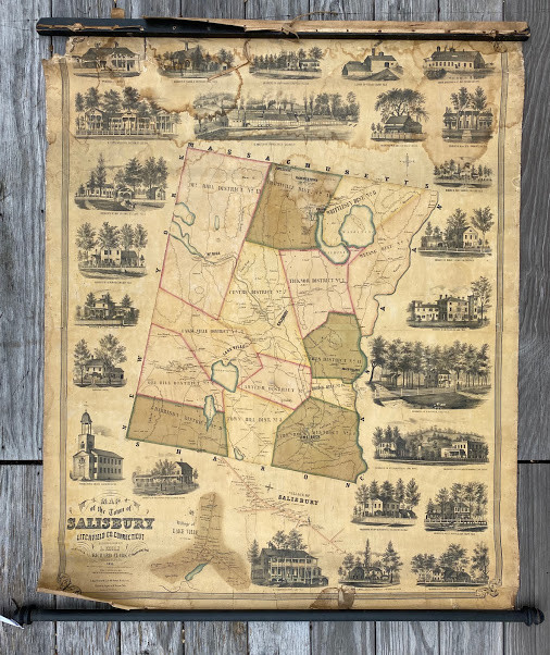
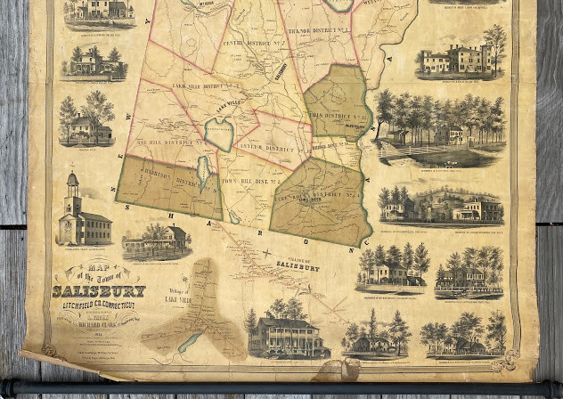
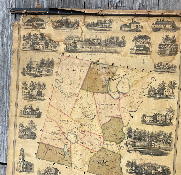
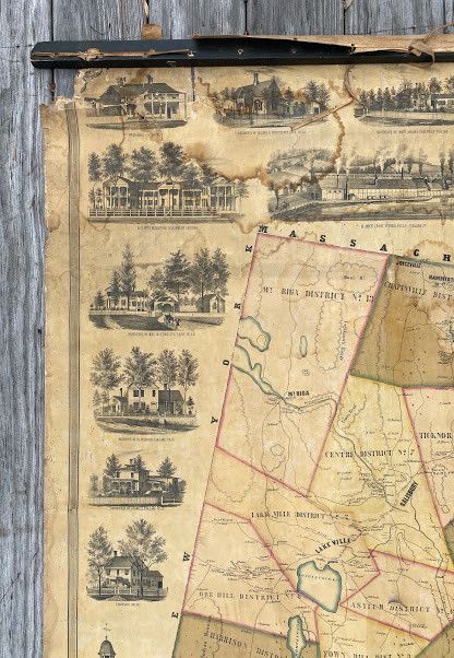
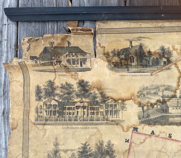
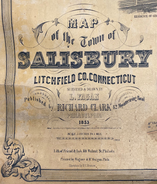
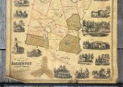
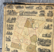
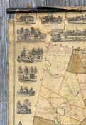
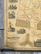
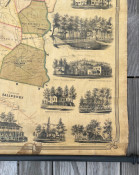
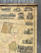
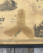
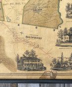
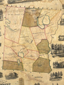
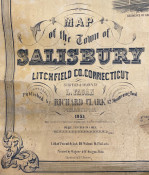
Map of the Town of Salisbury Litchfield Co. Connecticut Surveyed & Drawn by L. Fagan published by Richard Clark … Lith. of Friend & Aub … Printed by Wagner & McGuigan … Sketches by E.C. Beman. Philadelphia [Pa.]: Published by Richard Clark,1853. Hand-colored lithographed wall map, on two sheets joined (overall: 52 x 42in; 1321 x 1068mm), linen-backed and mounted on rollers. Condition: varnished (as usual), small void to upper left corner with slight loss to the decorative border, some other small splits, cracks or tears, some old dampstaining (see images).
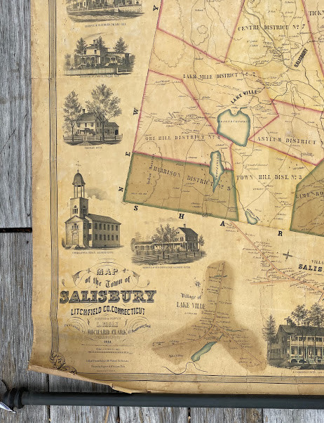
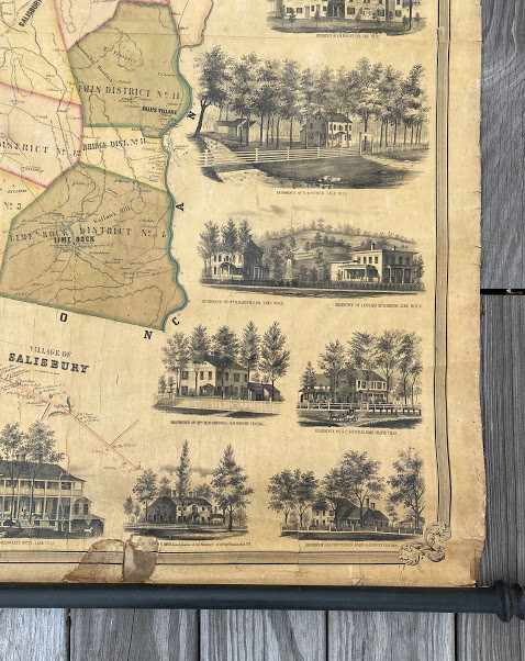
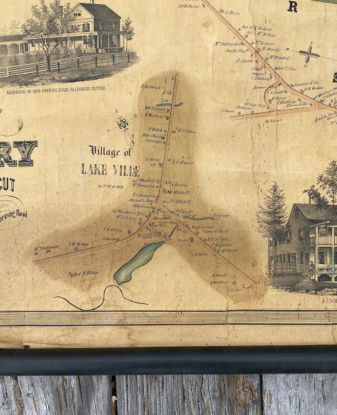
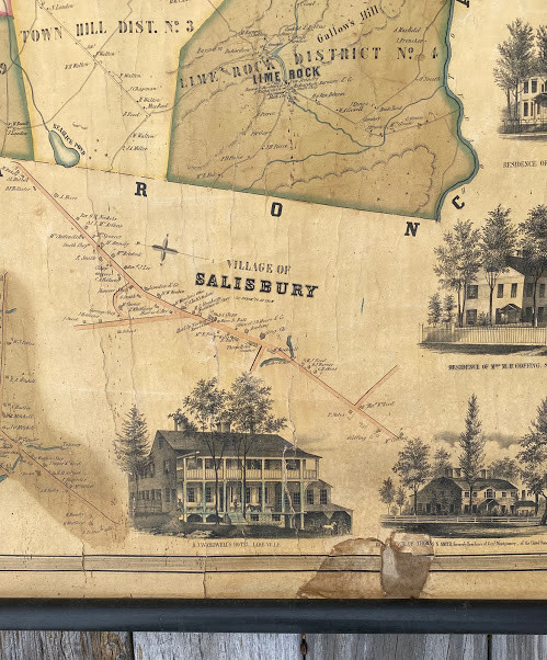
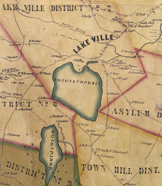
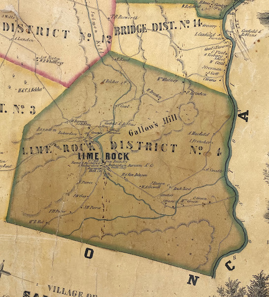
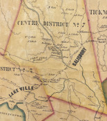
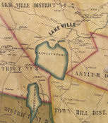
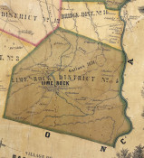
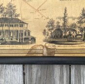
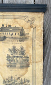
A valuable, quite rare and highly instructive map of the town of Salisbury. The main map (3in: 1 mile) includes the 'villages' and named settlements of Salisbury, Lakeville, Falls Village, Mt. Riga, Lime Rock, Chapinville, Hammertown and Joyceville. Also included are larger scale vignette maps of the center of Lakeville and Salisbury, together with vignette views of 25 homes, churches and commercial buildings in the town: the cost of production was offset by selling the space for these images in advance. To have an image one’s house featured on the town map signified a level of success that was visible to everyone that looked at the map. Clark and his main rival, Henry F. Walling, issued a large number of large-scale town maps at this time. Walling’s maps tended to be more accurate, whilst Clark’s were usually more attractive. The surveyor, Lawrence Fagan left his native Ireland in about 1850, initially settling in Philadelphia. Working almost exclusively in the North East US, he seems to have surveyed at least seven New England towns, all published by Clark. (Ristow, American Maps and Mapmakers, p. 388).
References: Thompson, Maps of Connecticut, #149; OCLC #557357913; Connecticut Historical Society, call # 3, no. 7; see Library of Congress, call #G3784.S2 1853 .F3 for Fagan’s manuscript map (the map on which the present printed version was based).
- Overall Condition: Acceptable
- Size: 52 x 42in; 1321 x 1068mm
- Sold By: Shadowrock Rare Books
- Contact Person: Adam Langlands
- Country: United States
- Email: [email protected]
- Telephone: 001-860-248-1547
- Preferred Payment Methods: Paypal, US$ checks and wire transfers, major credit cards through paypal
- Trade Associations: AA Approved


